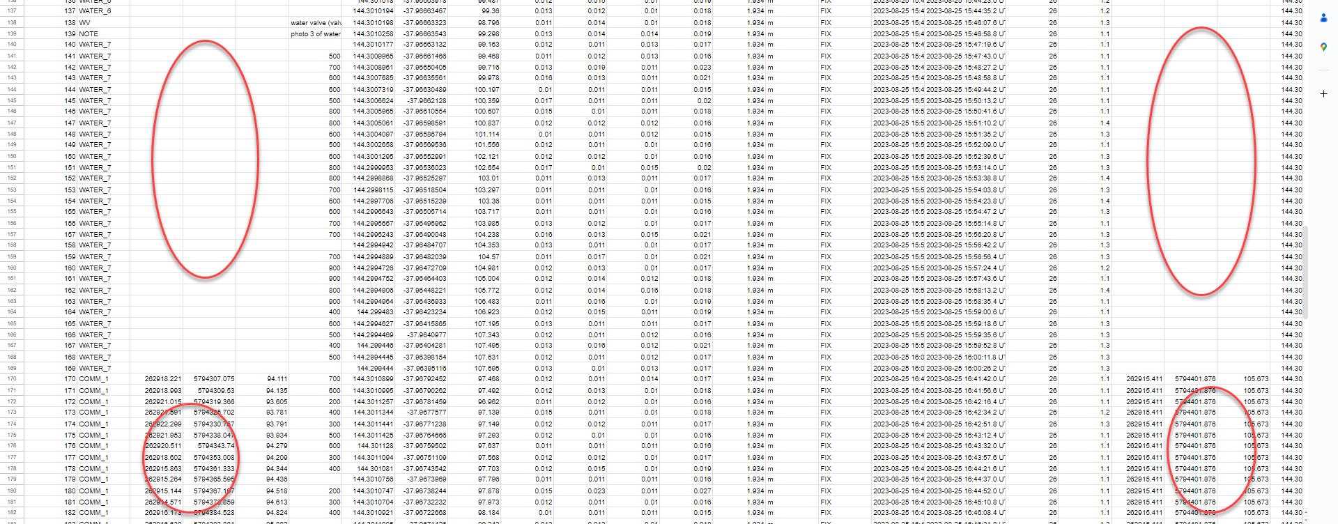
Has any one had an issue where you have been out on site picking up data all day. You can see the data on the screen, but when you are back in the office and download the CSV file and the DXF file, you find that 5 hours worth of data that you picked up is not shown.
You can still see it on the screen, but when you look within the file the info isn’t there.
Take a look at this spreadsheet to see what I mean.
You can still see the name of the file and the details about it, but the actual coordinates that you pick up on site are gone.
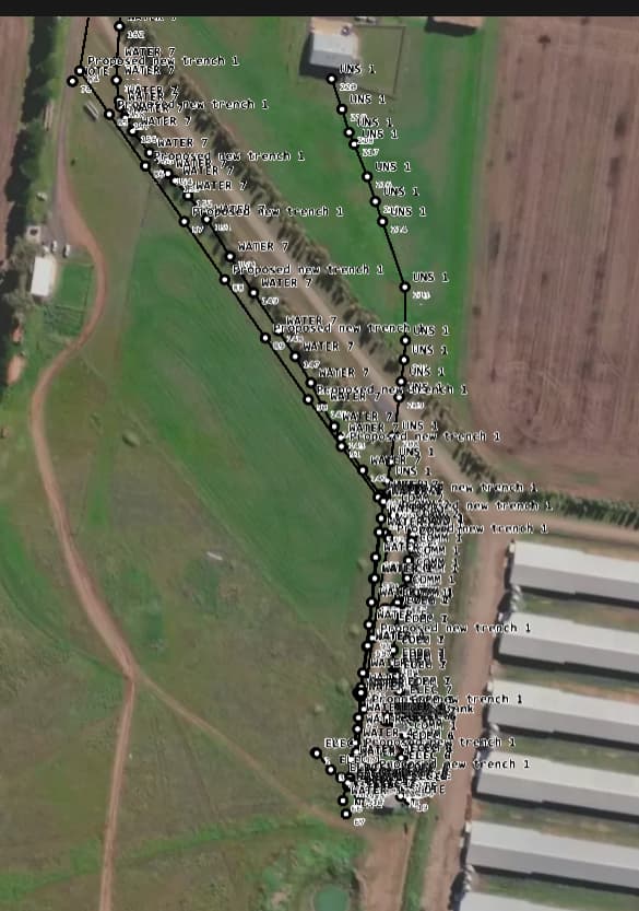
But when you look at the file in the cloud you can still see data in there where it is meant to be, see screen shot to see what I mean.
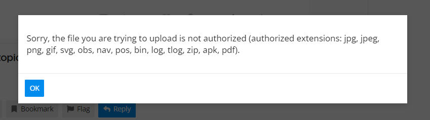
Hi @tatiana.andreeva thank you for your fast reply.
I am more than happy to upload the files here, however, it says that it can’t as they are not the correct file types.
I’ve created the project with your coordinate system and selected AHD height as a vertical datum. Then I imported your CSV file into Emlid Flow 360 and all points were properly projected into the local coordinates. I’ve sent the zip archive with the resulting files to your email.
Currently, our devs are investigating what could cause this issue. Usually, it may occur when the local grid and/or vertical datum doesn’t cover some of the points, so it breaks the conversion.
Once there are any updates, I’ll post them here in the thread.
Hey @kirill.pavlyuchuk thank you very much for fixing those up for me, that is very impressive.
In relation to finding the issues, if you can maybe try and replicate the same situation as I think it has something to do with the phone going flat on me.
Try and collect data over several hours, without closing the file that you are working on and let the phone go completely flat. Charge it up a little bit and then continue collecting data and see if the same happens.
I mean it could all just be a coincidence, but I have a feeling this has something to do with it.
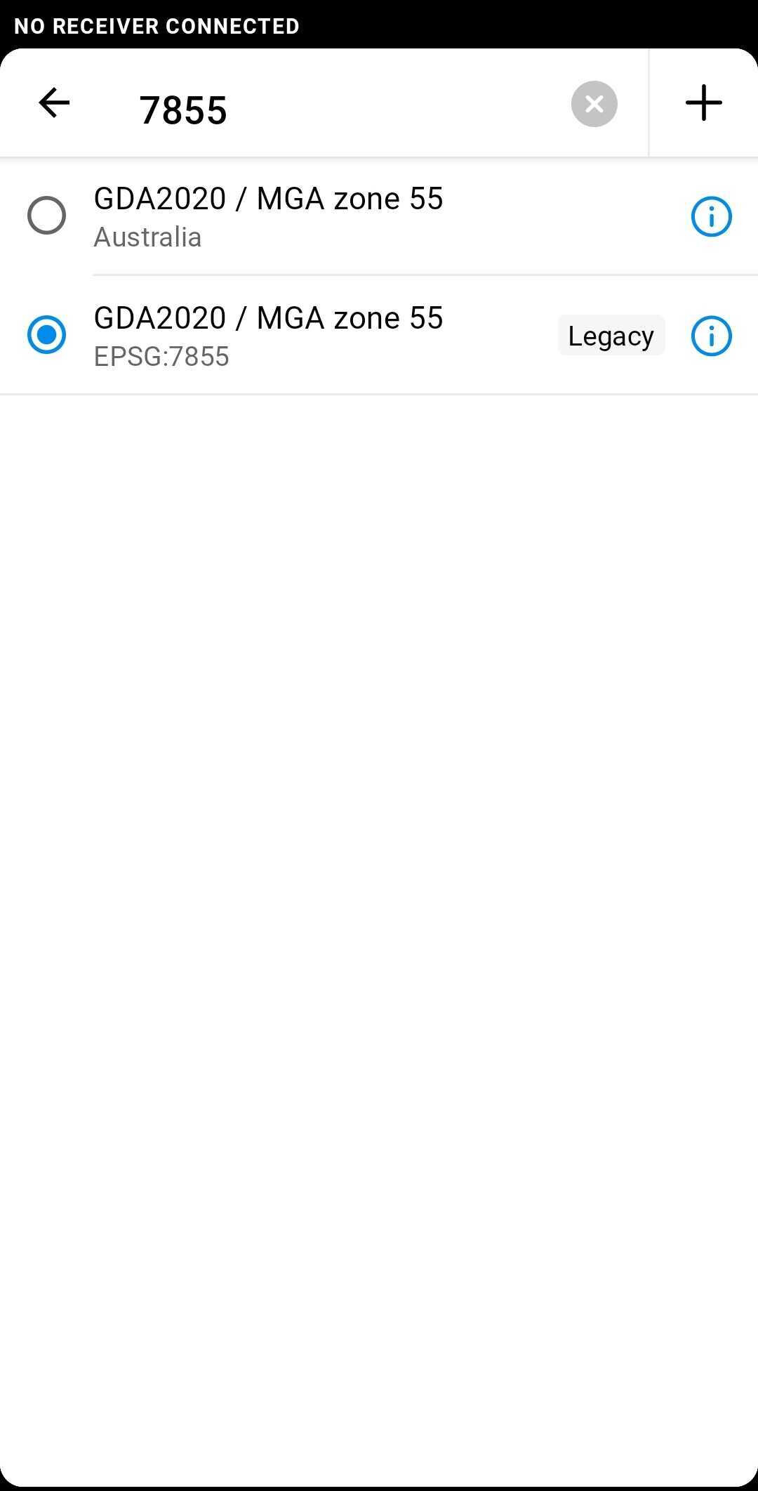
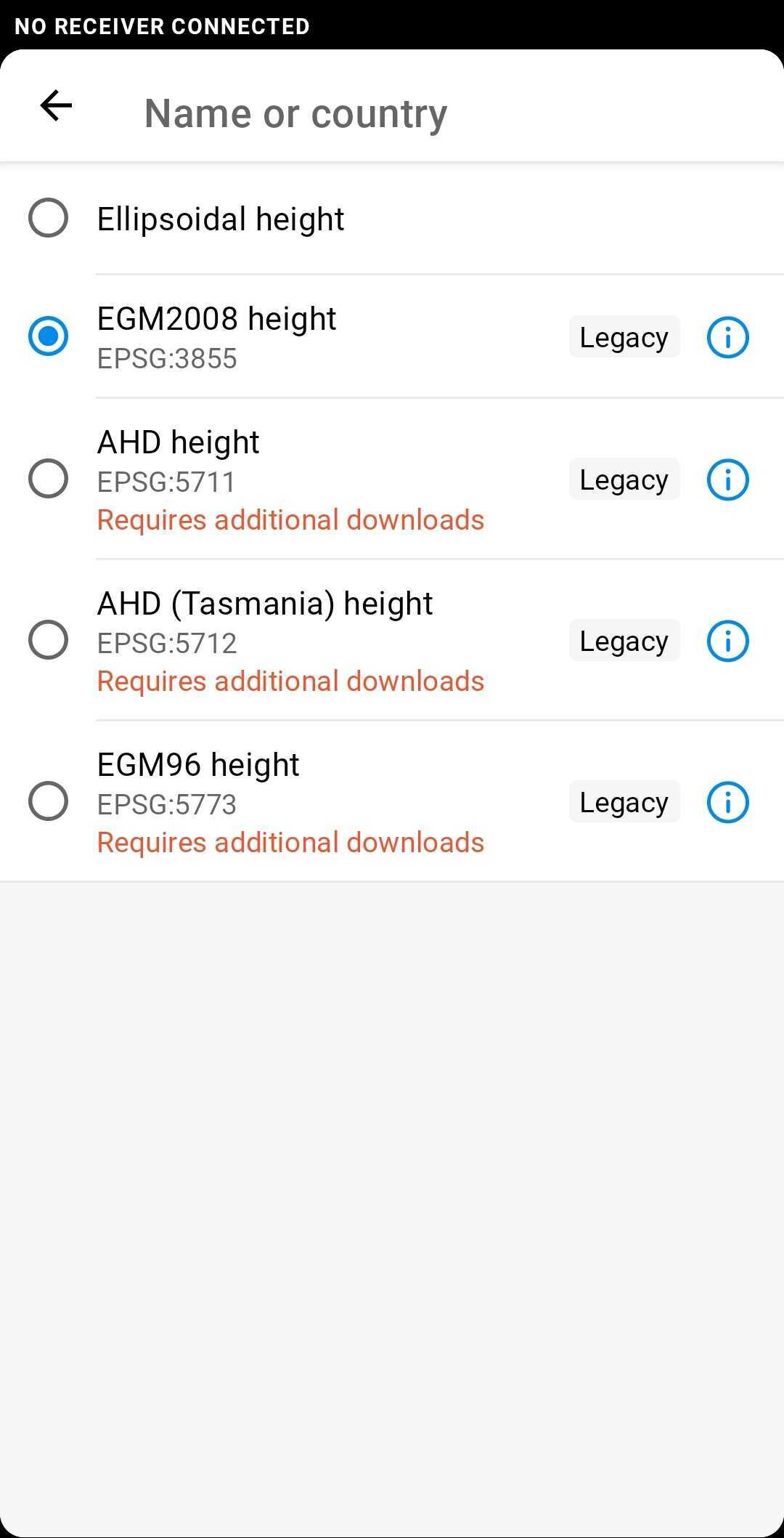
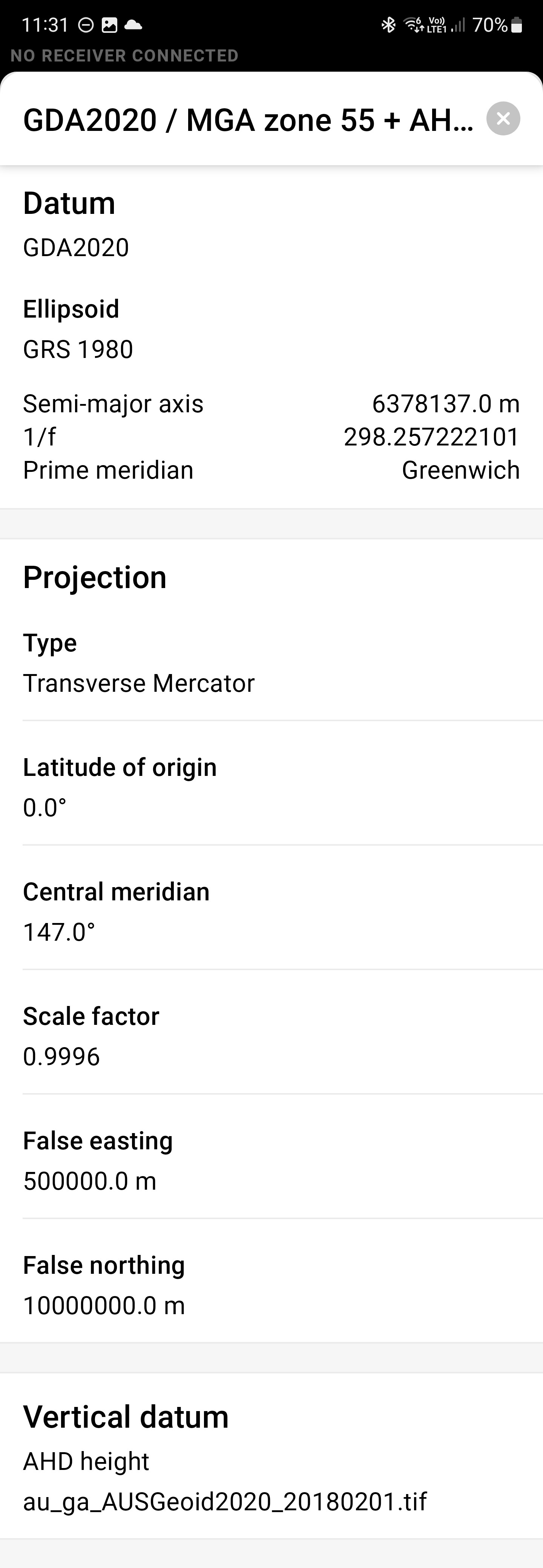
It seems we’ve found out the possible reason for this. Most likely, you used the coordinate system marked Legacy while creating the project and then selected the AHD (Tasmania) height for the project:
Hmm, that seems odd, I don’t think I’ve seen the legacy one before.
I’m away from the unit at the moment and won’t be near it for a couple of weeks, so can’t check what it comes up with when I go to use it.
But I did just look up this file and this is what it is showing.