


Hi all,
we are using drones to survey out pits with GCPs and Emlid Rs2 setup.
I was wondering if anyone here does any cut and fill numbers and what their workflow might look like?
Thanks,
Joe
I do, you can see how I placed my ground control in particular difficult site for GNSS here:
Can you explain more.
Size etc
Do you have XYZ data
One set or two sets?
Can you post some data similar to yours
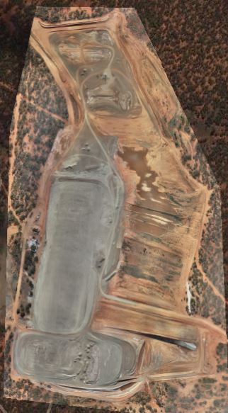
The total area of the site is 61Ha but only a few focused areas will have material moved.
I will do month by month checking what has been filled/cut between the two different data sets.
The contractors all pulling overburden and topsoil out of the pit to expose the raw material and dumping in another pit.
1 Like
This topic was automatically closed 100 days after the last reply. New replies are no longer allowed.