


I try to import a pointlist in reachview 3, latest version.
I use csv-templet:
Name,Easting,Northing,Elevation
P1,565625,5951080,10.0
First I make a new project with Koordinate-sytem ETRS89 (EPSG: 25832). Then I try to import the pointlist.
But this dont work.
Next I collect some points (in my garden) with the new project an export them as CSV-file.
Then I try to import this file, but it dont work.
Ok new project with Koordinaten-system WGS84. Make a point in my GIS, export as CSV an try to import - it works.
But if I used another GIS generated file with points in coordinates in WGS84 then it doesent work? This points are for a project 100km south of my home.
Can someone help me?
Hi @geologie1!
The ReachView 3 CSV import screen shows a pattern to be followed. A description column can also be inserted, using the same format used in the other columns. The header is also required. The description column is not shown, but it is imported without a problem (the blank line at the end must exist).
Example:
Make sure you are using the correct coordinate system, either UTM or geographic coordinates (LATLONG). For both, the header will be the same.
Latitude = Northing
Longitude = Easting
PS: the order of the columns does not matter, as long as you specify them correctly in the header.
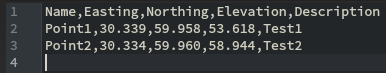
thanks for anther, but ist doesn’t helps. I used exactly the CSV-format like the description. Here an example:
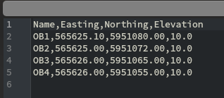
Name,Easting,Northing,Elevation
OB1,565625.10,5951080.00,10.0
OB2,565625.00,5951072.00,10.0
OB3,565626.00,5951065.00,10.0
OB4,565626.00,5951055.00,10.0
inklusive the blank line on the end.
the coordinates are ETRS89 and the Projekt are also in ETRS89
strange…
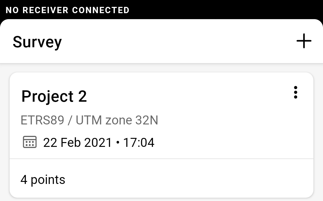
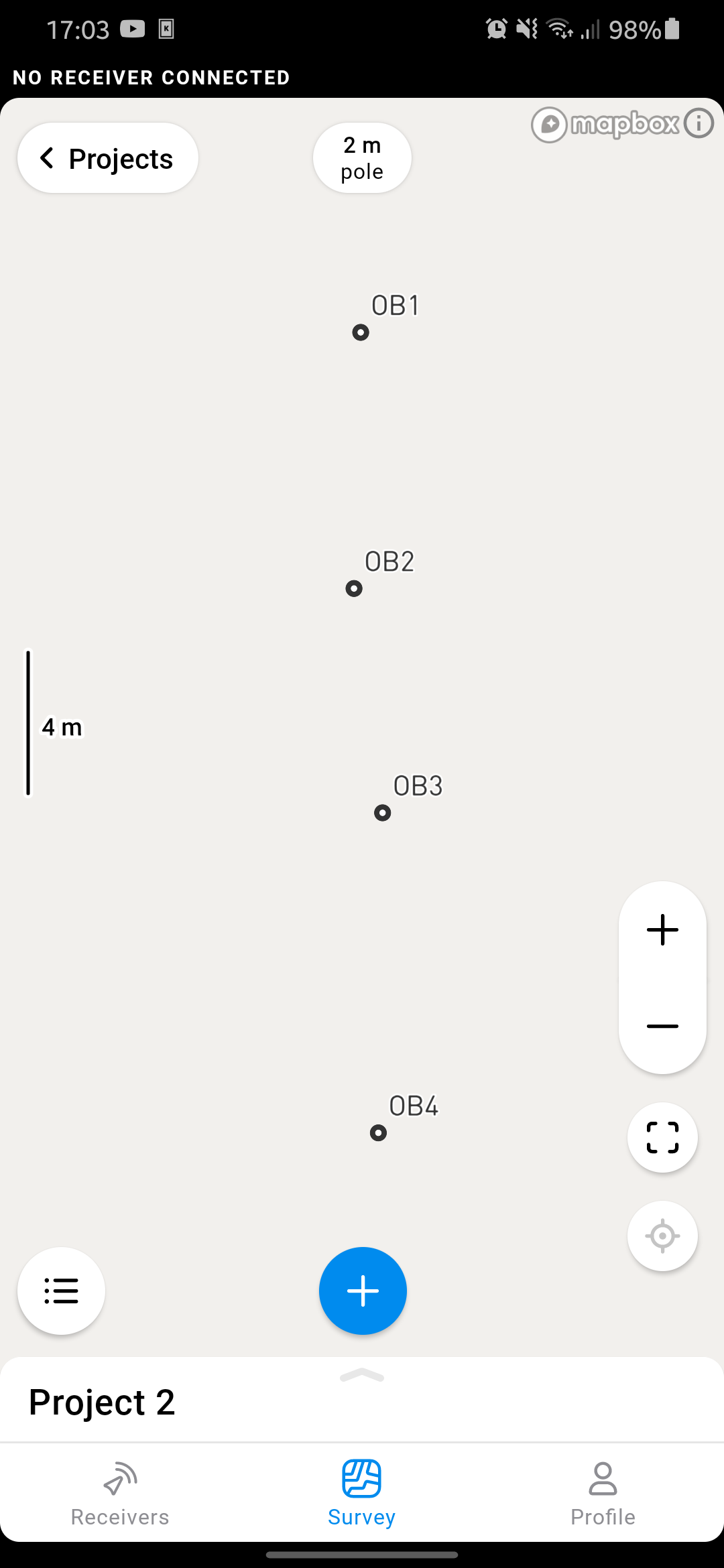
I tested the import of those coordinates you sent and I was successful.
I’ll send images here of how I left the CSV file and how is the project created in RV3.
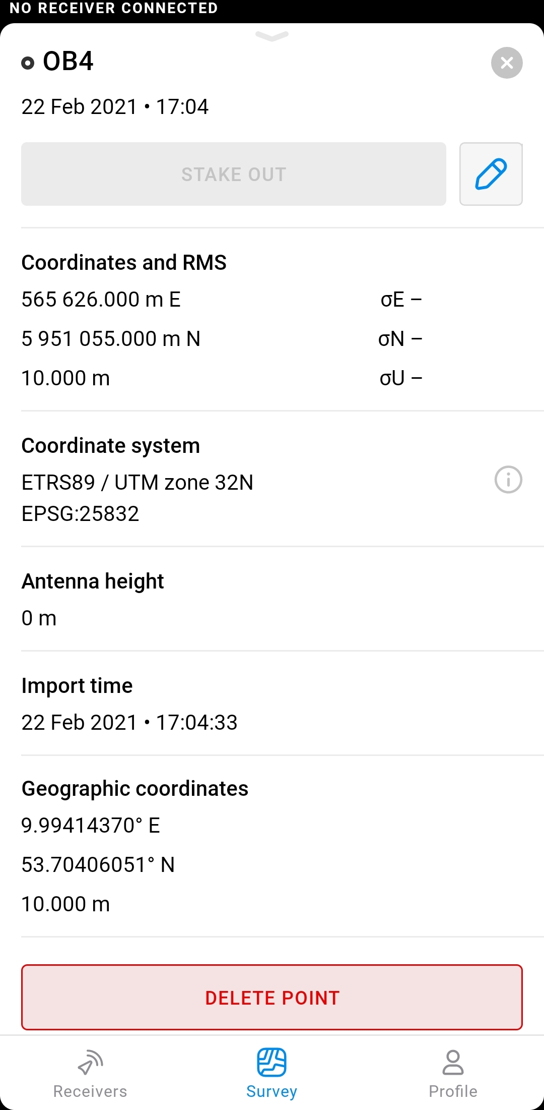
I find the problem,
the geoid hight must be set to “Ellipsoidal hight” otherwise it don’t work
thanks for help
1 Like
That’s right, even though the altitude is not ellipsoidal, it goes into the Elevation column.
Best Regards,
Pedro Augusto.
1 Like
This topic was automatically closed 100 days after the last reply. New replies are no longer allowed.