I have been using CSRS to post process Raw data from my EMLID RS2. Today, I set it to log data in static positioning mode for 5 hours. I exported the data as UBX and then converted it to RINEX 3.03. However, when I upload the OBS file to CSRS, it returns 2 Warnings and does to provide a solution.
Warning : Single-frequency only solution in kinematic mode. Please check your results.
Warning : Approximate position in RINEX header record was not used. Current solution is using a priori position initialized using a pseudo-range only solution.
I have used this website multiple times already and now I am worried that I accidentally changed a setting in RTKCONV.
Can anyone help me with this? I would attach my UBX file but the forum says new users cannot upload attachments
You can share the log with us using different file exchange services, like WeTransfer or Google Drive. We’ll check its quality to see what could prevent the processing.
Normally with the latest stable firmware release, you could completely circumvent RTKConv and export to RINEX directly in the receiver. All relevant info is now added to the header automatically. You could try that (word of caution, updates of the firmware are always a risk to your data so back everything up).
Thanks for the advice. I logged data again today about 5.5 hours total I had the data set automatically exported as RINEX 3.03. Sent it off to CSRS and it came back with the same issue. I checked the GNSS settings to be sure. I am still on static. If some one or some thing bumps the receiver would this cause this issue? There are monkeys in the Forest that I am working in and they have been known to take a liking to new objects.
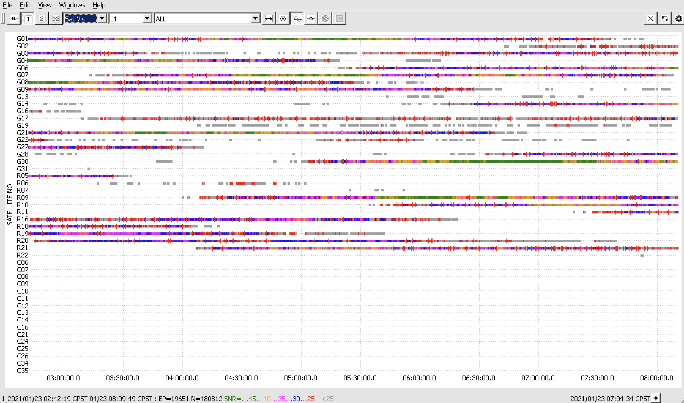
I was able to process the log in the CSRS-PPP, but the accuracy of longitude and height was less than 1 meter. As I can see from the raw data log, there are numerous cycle slips, and all satellite signals have low SNR most of the time:
It looks like the sky view was obstructed, which might lead to lower accuracy of the results. May I ask you to share pictures of the environmental conditions to check that?