When you work with the receiver in standalone mode, its accuracy is several meters only. 2 receivers working in PPK allow you to improve this value to several centimeters.
However, positioning mode can’t affect the time marks recording. What could do that are the issues with the Reach connection to the camera hot shoe or the quality of the logs themselves. That’s why I’m asking you to share them with me.
You can share the data via Google Drive or WeTransfer. Or, as Bryan said, send it to me via private message or support@emlid.com.
Thank you. I received raw data logs. Give me a bit of time to check them, and I’ll get back to you.
Can you please also share close-up photos of your setup? I mean, the connection of the camera hot shoe to Reach M2. It’ll help me check if it can cause time marks missing.
Thank you again for sharing the data, I’ve received your photos as well.
As we discussed above, the issue with missing time marks can be caused by 2 reasons: the setup or the interference from the drone electronics. I believe that both of them are possible in your case.
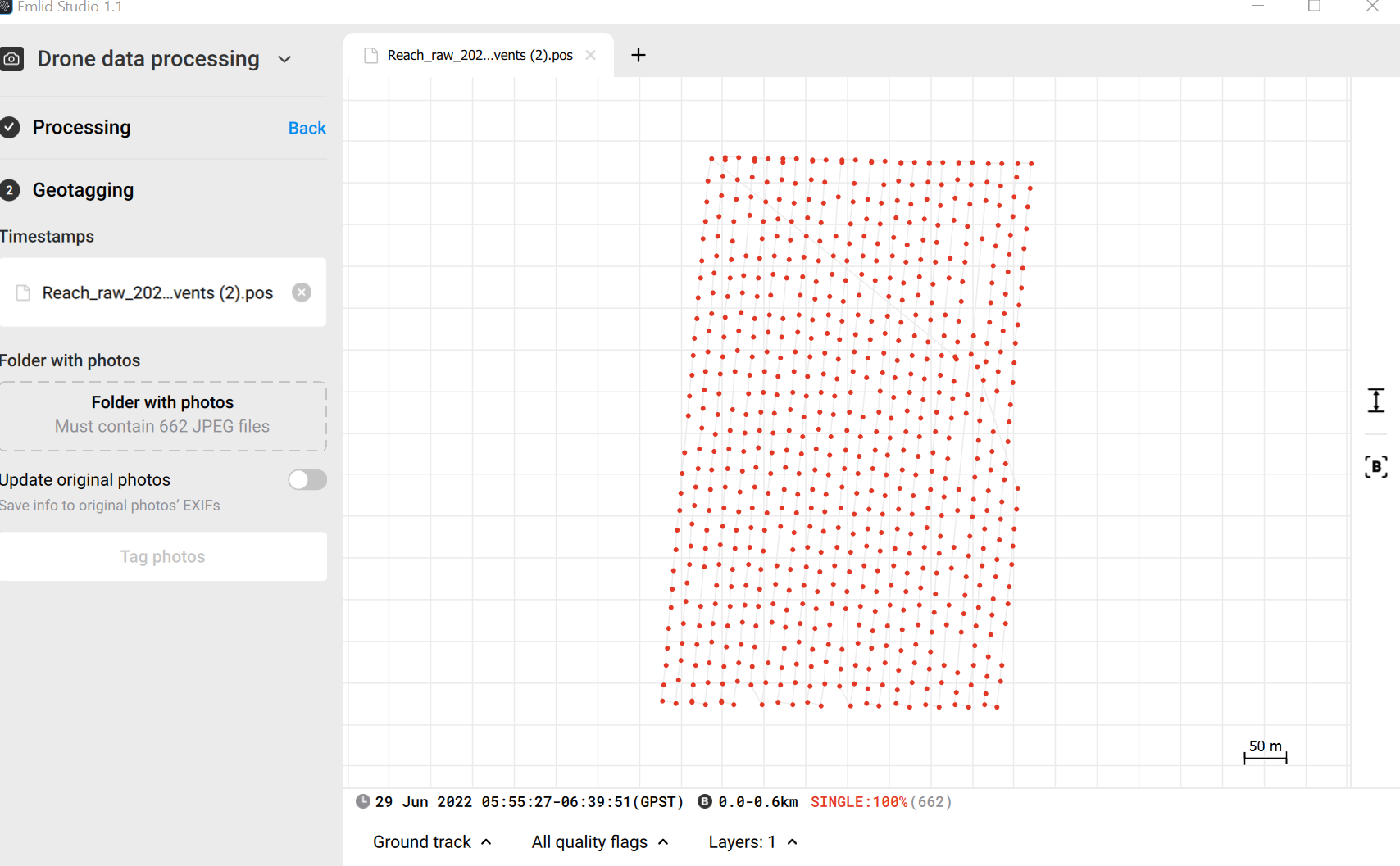
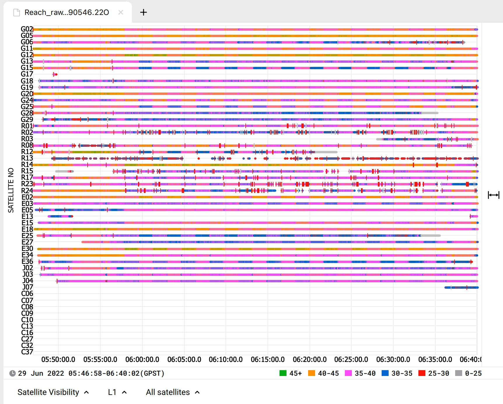
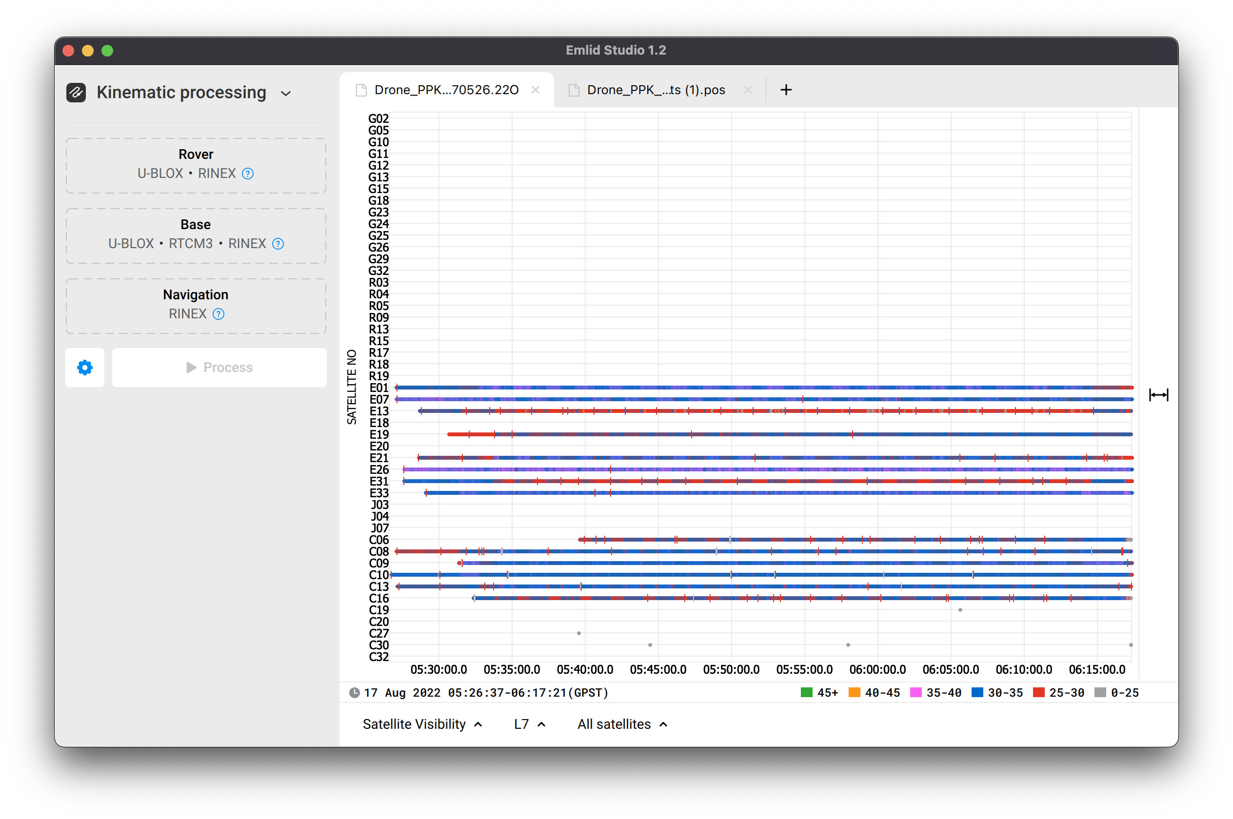
Here are the logs from your receiver, opened in Emlid Studio:
You can see that the SNR of all the satellites is lower than 45 and changes abruptly at the same moment of time. All it looks like your Reach M2 is affected by the interference from the drone or drone’s electronics.
So I’d start with moving the receiver and GNSS antenna from all the sources of RF noise. It’ll improve the data quality.
Then you can check if the issue persists. If it’s still there, the setup also requires some improvements. As the next step, in this case, I’d try another cable to connect Reach M2 to the camera hot shoe.
I’m still facing the issues of missing time marks, as you told me that the reason that is affecting the Reach M2 is due to interference and a hot shoe cable problem.
to eliminate those problems I moved the Reach M2 outside the drone body and even changed the hot shoe cable.
Even after that, there are missing time marks.
Thank you for the logs sent via email! I’ve analyzed them and can draw some conclusions here.
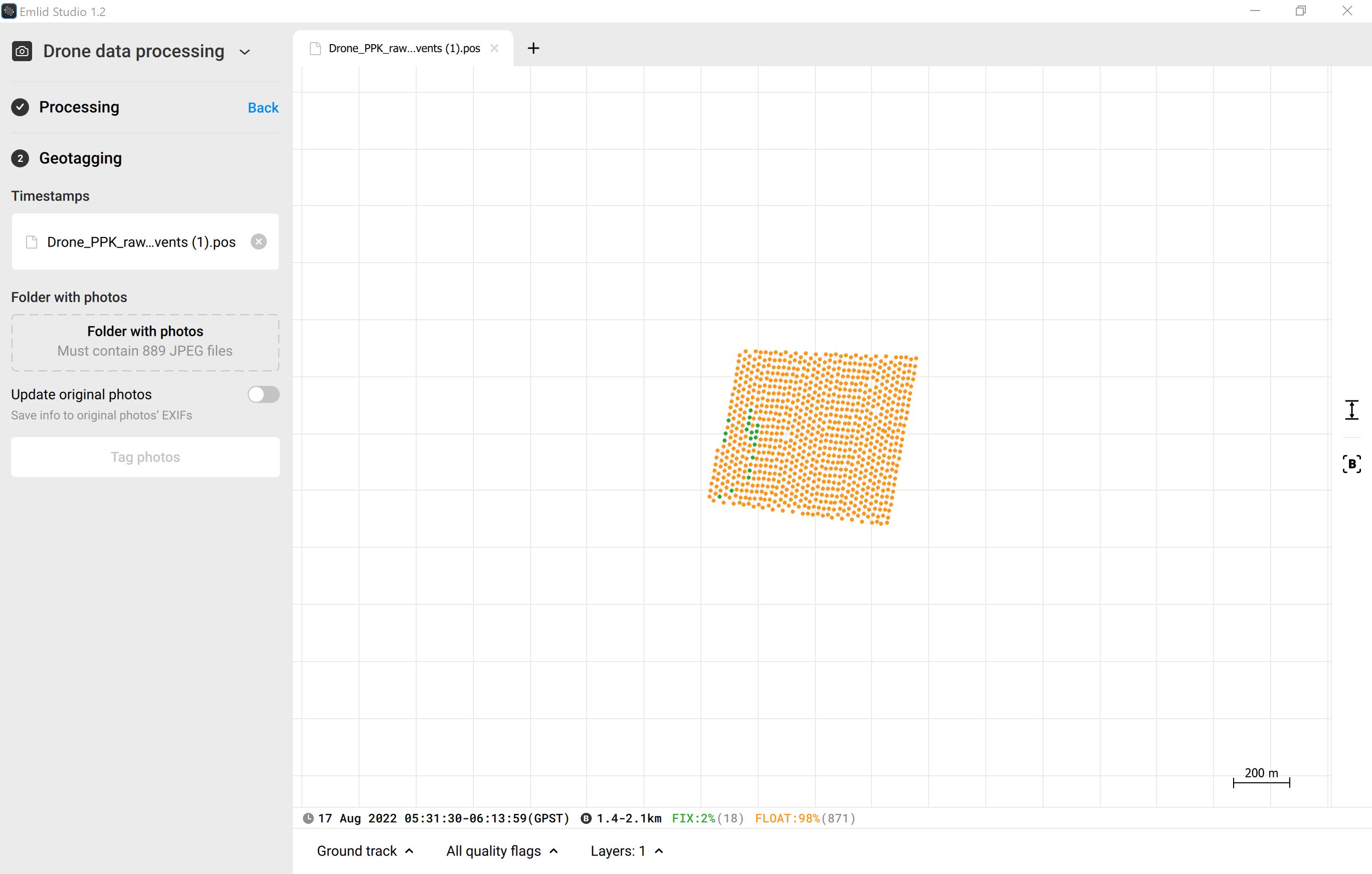
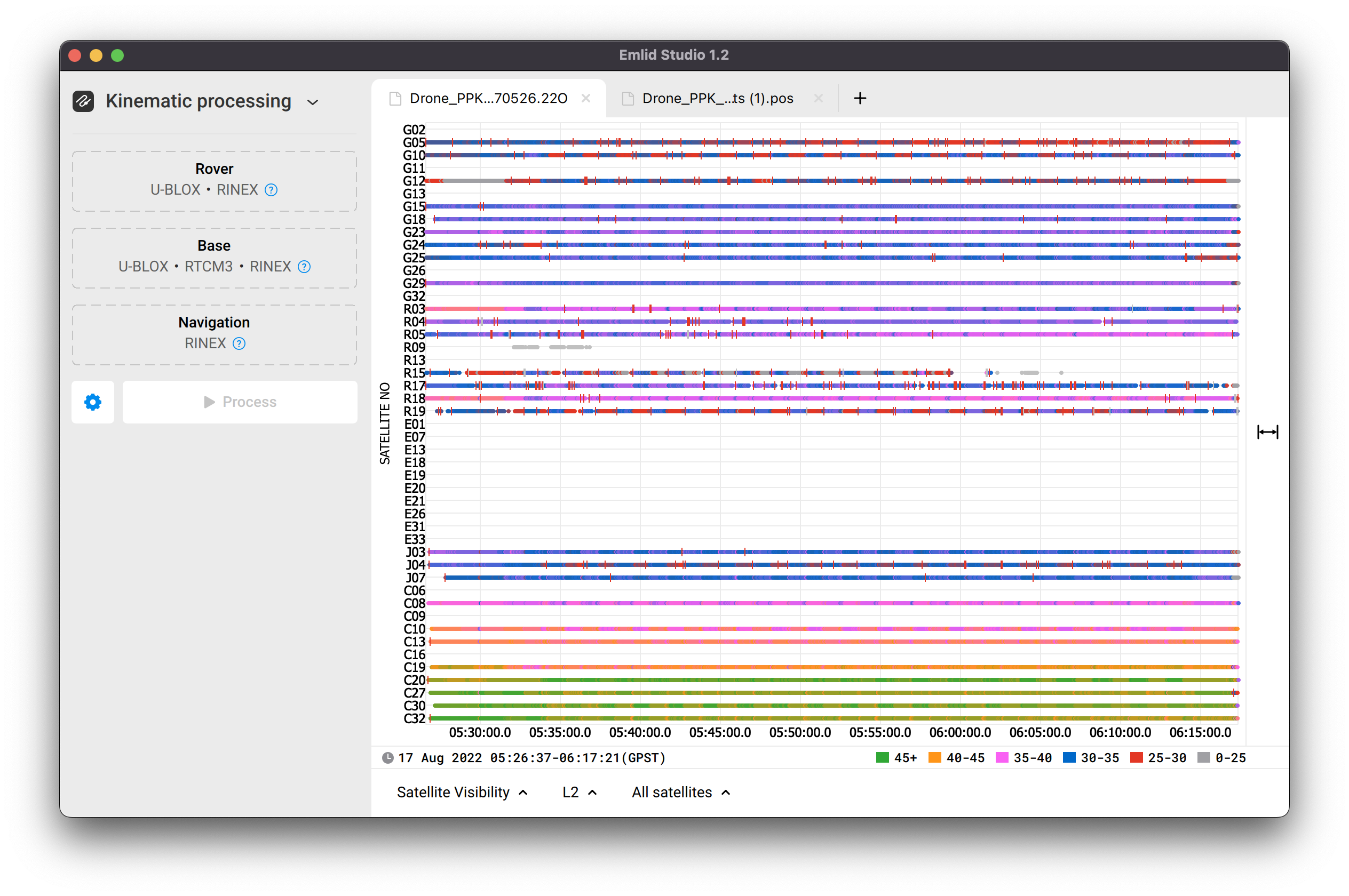
The result is slightly better than in the first case, when all solutions were single, but it’s still not enough. Despite Reach is placed out of the drone and the hot shoe cable is changed, there are still cycle slips in the raw data. Take a look at the screenshots from Emlid Studio:
You can also see that SNR is pretty low and fluctuates for some satellites (G10, G23, R19, E31).
These facts indirectly show that something interrupts the signals or interferes and causes this issue. Do you have photos of setup while you were recording this data?
How was GNSS antenna placed in this case? Isn’t it possible that it wasn’t properly isolated or placed above the ground plane?