I would say so, thanks again Tore. The Cartesian coordinates appear to very near the rest of the waypoints.
wizprod. That’s the sort on thing I’ve been doing RTK and save RCTM at the same time for testing in post, also download the OBX and NAV the following day for further testing.
Sorry to keep on, If the BASE station coordinates are show as approximate in the RTCM header (converted to OBS) how does the ROVER know exactly where it relative to the BASE to calculate it’s own exact position, otherwise it’ll calculate it’s absolute position relative to an approximate BASE ?
The Rover position is precisely determined relative to the Base position. At the same time, the rover coordinates offset from the real location depends on the position accuracy of the base. If the position that has been set in the base station is different from the actual True position on earth the offset equal to this difference will be in the rover position as well.
Hi Andrew, Thanks for the reply. In the OBS & RTCM headers the location of base station is identified as approximate so would I assume any reference from that alone would be approximate and you would have to use the exact location from Positions & velocities Published by EUREF within RTKpost in this instance to obtain an exact location. ?
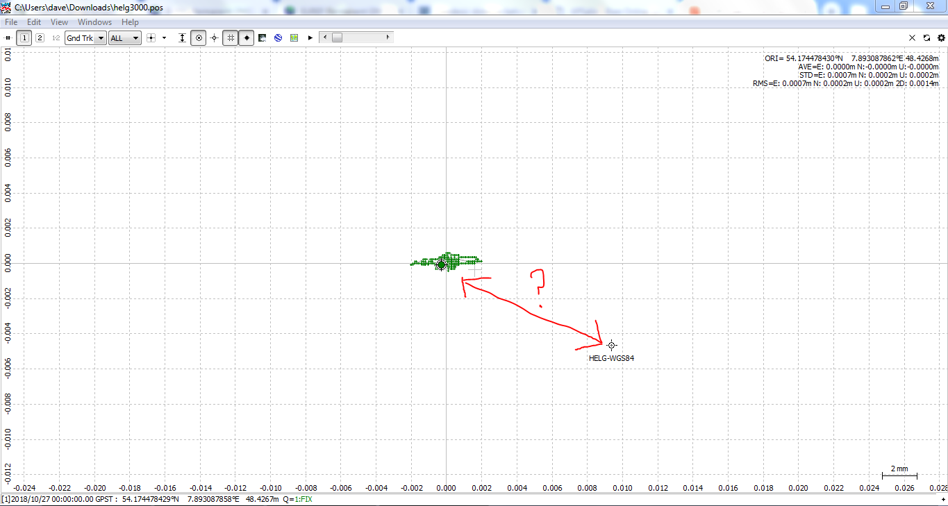
Also ,what I don’t understand is using two EUREF base reference stations HEL2 and HELG (1704.142m apart) one as base and the other as rover, why is the error quite large (~10mm) in RTKplot given the coordinates from Positions & velocities Published by EUREF as reference. I’ve tried many different datum’s for the conversion XYZ to lat long and WGS84 seems to be the closest to the plot but it’s still off by a few millimetres from what I would expect given the distance apart of the two bases. What I just thought is, maybe using the downloaded data OBS & NAV from the two bases this could bring about an error from the ‘approximate’ locations from the OBS headers ?
I’m very tenacious when it comes to errors and I want to identify where and when they come from.