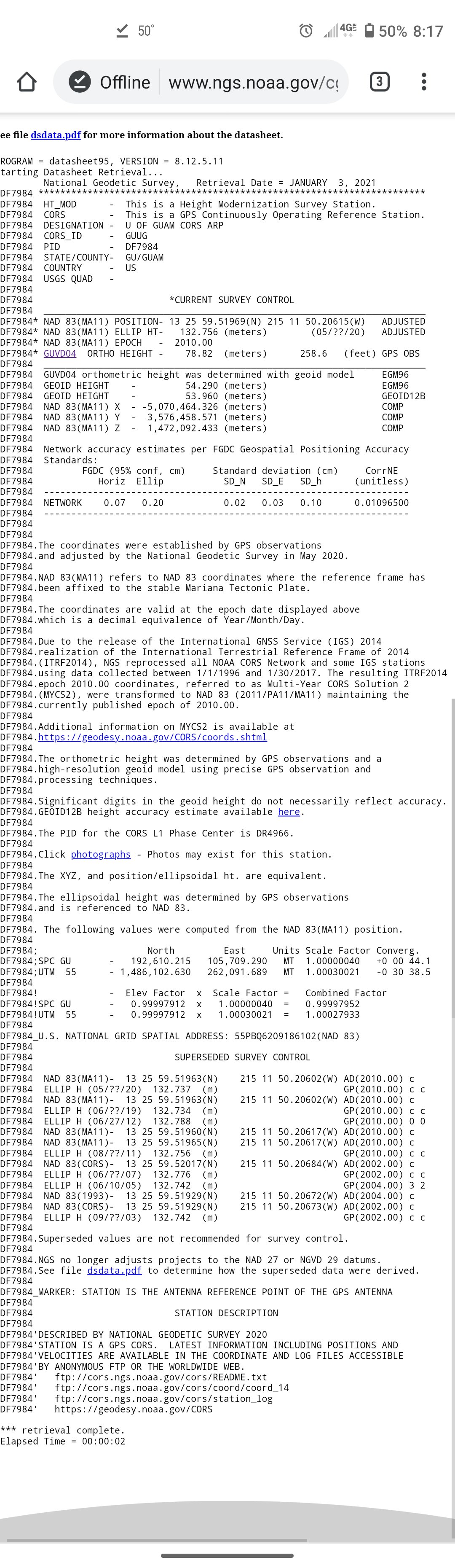
Hi! We are q bit confused as to what to use for “ellipsoid reference” and geoid reference" for our location. Does a US state plane system exist for our location? Guam.
Our WGS84 trial run placed actual locations well off from those points collected from our Phantom 4 Pro.
Thanks for any help.
Before creating a new thread please refer to Quickstart guides for Reach and Reach RS.
In case you are creating a thread about an issue it is necessary to provide following information to get help:
If love to go there one day… My dad was in the US Air Force from 55-65. He told me about his many adventures there in the South Pacific. He was one of several units that used triangulation and astro-geodetic techniques between the islands for orientation of microwave relay towers that the air force used in communications between some of the island bases.
That sounds very interesting. Must have been quite the project and I’m sure a predecessor of much of the technology now being used out here between the military installations. Well worth the visit here and now you have a connection. Thanks again for your help!