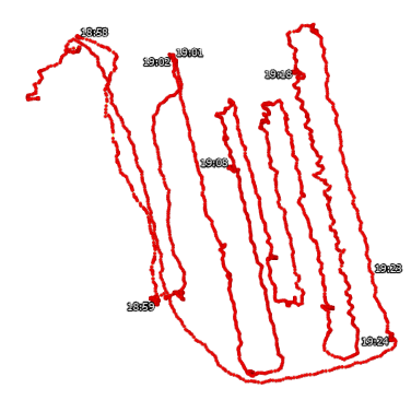
I previously made a thread about how to actually use a lot of the features of the RS2 and I got a lot of great feedback and help from that. Thank you all for help on that problem. I now am in the final stages here and I once again need help. I have a file which I have successfully post processed using Emlid Studio and all I need to do now is get it into a format that I can use to send it to ArcGIS. This is the result I got from Emlid Studio.
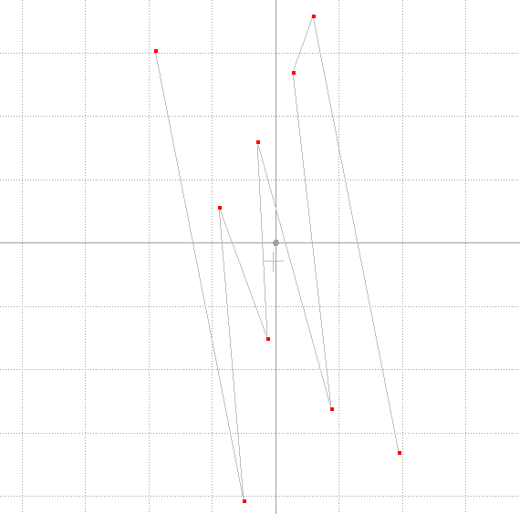
If I can pretty much get exactly this image into ArcGIS, that would be perfect, but ArcGIS doesn’t recognize .pos files. I saw someone had a potential solution that involved using RTKconv to turn my .pos file into a .kml file, but it ended up not really looking how I wanted it, and it showed the whole track I used instead of the Stop & Go points. Here’s what it gave me.
The little timecodes there are the points that I wanted to show but you can see the red lines are all the extraneous data I collected while pathing. If anyone has any experience with ArcGIS pro and how I might be able to replicate that first image within ArcGIS instead of the Emlid Studio viewer, let me know! Thanks so much!
I second what Christian pointed out: you need the CSV file to work with Stop&Go results.
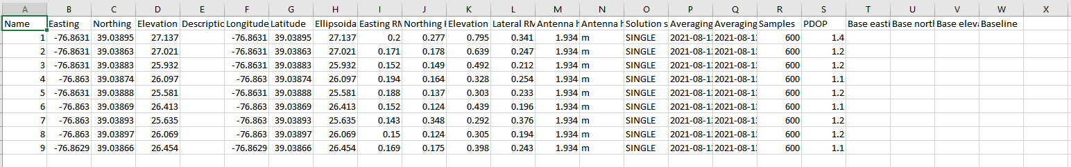
I see that the points on your Emlid Studio plot are red which means the solution is Single and a few meters accurate. If you share the data with us, we can take a look and check why you got such results
What kind of data do you need? I’ll upload the stop and go survey .csv file, let me know if you need any other data. Looks like I have to upload a screenshot since .csv is unsupported so here it is:
I was just taking a look at this and it seems like there is no base data and thats probably why my solutions are Single. Not sure what caused that though.
Edit: I just ran it through Emlid Studio again but this time only accepted Fix readings and got this:
Ok I realize I’m kind of answering a lot of my own questions, but I just realized that Stop&Go edits your .csv file to be corrected and I did not know that before. Looks like the problem is solved, Thanks so much everyone I could not have done it without you all to help teach me this stuff! <3
The Stop & Go tool creates a copy of the CSV file named “*_corrected.” We’ll update docs with this info to make this step clearer.
The first step to answer a question is to ask — and it often helps to find out the answer on your own. So feel free to shower us with all your questions