I not have problems to connecting the Reach to my QGIS, by GPS Information Panel, but for save points, do not is a tools effective to me.
There is some Qgis Plugin with which save points automatic, programming for different change, distance horizontal, or vertical, time interval or other.
I am using Magnet Field Topcon for my work of agriculture of precision, and I would like the workflow be similar.
I forgot to get back to you, sorry. I think Tatiana is right, there is no standard plug-in for that. I’ll show you the closest thing I can think of.
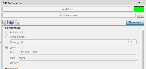
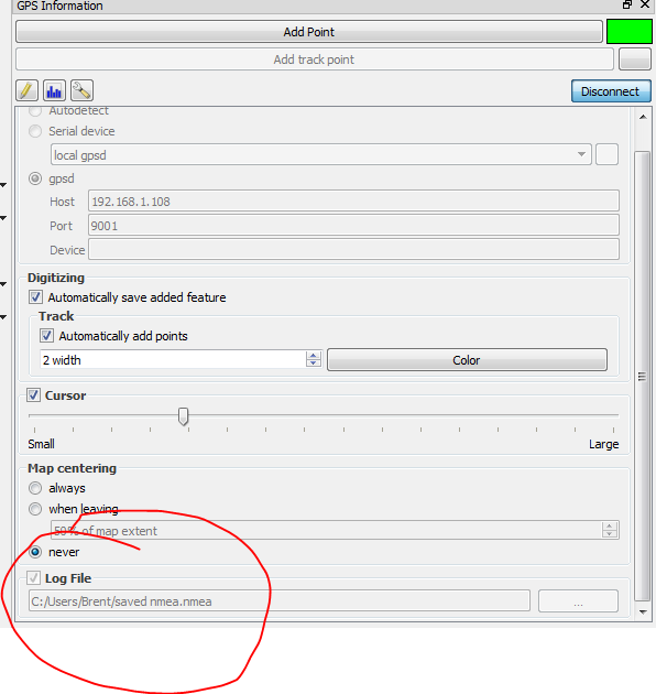
1.Run QGIS on a device on the same wifi network as your Reach (or connect by USB).
2.Open GPS Information toolbar in QGIS and configure NMEA file input. Connect. The light will turn green once you’re connnected.
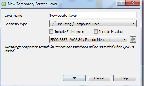
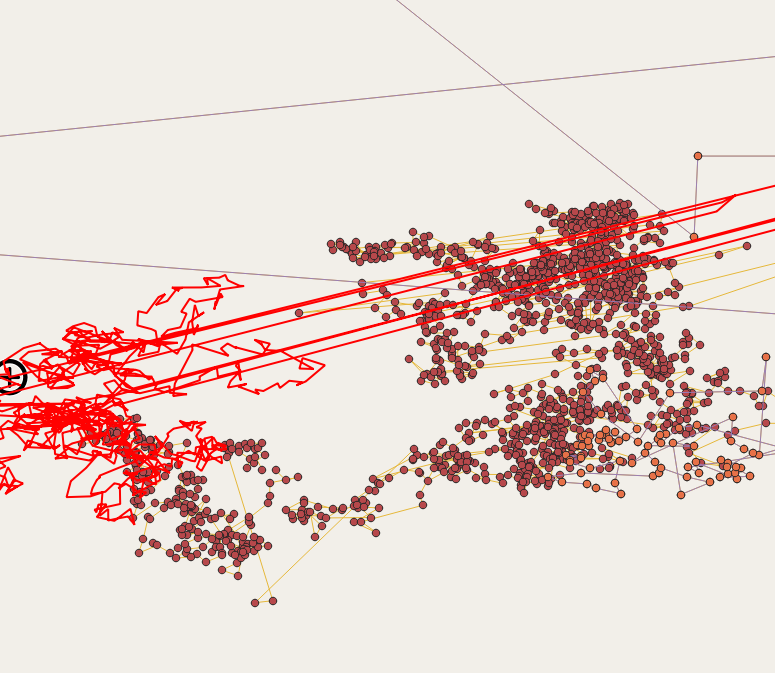
Create a new layer. Important!!! - LINE feature.
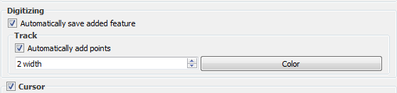
Select Automatically save added feature and Automatically add points.
When you select the new layer in the Layer menu, you’ll see the option to Add line. Click this once you’re done. QGIS starts drawing the line as soon as you connect. Adding the Line saves the one you’ve been on and starts a new one. QGIS is not saving points but a line with many vertices.
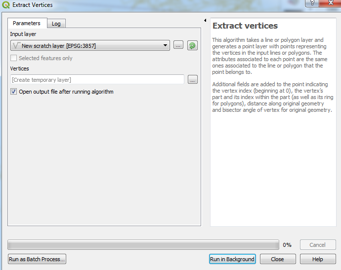
Now you have the easy project of extracting the vertices in one click and turning them into points.
Open Vector-Geometry Tools-Extract Vertices. Select the Line layer you created. Press Run
A little disappointed not to find an application that works for me. I gave myself the challenge of developing it myself.
I find the problem that Qgis does not show me some data, and the elevation is what I need the most.
The information if it is shown in RTKLIB, but not in QGIS or the plugin that I am writing.
Any idea that it may be wrong.