Just got the reach RS+ and we’ve been playing with it.
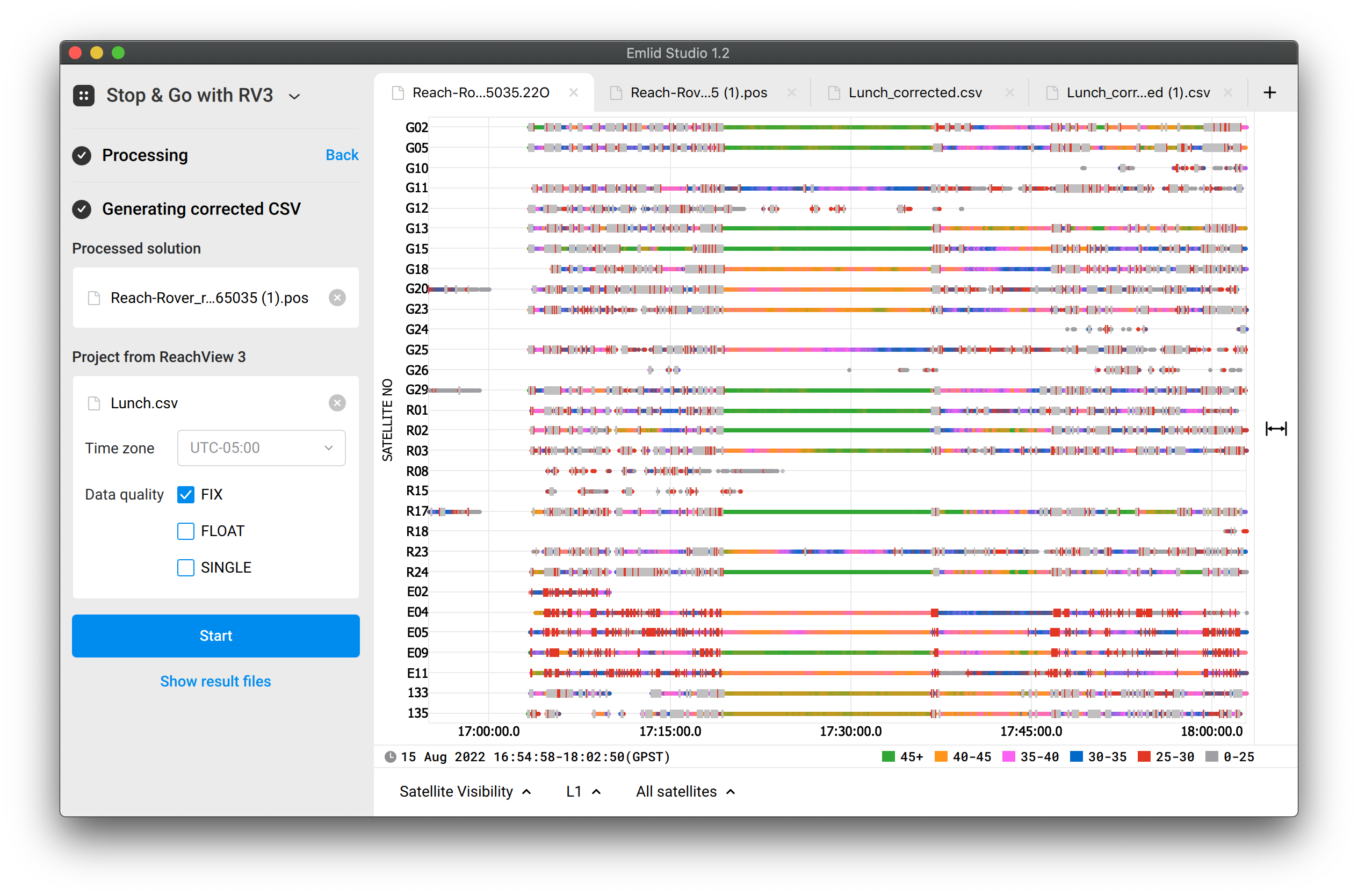
We dont have access to NTrip but we have plenty of CORS stations across our state here in Louisiana. Most of the time we are getting 24-26 satellites.
We get a ton of fixes in our rinex files during post processing, but can’t seem to consistently get a fix on a point from the project csv file.
I’ve attached our files and the cors base station to hopefully get some insights into what could be going wrong.
We see a lot of disturbed signals at the beginning of the log and at the end. I suppose the device was in a car or something like that.
The point was collected from 17:21 till 17:36 UTC. In this time interval, the signals are pretty good. But you work with a single-band device, so it can’t calculate a Fix immediately after the signals have become good. It needs some time for initialization.
So, to fix that, I changed the Filter type to Combined. In this case, the calculation go forward and then back, which helps gather more data. And make sure you checked only Fix Data quality option.
Oh wow… I didn’t know those made a difference… I am going to go back and check my history and reprocess some other things to see if I indeed had fixes when I only saw floats. Thank you so much!!
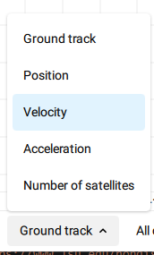
P.S. How do you get the satellite velocity view? These are my options:
The options from your screenshot are supported for .pos files, while the Satellite Visibility is available for raw data logs. You can drag and drop the logs from the base and rover directly to Emlid Studio.
Any chance you can take a look at this one?
Sure, I’ll check the new dataset and write you back!
I’ve managed to obtain a 100% Fix with your data in the following setup:
sjb12290 raw and navigation data used
After resetting settings to default, changed Filter type to Combined and SNR masks for L1 and L2 to 40. Changing the masks helps to use only the clearest signals in the calculations.
With single-band logs, Emlid Studio tries to use more or less all the data it has. Also, in general, time-to-fix is longer for single-band data. So it’s a good idea to force the software to leave only the clearest signals. This is what we call “playing with the settings”.
By the way, we’re preparing the guide about logs analyzing. It will uncover some secrets of data post-processing.