I need your help to understand if the approach is correct
I placed the REACHRS2 in a fixed place as base station for an intensive mobile mapping survey.
So to use the data from reach I need to calculate the exact coordinates of my base so I used the long observation (approx 11 hours) then I downloaded the data from a CORS and I calculated the coordinates of my base. After I will enter this coords to post process the trajectory of my car
is this approach correct ? How can be sure about the quality of the coords of my base station ?
In short, you have only your length of observation and length of baseline to make sure you are within an acceptable limit (likely 5-10 cm of elevation) in the absolute space. It really comes down to your baseline. If more than 40-50 km, you need days of observation to be sure (under 5 cm elevation).
The best way is to have multiple CORS stations to process the base observation from , create CORS1-Base-CORS2 (etc) loops to verify, and use a postprocessor that can do Least Square Adjustments (like Onpoz Ezsurv or the like). With this approach you can get down to 0.5-2 cm of assurance using 7-14 days of 24h obs)
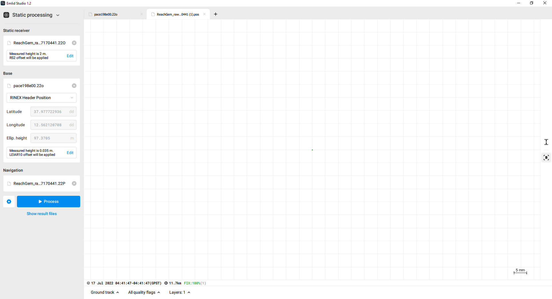
The approach is correct. But Christian is right, you should pay attention to the baseline. And with 11.7 km, the results should be with precision around 2-3 centimeters. I’d say it’s quite good.
Emlid Studio doesn’t show you the line between base and rover, but it can show you the base point if you type on the B button on the right side.