


Hi! Can I ask a question?
I’m looking for a method to know the base station position.
I am this step now.
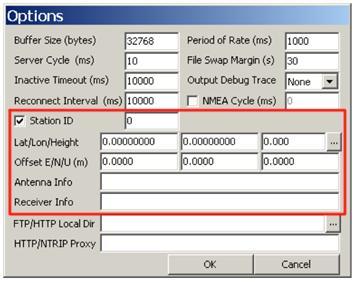
And I’d like to fill in ‘Lat/Lon/Height’ of base station, but I don’t know it.
Actually, I found one method.
That’s it.
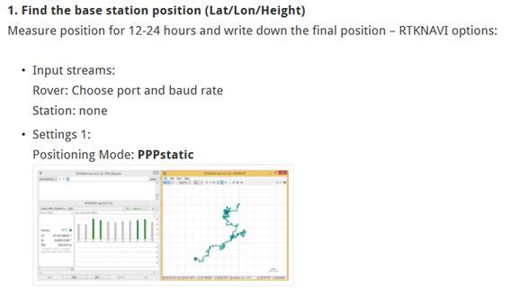
However, I think it’s too time consuming. So I hope to find another one.
If you have some ideas, could you tell me please?
Thank you.
1 Like
I was going to recommend the below, but then saw they only work with dual frequency.
http://webapp.geod.nrcan.gc.ca/geod/tools-outils/ppp.php
Accepts single frequency files, per this comparison
http://gpsworld.com/a-comparison-of-free-gps-online-post-processing-services/