


in an RTK survey how do I obtain the average value of the position of the Base? What is the method, download the UBX file? Thank you
Luis
Hi @agrimgalina,
Can you clarify your question?
Do you need base average position after surveying or do you need it before?
Hello Andrew, I do not understand why the base is configured in kinematics if it is a base point. In my Promark 3 I must configure the base as static. I need to georeference my base with a permanent station at 86 km and I can not get a fixed solution. Please explain to me
86 km for RTK is too much generally, it should be under 10 km.
But to answer your questions, this is how I would do it:
- Connect to the permanent station on the Reach base, through the Correction Input tab, NTRIP.
- Set the RTK settings to reflect the purpose, so setting it to Static. At 86 km, you will likely not get more than a float solution. If I were you, and I had to re-use this point over and over, I would occupy the new point for 24 hours, and then postprocess it.
- If postprocessing is not an option, then average the Float solution for 10 minutes, but preferably more.
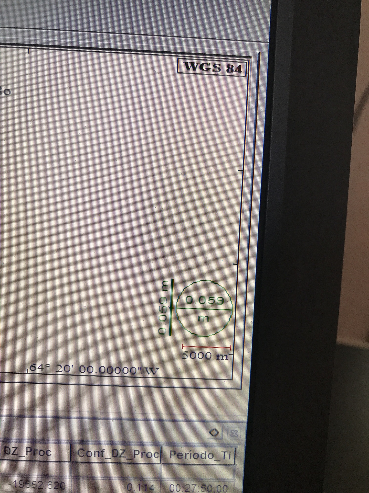
Thanks Christian but I live in Argentina the minimum distance to a permanent station is 58 km. look at the result in GNSS solution 6 cm for the precision is enough to give coordinates to the base. I can not achieve this in RTKlib
I share your troubles in that regard. Where I live, the nearest (free) NTRIP is 130 km away, which gives me a fair float solution. Nearest CORS solution is 60 km away, which for PPK gives me some quite low RMS solid Fixed solutions.
Do you have the CORS and base obs? I’d happily give it a try in RTKpost.
Can you explain how to process PPK that I do not understand?
Have you tried this guide?
if I have all the data cords and obs
Try and upload them here, and I’ll have a go at them.
I’ve been guided by that tutorials but I do not get fixed results and in gnss solution if
Can you upload your files?
BASE.zip (8.4 MB)
ROVER.zip (3.4 MB)
http://www.ign.gob.ar/NuestrasActividades/Geodesia/Ramsac/DescargaRinex
Base is CORD
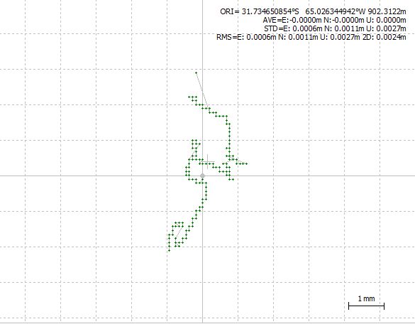
How do I obtain the result of the average of the coordinates of the base? the precision is a little less than 5 cm
Your CORS obs are missing some obs from the beginning (cord322u.18o).
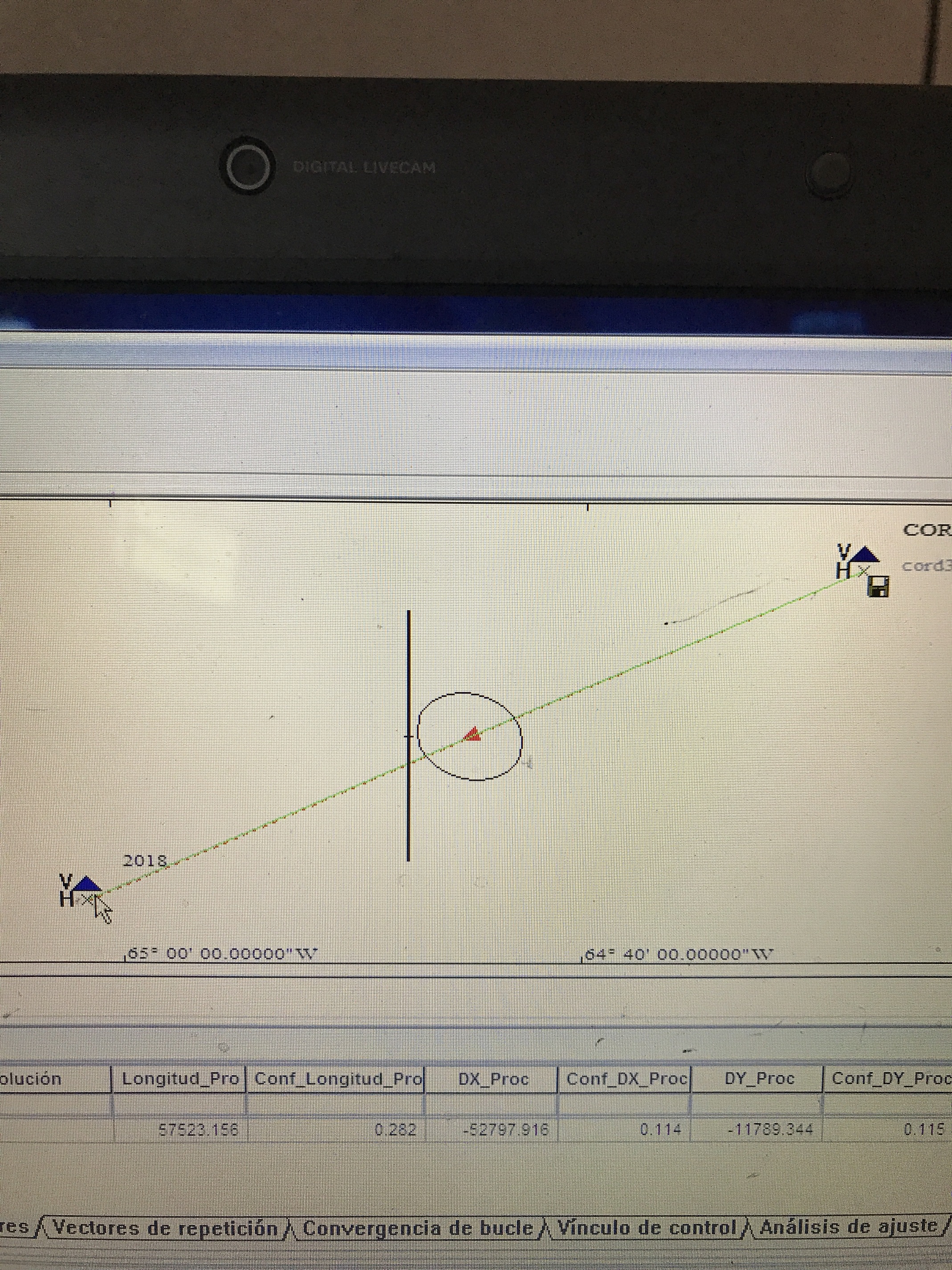
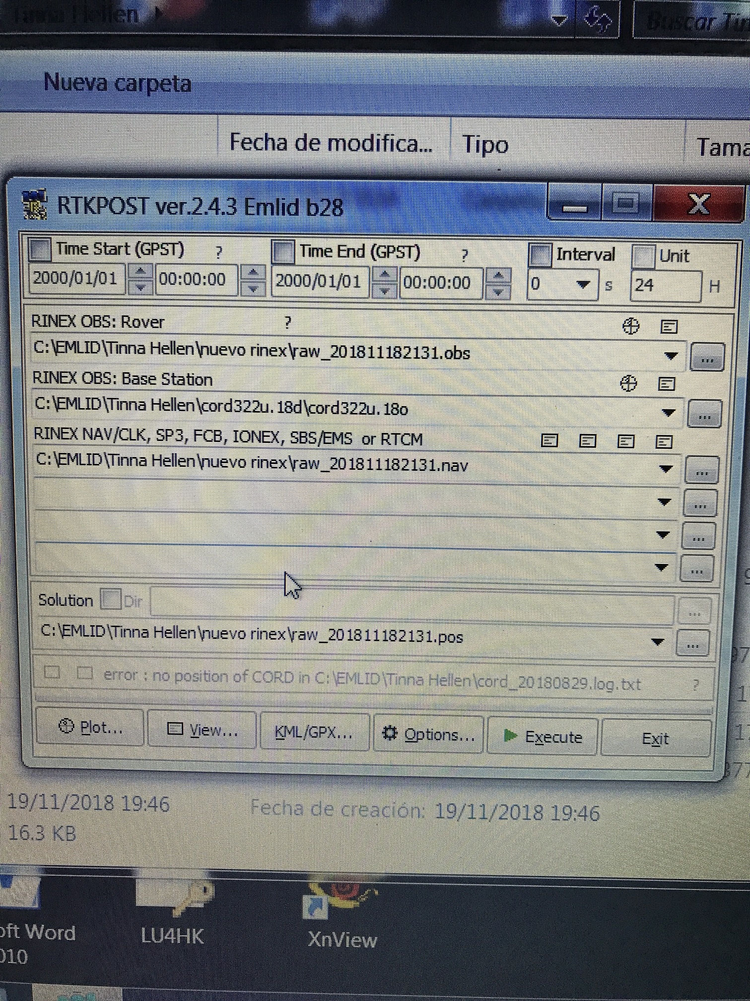
the results of my processing:
This one is using the position of the Cors station in the Rinex header
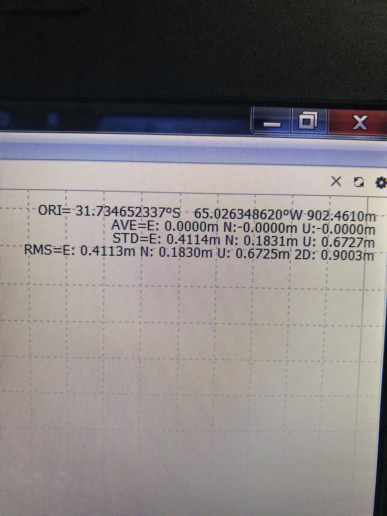
This one is from the log file of the Cors station (ftp://ftp.igs.org/pub/station/log/cord_20180829.log). 11 cm difference in result, but same RMS.
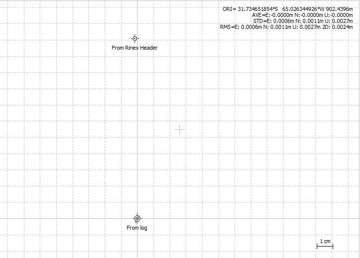
Pos-file for your reference:
raw_201811182131.pos (933.7 KB)
Christian
What are the parameters that I use in the RTKlib to process?
I think the most important ones are “Combined” for the Filter Type, and Fix-and-Hold for AR type.
You have a very good service that explains all this. It is free and very easy to use. Postprocessing here by rtkpost is not suitable. You have to use VRS near the point. I’ve provided all the details in the reports. Additionally, I made the classic adjustment, which also gives good results.
There are a few threads about how to use the VRS - then your receiver is just as valuable as the most expensive ones.
Regards
Report_RapidStatic_Luis.pdf (427.2 KB)
Report_Static_Luis…pdf (513.4 KB)
vrs13220.pdf (1.3 MB)
1 Like