I have recently setup my EMLID RS2 as a base station on a building to send correction to multiple rovers.
I’m using PPP to accurately determine the coordinates of the base station. I’m collecting 24hrs log and upload it to Canadian NRCAN CSRS-PPP service.
Since the antenna is installed on a building, it is very difficult to accurately measure the antenna height. My question is, how important is the antenna height for ppp calculations? If it is, what would be the best method to accurately measure the antenna height from ground?
or JUST the typical EMLID RS2 Antenna Phase Center (APC) of +134mm (+0.0134m) … even more so the L1 APC of the calibration file which is +134.92mm (+0.013492m)
Or is OPUS already taking the APC into consideration from the antenna calibration file… so just enter ZERO only?
I.e. the same as if just using a 2M pole set on a nail in the ground. Obviously you would just enter the 2M height as that is to the bottom of the RS2 which coincides with the (Antenna Reference Point (ARP).
It is very easy to make mistakes here… therefore elevation problems later.
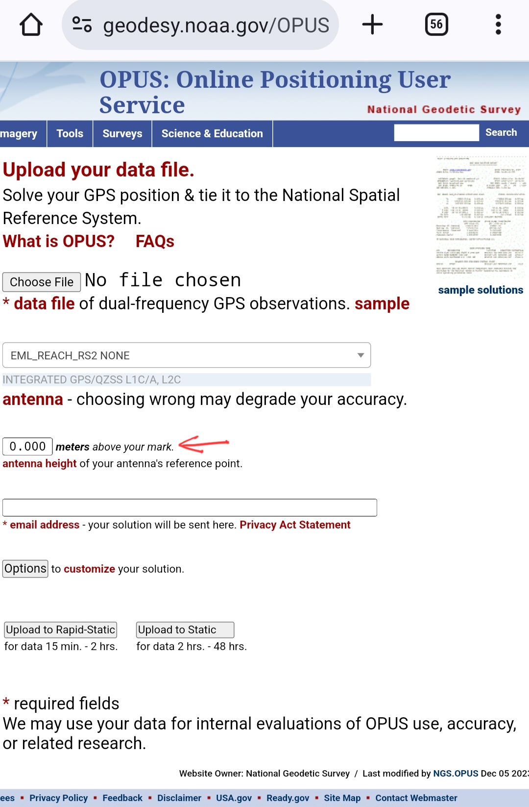
I am “guessing” since it will be mounted above a building, to enter just ZERO? Seems OPUS will take the Antenna Phase Center of +134.92mm (+0.013492m) in consideration automatically from the antenna selection, therefore the data in the calibration file?
Correct. OPUS gives you a solution using the antenna cal so it would be a zero antenna height entry. Then, OPUS factors in the APC (~135mm) in the Z axis.
Here are some links/FAQs regarding OPUS and this topic:
Is antenna required? If I select “NONE” will it use the L1 phase center?
While strongly recommended, if you leave the antenna as NONE your data will be processed with no offsets applied, resulting in a position a few centimeters above or below the L1 phase center. Ignoring your antenna’s phase center variations will be interpreted as changes in tropo delays, causing errors in the tropo parameters which will degrade your solution.
Ok so just to be sure , if my base station is on the shop roof permanantly then for antenna height i enter zero?. If i upload my file to nrcan website how is the most accurate way of doing it . I see there is ultra rapid. Rapid and final. Looks like final is the most dead on . How to i acheive a FINAL result.
In the spot where i enable logging for info for Rinex header enter 0 for antenna height?
Which gps constellations may be turned on while the raw data is being collected? Only gps and glonass?
Also difference between ITRF processing mode or NAD83?
I want to get it right in case we ever have 2 or more base stations i want all my ab lines to be exactly right no matter which base i am connected to
and also one last question when my report comes back from nrcan i enter the manual coordinates in the emlid as well as the elevation. in those 3 spaces. but the antenna height… leave at zero or enter what the emlid’s physical height is ?
Yes. Zero is what you want for a permanent setup. Also, the ephemerides being final (“precise”) is ideal for that permanent setup. Somewhere between two and three weeks (after the static logging) is when the precise ephemeris is available. you will resubmit the Rinex file at that point. If it’s a permanent setup, I would log multiple 24hr sessions. Then submit to OPUS (or NRCAN) and then average the position to come up with your final position for that permanent base setup. I would never recommend using “ultra rapid” ephemerides. I would only settle for rapid or precise. You’ll find that results are very similar between rapid and precise when compared. I hope this helps.
OPUS about page on ephemeris/orbits….
Wait a day before submitting your file: OPUS will use the best CORS and orbits available at the time you upload your data. While most CORS are archived within 30-minutes past the hour, some aren’t available until the next day. If you process your data in less than 24 hours after collection, OPUS will use Ultra-Rapid orbits. Rapid orbits, available at 17:00 UTC the next day, will offer a slight improvement in your accuracy. Final orbits, available weeks later, offer only slight benefit to solutions in areas with usable CORS nearby.
To sum up the workflow with the NRCan CSRS-PPP service:
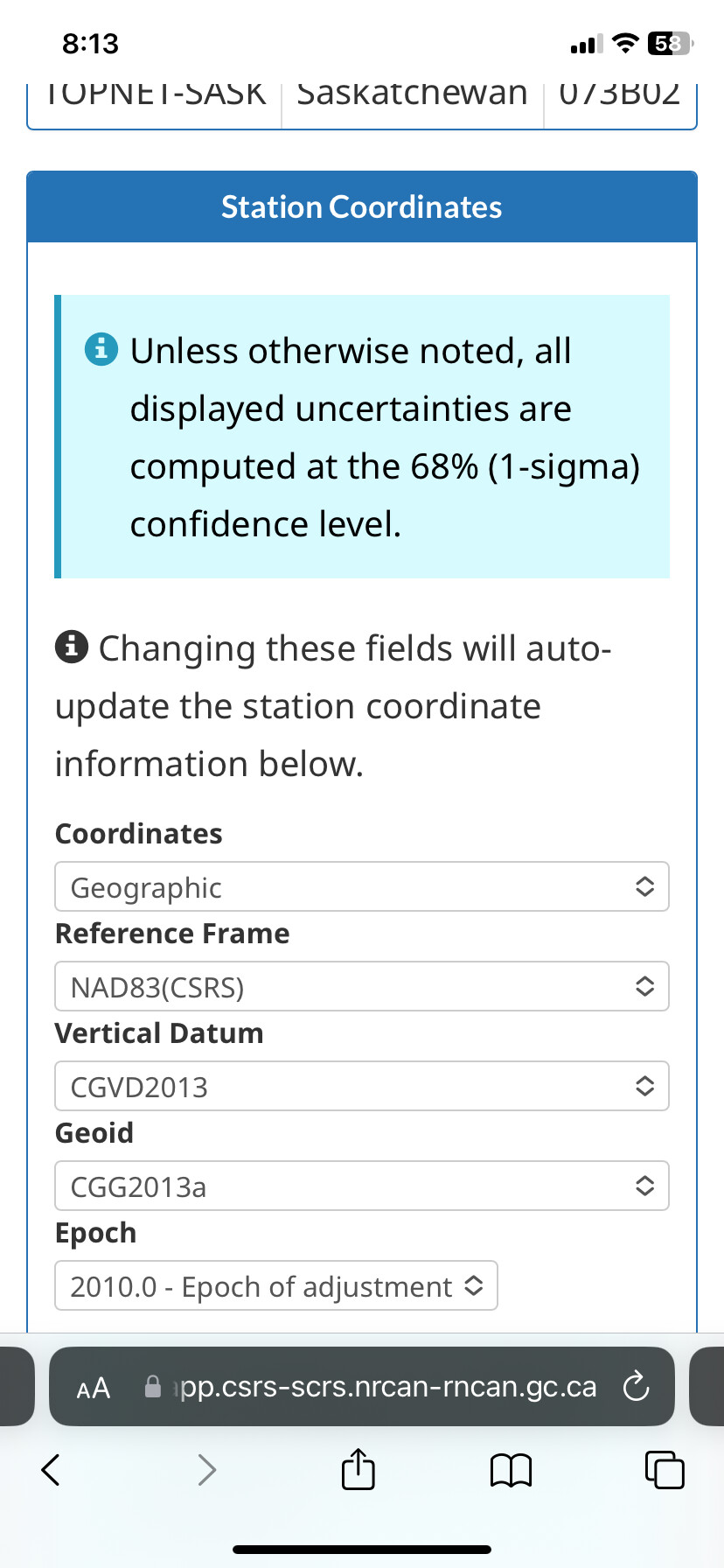
If you set a zero value for the antenna height, you’ll get coordinates of the bottom of the receiver.
If you’ve specified the measured antenna height, you’ll get a position on the ground.
Enable a CSRS preset in the logging settings. It’ll include only GPS and Glonass, as NRCan ignores other constellations.
This option defines the coordinate system of the output position: NAD83(CSRS) or ITRF.
You need to enter the height from the point with known coordinates to the bottom of the receiver. If your base station is on the shop roof permanently, you can leave it as 0 both in the Logging and in the Base settings tab.