Hi I’m a new user and I have a question about importing data into Emlid Flow. Although I can import CSV files from my device that I’ve previously exported from the same software I am having tremendous difficulty creating my own from outside data. In general it would helpful if there were better background file options.
My question is what coordinate system does my imported file need if I am using Global CS as my project coordinate system. I’ve also tried WGS 84 UTM for my region for Shape, CSV, and DXF formats without any success. Exporting in QGIS and Arcgis Pro.
Additionally, I’m importing data into gis software as a KMZ then exporting into the aforementioned formats.
I’d like to avoid having to write the CSV file manually. I’m already compromising by not having circles and other polygons and if I have to do that it will only be points.
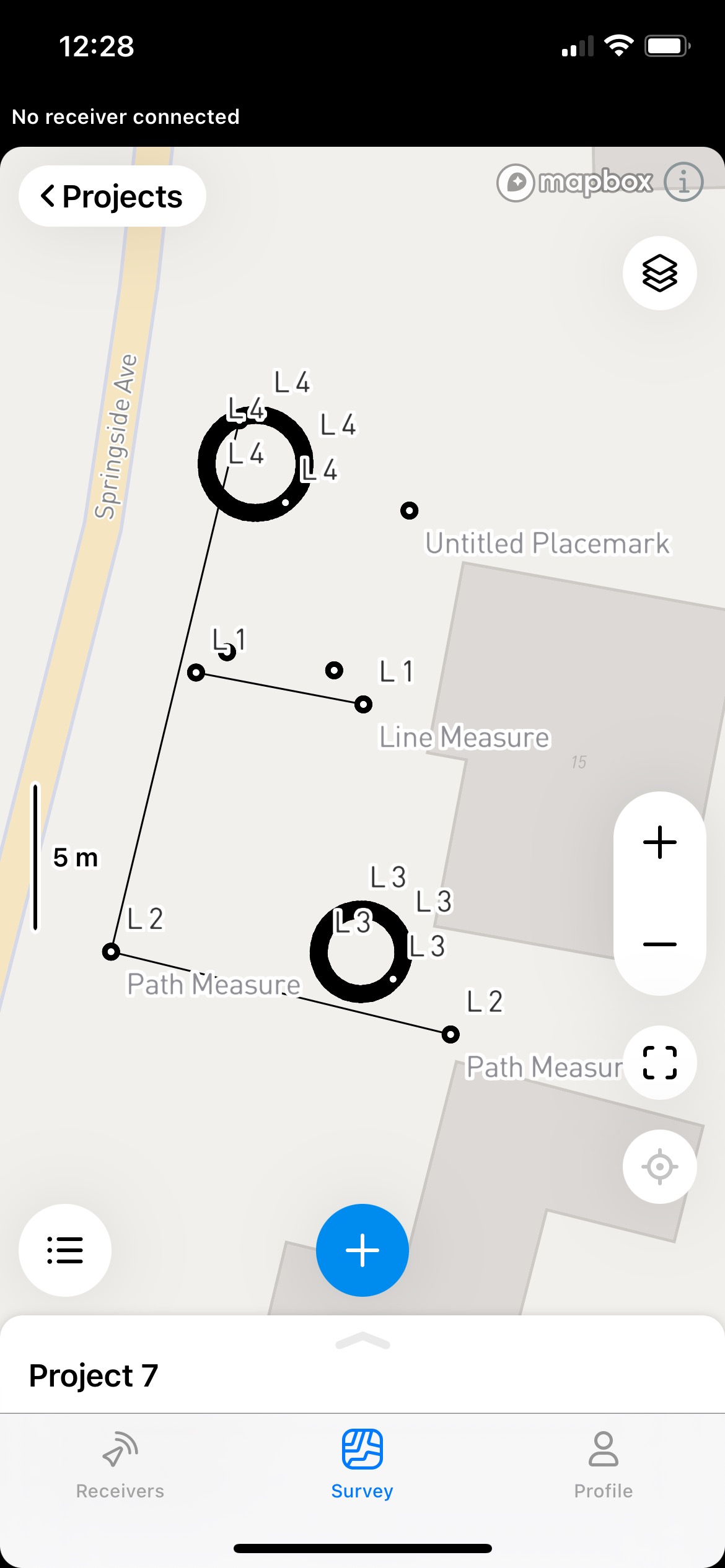
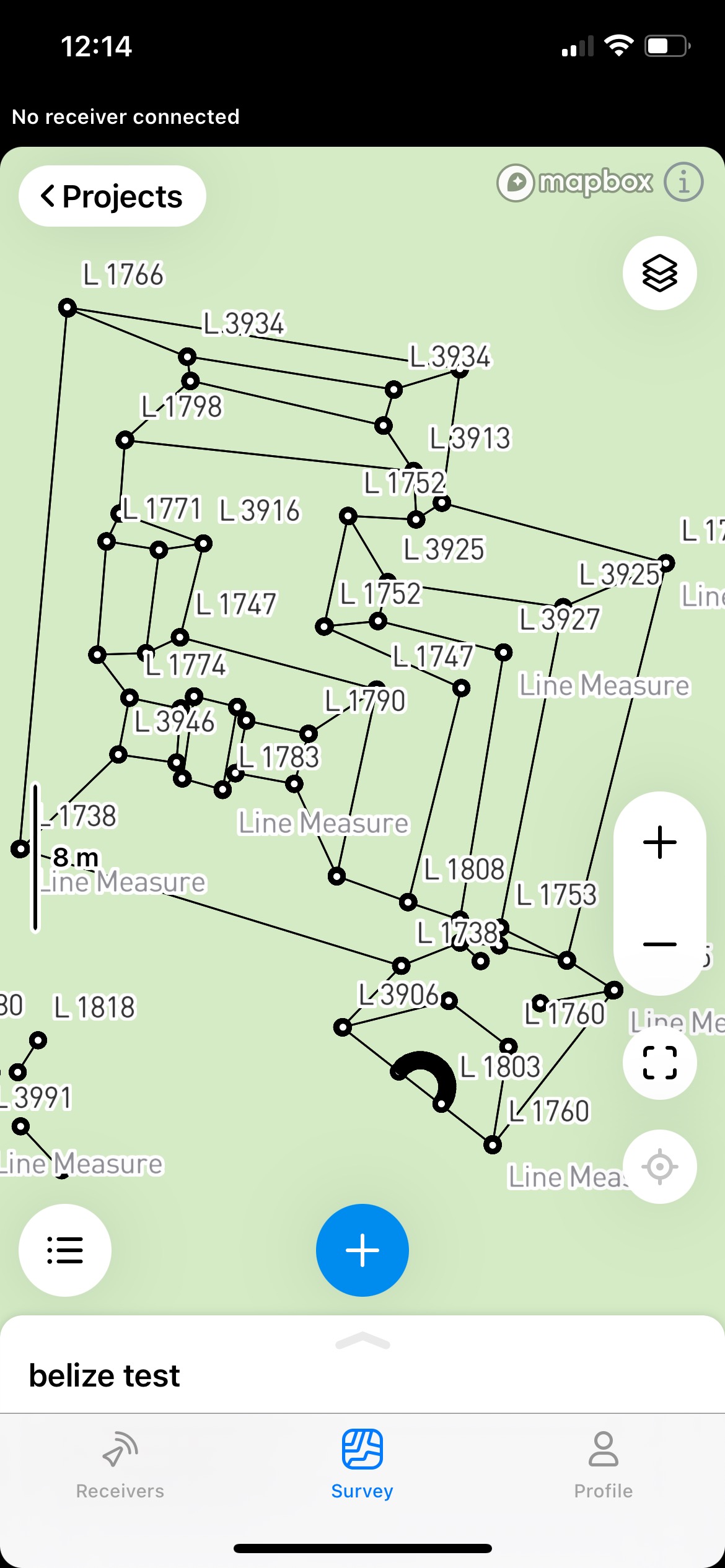
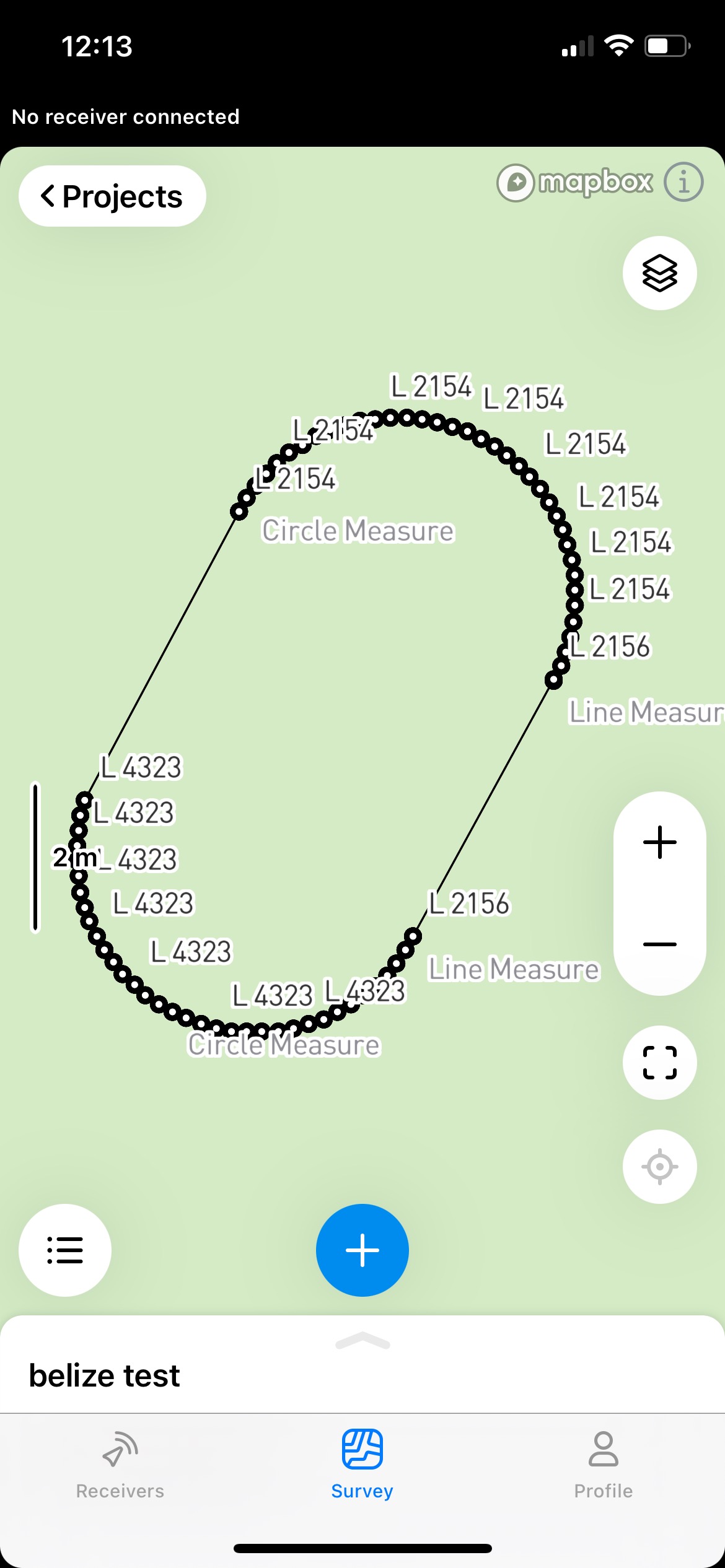
I found a solution that I’m fairly happy with, including shapes that approximate circles and more complex polygons. Since I was told that Emlid Flow cannot import circles and complex polygons I thought I’d share my work flow here.
My earlier problem clearly related to the coordinate systems not matching between files I was importing and Emlid Flow. To solve this I opened a project in Emlid Flow and set the CS I desired, then logged one point and exported the file as a shapefile. I then imported the shape into Arcgis Pro and used the Project (projection) function match the shape files I was trying to import to the file that I logged in the Emlid app. Not sure why I had so much trouble matching the coordinate system of GIS software and Emlid Flow but that fixed it. I’m using WGS 1984 UTM 18 N. Perhaps I was in another WGS 1984 CS, web Mercator, or a legacy CS or something.
The polygon shapes were simply drafted in Google Earth as paths. I think some of them I drafted in QGIS as shapefiles and then imported into Google Earth where I was working at the time. Google Earth because I was delineating features visible in aerial imagery. The polygons and circles all were interpreted by Emlid Flow app as closed paths, points and lines resulting in shapes that approximated more complex polygons. I exported the GE .kmz file into Arcgis pro, used the KML to Layer function, set my coordinate system and exported as shapefiles to be opened in Emlid Flow.
If there is a way to improve this workflow I’d be receptive to feedback. Thanks.