


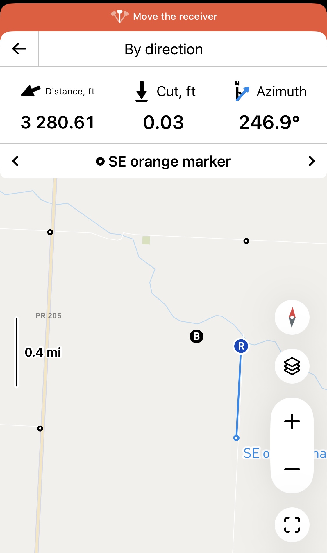
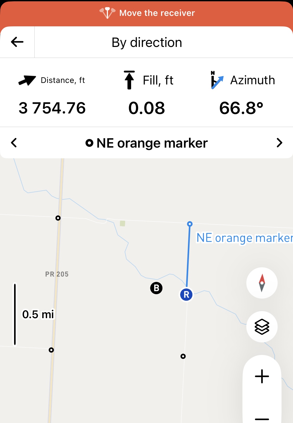
I am having trouble with the azimuth reading. My surveyed points are historical mile markers. I am not near a correction line. When I stand approximately in the middle of the line the azimuth readings in correlation to the mile markers does not equal 360*. I am close enough to where the line should be that I expect either 0* or 180* +/- 5*. What am I doing wrong? Is the azimuth calculated differently than I think? Thanks in advance.
Hi Calvin_Ingraham,
Welcome to the Community Forum! Thanks for the screenshots—they made it much easier to understand your issue.
With azimuth readings, the angle is referenced on two vectors: one pointing North (grid or ground) and the other toward your target point, and both start from the rover’s position. So, if you switch between two target points along the same correction line, the angles won’t necessarily add up to 360 degrees.


However, you mentioned having a shift of angle readings when you got close to the correction line. I’d love to check this out for you. Could you share which coordinate system you used for this project? That’ll help me check everything out.
1 Like
Thanks for the reply. When I started the system the next day the results were what I assumed they would be. I believe my issue was not having the rover stable when I powered it on. I knew the importance for the base station but hadn’t realized the rover could give me issues as well.
1 Like
I doubt anyone on here could do this manually from memory. This is one of the routines I programmed in my HP41 when I bought mine in the dinosaur ages. It’s a good read and website for manual survey computations:
https://jerrymahun.com/index.php/home/open-access/17-trav-comps/45-travcomps-chap-f?start=2
2 Likes