I am doing collection of a large number of topography points on a river bed by using a Reach RS2 mounted on a backpack. I will be wearing waders and walking around.
I would like to set up Emlid Flow so it takes a reading say every 5 seconds or ten seconds. Is this feature available or could it be added?.
I understand that the log takes readings at 1 second intervals so I could use that but it would be good if I could do it through Flow using the maps etc to see the points and where I have already surveyed in real time.
I guess the other way to do it is set the point collection time to a very short duration and just keep pressing the button every 10 seconds to take readings. Since I am moving - the observation time would need to be very brief.
Until an option like that is included there is an app i use called auto clicker which can be used to press down on the Measure button with a user defined time interval
You can also simply do this by turning on logging at 1hz. You’ll get a position every 1 second. I’ve user the LLH logging for this. This would, of course, be happening behind the scenes versus collecting in EM Flow.
Oh, the workaround with an auto-clicker app is curious! Have never thought of it.
From our side, I can say that we have plans to implement automatic point collection with a fixed time interval. I’ll note your +1 for it. And as soon as I have any news, I’ll post it in this thread.
And I can also support @Zaz5400 suggestion. If it’s ok for you to have the position info after the survey, just record a position log. You can start and download it in the Logging tab.
Using the logging tab is not such a good workaround because you cant annotate the point type and it is difficult to start and stop the data collection sporadically - which happens in the field. You also cannot see in real time where you have been on the map which also helps especially if you are working in an area with no visible landmarks.
I am looking forward to using this functionality in Flow.
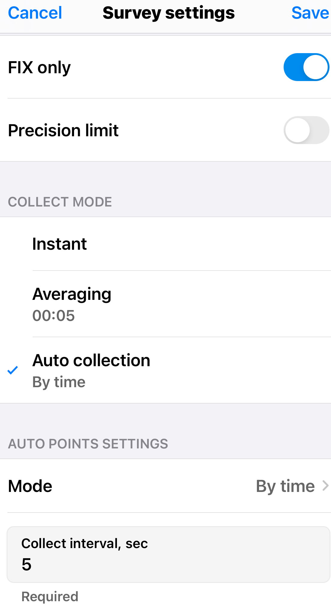
We’ve just released a new version of the Emlid Flow app with the feature of automatically collecting points over a specified time or distance. This feature is part of the Survey plan.