Reach RS+ to Twinmotion
Hey guys,
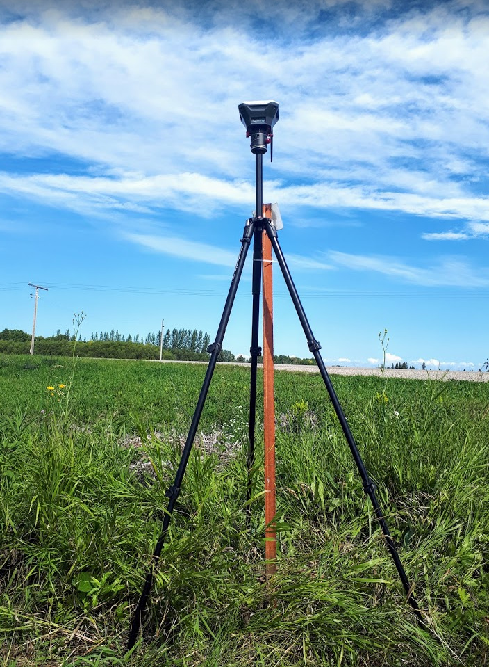
It’s been a while since I shared a project and I thought I’d post some pictures from an arch. visualization I’m working on. A group in northern Saskatchewan is wanting to build a new school and community use building on the same property as their church and existing school. I used Emlid Reach RS+ and Mavic Pro with GCP to survey the property for visualization and design purposes. High accuracy wasn’t critical but it’s nice to have it more than just a guess. I’ll go through the steps.
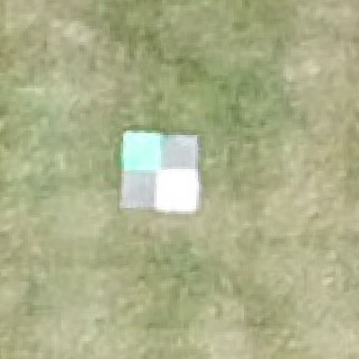
- Base station set up and survey. Relative accuracy was all that mattered but I set up my base station approx. over a property point so I can integrate it later if needed.
I flew the site, downloaded the ground control points, and, instead of purchasing my own high end processing software for occasional jobs, I just use Upwork and find a freelancer with Agisoft and get him to do it for 30 bucks. For me, it works out great.
Surveying the ground control points worked fabulous and I ended up doing a little demonstration for some local farmers. They couldn’t understand how I could have RTK for such a low price.
Of course, QGIS was used for generating the contours and adding property lines.
Then Revit for viewing the point cloud and designing the new building.
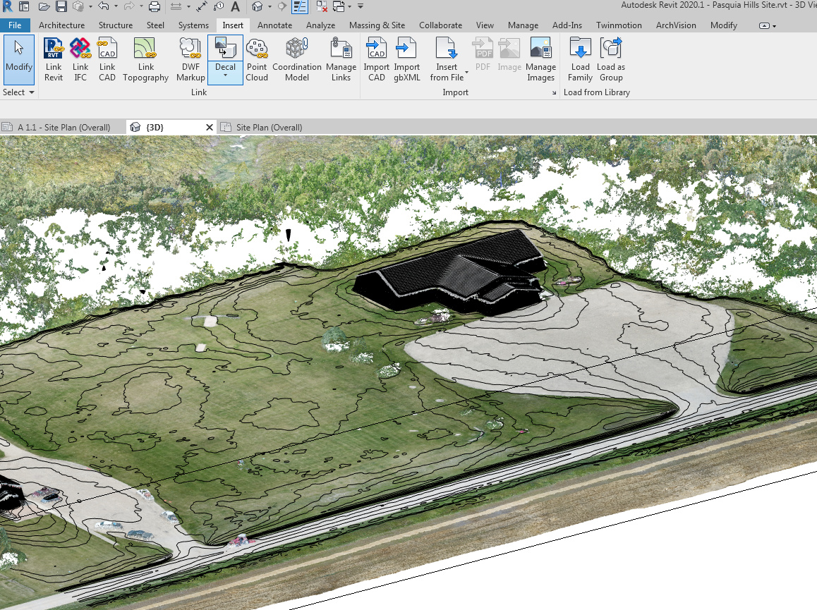
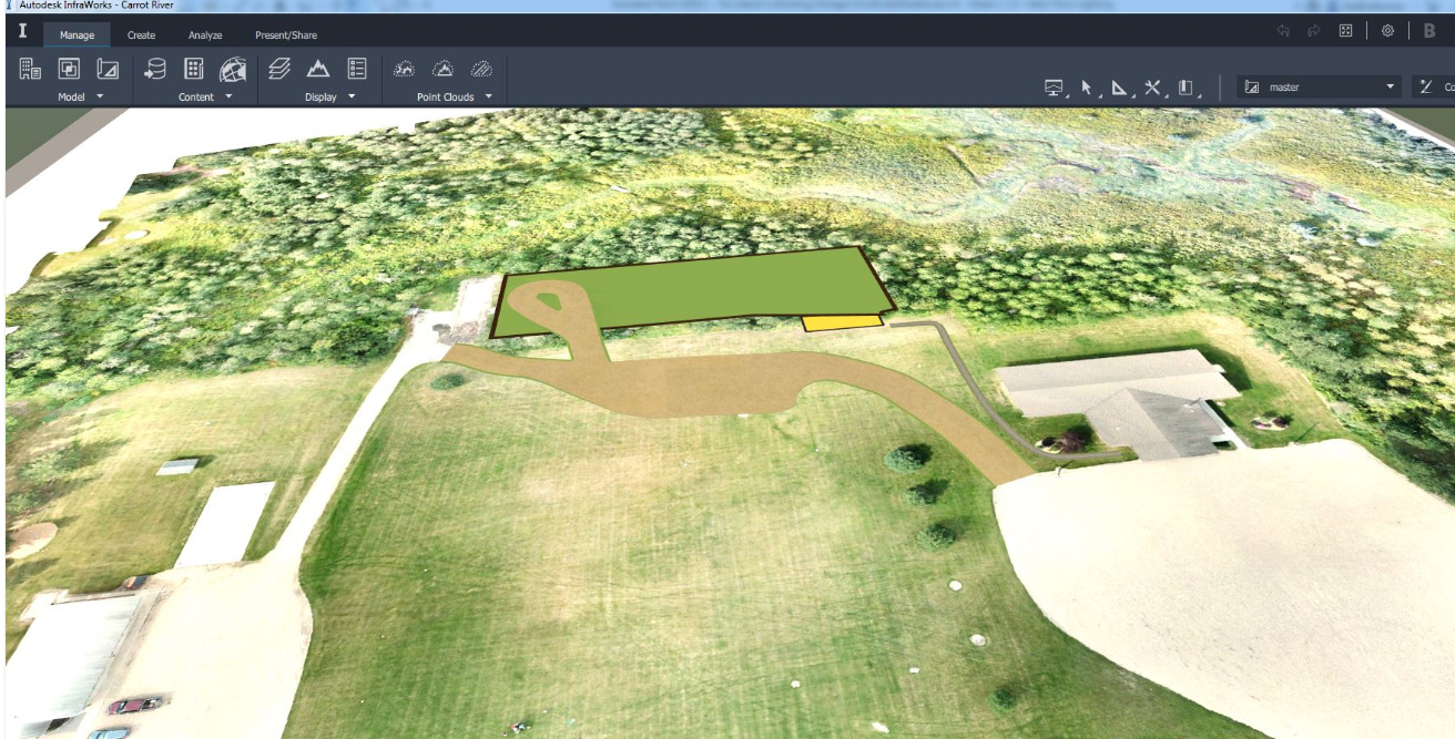
Then I imported my plan to Autodesk Infraworks where I added small roads, sidewalks, and parking. So I imported QGIS rendered drone imagery with new building location and used it as ground imagery in Infraworks. This is great software for 3D site design but it’s not super realistic.
Then I exported it all (except the new school) as a 3D model and opened it in…
Twinmotion! Here is the software I want to feature in this post! For all surveyors or designers wanting to enhance your 3D models and landscapes! It’s FREE for now and extremely simple to use. Download it before January 2020 and have it free for life. A cutting-edge real-time visualization tool - Twinmotion
One click integration with Revit. I send my school to Twinmotion and manually positioned it. After this, any changes made in Revit are automatically updated in Twinmotion with one click.
Import your DEMs to make landscapes (without the texture maps though) or import the .obj files of your sites. Add any Sketchup, .fbx., .dfx or nearly any other 3D models you can think of and bring it alive with Twinmotion. Highly accurate photo realistic renders are often a problem with exterior and civil views. Often we do the building highly accurate but just try to make the exterior pictures attractive and believable.This solves that problem. Paint grass,flowers, trees. Add weather effects. Once again, let me repeat. Insert nearly any 3D model and change it to highly realistic materials. Now that Quixel has been bought by Epic games there are almost limitless materials available for free! https://quixel.com/
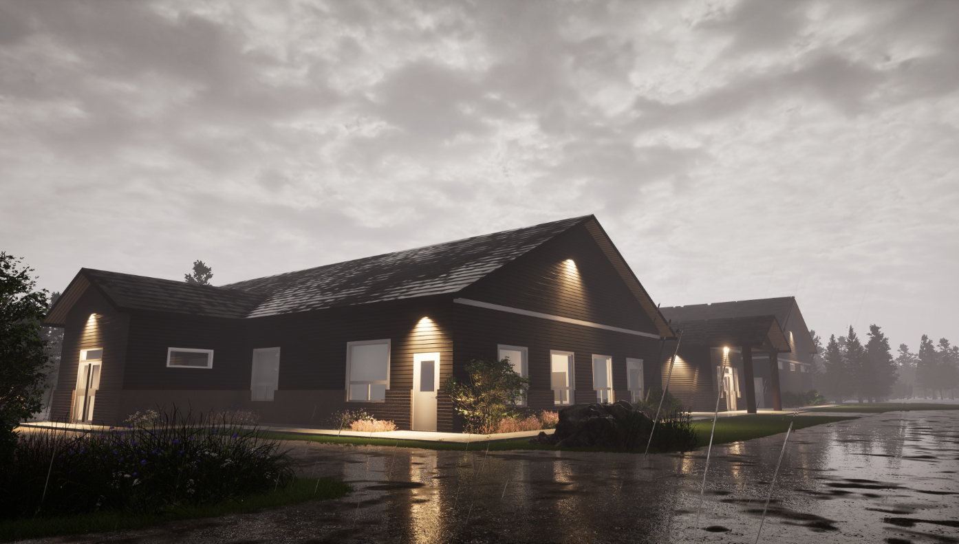
Here are some shots of how I could combine drone imagery with proposed project. Remember, this is all simple, code free and painless. Each render took about 30 seconds and a 10 second video clip only takes a few minutes. No photo shop or image editing.
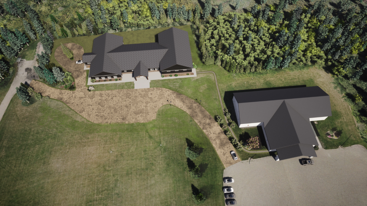


and my favourite.