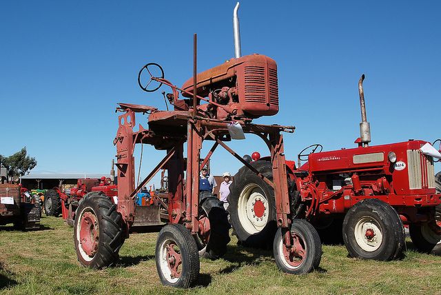
That is a good idea. So he has one of these?
… or maybe it is more like this:
haha  he just might
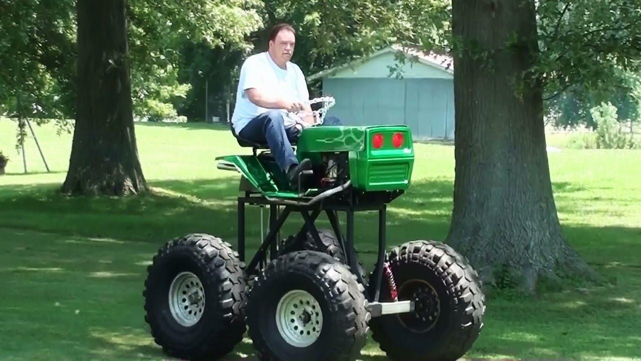
Or forget the farmer and DIY with one of these:
I promise to leave your thread alone after this last one 
If he is a wealthy farmer, maybe this is his crop patrol vehicle:
At least you wouldn’t have a problem with skyview !
You’re probably going to need a fence post driver, and may have to double the depth at it’s least depending how hard the surface is. So longer posts. Wind will probably sway them at only 30cm deep. This will probably be the hardest part of your project.
PVC piping with fittings / flange and angle cut spike tip may work also.
To do this properly, you should actually fly cross-strips. Depending on yuor setup, every few KM you should be placing points perpendicular from the strip by a few 100m and include these in your flight plan. This then strengthens the model substantially. Even the staggered approach can induce twisting within the model as so much weight is placed on controls.
Given the description of the terrain, this is going to be a challenge to find reliable tie-points and the model will rely a great deal on the control. Thus, I would make a great deal of effort with that.
A 1 kg hammer was quite sufficient.
Getting in more than 30-40 cm into is going to be the Max, as max pole length is 150 cm. Both because I can’t find them any longer than that (and still reasonable priced) and because if they much higher, they are harder to get into the ground, as you would have to lift the hammer quite high for the initial throws.
Wind won’t be my biggest problem as I see it. When the GCP is roughly level with the top of the crops, the wind impact is also greatly dampened by crops themselves.
A bigger challenge is staying precise while and after measuring the GCP. The weight of a GNSS unit on top might sway it…
I have done extensive testing and this is not true in the case of a corridor, especially if you are using PPK.
When using proper PPK, then yes, I agree with you. If its a Phantom or similar platform and you are already pushing the limits of photogrammetry with floating targets and dense foliage, then maybe consider it.
Just my 2c worth. Take it or leave it, it all depends on how much time, money and effort you want to put into it. What I have seen before is guys doing linear surveys of roads etc and the result is a complete mess up with fake “hills and valleys” between control.
You got it. That’s why I made sure to state above that the red line is with PPK and the extra GCP’s on each side would be needed without.
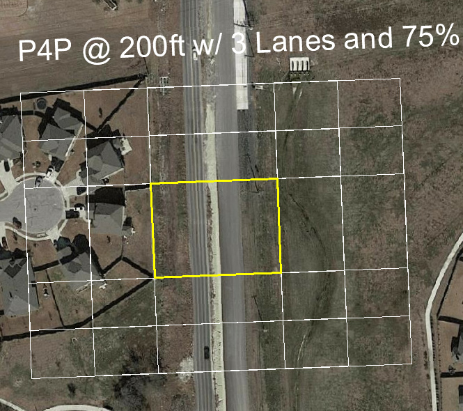
I know this gets off the GCP of the post, but when I hear “corridor” I think of roadway and utilities like pipeline. In the US our Right-Of-Ways vary from about 50ft-150ft and some of them can be flown with two passes. There is a point though where the width will require GCP’s in the middle. In my testing this was about 250-300’ (75-90m) due to the requirement to acheive at least 65% overlaps across the entire section.
With a Phantom 4 Pro the FOV is 84deg meaning that at 200ft you are capturing a subject width of about 360ft and obviously a front to back width equal to 75% of that with a common 4:3 ratio. This is a recent project that I flew with a 170ft ROW. You can adjust your altitude and number of lanes accordingly.
Any pointers on how to make sure that waypoints are completely aligned with the corridor (given that one has the precise location of the pipeline)?
Neither the Pix4D nor DroneDeploy apps have tools for this it seems. Well, DD does it seems, but then you need to be on their Business-plan, which is not gonna happen.
No problem. Just put a Reach M+ on each GCP. Then you can coordinate the position of each GCP by PPK for the exact moment the image is taken.
You will only need a small bucket full of M+ ![]()
That is one way of moving a good portion of time the total time spent from execution to planning 
OK, more practically then: If your GCPs are sensitive to weight, then you could just use one M+ and the TW4721 antenna to capture your GCP instead of putting Reach RS2 on there.
You could even put a handle on the TW4721 antenna’s ground plane or some other easy way of orienting it. (maybe a small dowel pin under the antenna that locates it into a hole in the center of your GCP?)
You could use QGIS. It would be especially helpful if the client has a DXF CAD file of the project. If you can find a solid stationary object you can create a base point from it and then put in some rough points for you GCP’s to stakeout. Then you can place you GCP and shoot it for a tight coordinate.
In the past, if I had nothing, but there were objects on the ground that I could use I would do a dry-flight and then bring that into QGIS to do the above operations. Just a couple of ways to make something out of nothing.
Are you looking for absolute vertical or just relative?
Basically what AeroPoints do for a third to half the cost… 
I forgot to mention that I actually spent some time playing with PVC fittings yesterday and the idea of making a 3-leg tripod at 1.5m tall. While possible to do, I was trying to keep the size down (1/2" / 13mm ID); keep it sturdy and collapsible; and keep the fittings to a minimum, but no great solution came of it. I think you’d still have to anchor the legs no matter what.
In other words, the ‘pipe in the ground’ idea only sounded better afterward.
Christian, you might want to check out 3DSurvey app (3Dsurvey Pilot on the App Store)
It has a very good PI to PI planning mode (linear).
It is not a perfect app, as it doesn’t have pause mission, multi-battery or any of Pix4D Capture,DroneDeploy or DJI GSPro extra perks, but it get’s the job done and it’s free (for now).
P.S.- I do not work or get any compensation from the company for mentioning them. I just like their linear feature.
Pix4D Capture and DroneDeploy are also free for flight. Then you can process wherever you like.