While working through the post-processing of data to solving another problem, came across the question of if we could change the Pole height after survey project finished.
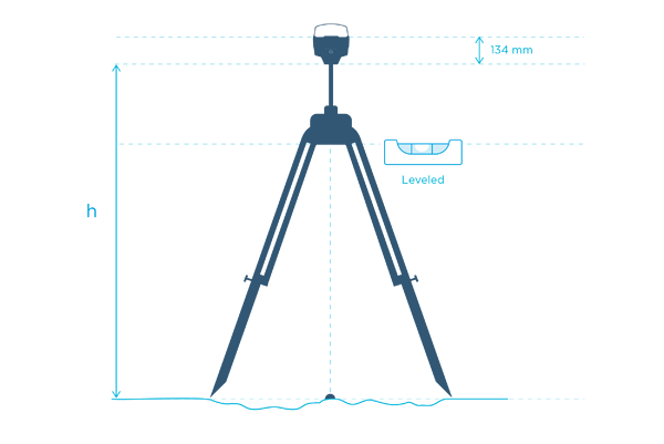
For additional clarification, when you start a survey project, the app may ask you optionally what the pole height may be - default its 2m. Now I was out in the field and didn’t get a chance to properly measure/input the correct for the h in the below image:
Is there a way to do this after the fact? The points I surveyed aren’t known points and it was done via Fix solution status. From the post here: Question about pole and tripod height - #12 by svetlana.nikolenko it looks like I could potentially use the .pos file to work backwards. Thanks in advance!
I apologize for my misunderstanding, but isn’t post processed data based on RTK data? If so, I suppose RTK data would be the best place to make the correction and adjustments.
I want to confirm that it’s impossible to change the antenna height in the ReachView app after the survey. However, if you know the right antenna height, you can still post-process the data with it.