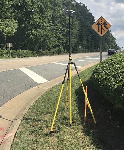
Accuracy Testing for Reach RS underway.
I have been working on getting a good understanding of how to configure and use Reach RS for the past month working up to a goal of comparing the Reach RS units vs L1 and L2 survey equipment from other manufactures. Today was the first time we have set up and tested the Reach RS unit for accuracy against a known point. Today we conducted our first accuracy test.
We set up two units in a base and rover configuration using the LoRa for correction. The base ran an averaged single position with a collection time of 15 minutes. We will be using 30 minutes for future test and would ideally like a 45 - 60 minute option for the average single. Our rover was configured to get corrections from the base and set up over a known point / survey monument. We utilized GPS, GLONAS & SBAS satellites on both base and rover. Once the base had it’s single solution the rover began to dial in its location with a great AR values. We let the rover get to 999.9 and stay for a couple minutes then turned everything off.
Back at the office we downloaded CORS data plus the base and rover logs. We post processed the base against the CORS then the rover against the solution position from our base.
A little WGS84 ellipsoid to NAVD88 conversation for the height, converting the horizontal data to U.S. Survey feet because thats what we work in. Comparing the post processed results we are ±0.111 Northing ±0.055 Easting and ±0.0570 Height from the coordinates on the survey monument. I am very pleased with our first test. We will be repeating this test on a number of known points. The next phase of this will have us collecting the same locations with Reach RS and other units to compare both to the known points and to each other.
I will continue to share info as we progress with our testing. I also have a lot of notes for feature request that I need to post. ![]()


