


Hi,
I’m new here, and to surveying. I am trying a new reach 2+
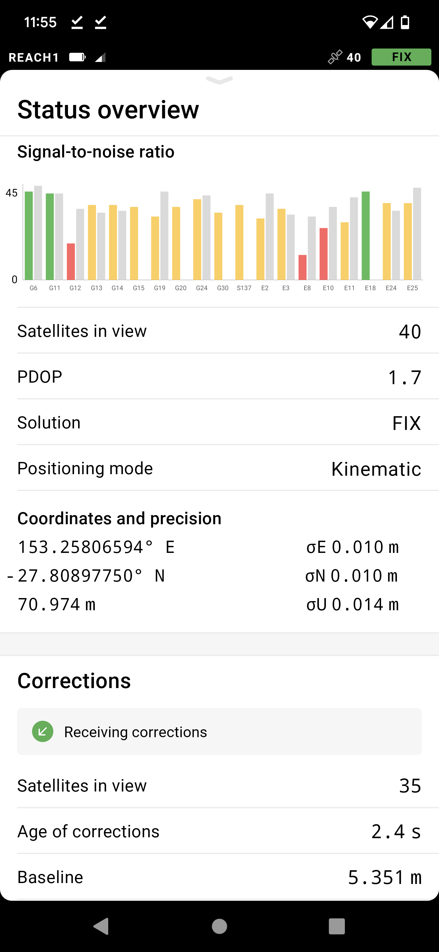
I have tried 2 different correction services, and the GPS is in an open area, but I only get 10cm accuracy. Any tips?
Thanks
Tristan
Hi,
I’m new here, and to surveying. I am trying a new reach 2+
I have tried 2 different correction services, and the GPS is in an open area, but I only get 10cm accuracy. Any tips?
Hi Tristan,
Welcome to our community forum!
As I see on your screenshot, the precision is 0.010 m, which is 1 cm ![]()
I’ll see myself out
If I setup my own base station, and I’m within a 100 m or so, will accuracy increase further? Or is 1cm the general limit
Hi there,
‘1 cm’* is the best you will get. Using a base/rover combination will not change that.
If you need smaller values (mm), consider the use of a total ($$$) station, but do not skip the entry of the values that account for the correction of curvature and refraction. It should then give you measurements with a 3mm cadastral confidence level (up to a couple of hundred meters).
Regards
Buddy
PS: Please keep in mind that the values displayed are *1 sigma (68.3%). If you need a higher level of confidence (95.5 or 99.7%), you need to multiply by 2 or 3 respectively.
(This basically applies to all GNSS receivers available.)
Thanks mate,
Sorry, I don’t get the reference to “a total ($$$) station”?
Hi there,
Total Stations are far more expensive than GNSS receivers. That was the point.
Cheers
Buddy
This topic was automatically closed 100 days after the last reply. New replies are no longer allowed.