


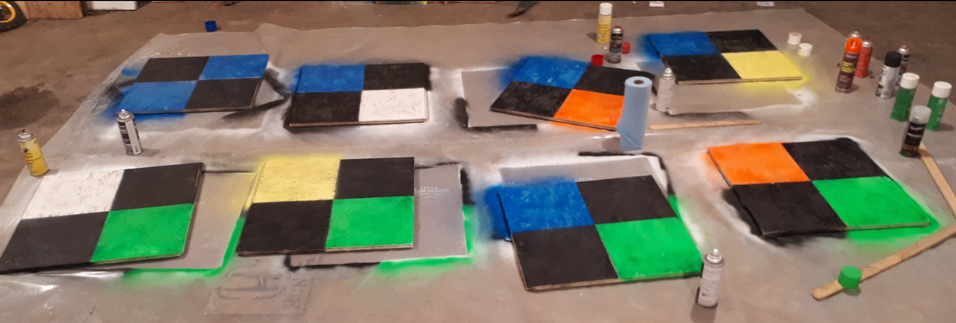
Hey guys! I just wanted to share an idea I had the other day. One of the challenges (albeit not a huge one) of UAV mapping can be identifying the ground control points and ascribing the correct coordinates to each one. I realize that modern software can figure out quite close which point is which but I thought there is still oportunity for confusion. Probably my procedure for dealing with this is common but it seems like I haven’t seen it in other posts here. Normally I just see black and white or cross shaped ground control points. I have at times painted the number on the ground beside the gcp but it can be hard to read from a high elevation. I decided to color code them so no two would be the same. When I survey I will name the points by the color of the gcp. ex, “blue-red”, “green-yellow,” etc.
User @bide made the suggestion to have your computer automatically recognize the individual points but that’s beyond me! 
I’m curious what other ideas and experiences users have with making gcps.
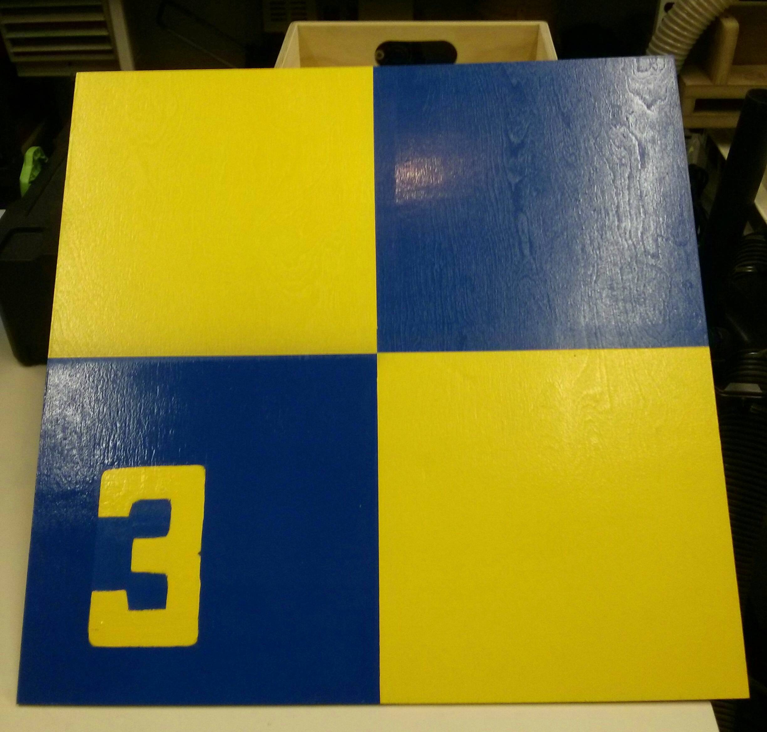
Hey Brent. Mine are 2’ x 2’ checkerboard like yours with 6" tall numbers. They aren’t too difficult to read. Nice idea though!
I use a combination of painted targets (have a few different sized templates) sprayed on road etc, or checkerboard vinyl flooring like this:
I guess it all depends on how good your camera resolution is and how high you fly but at 70m AGL I can see these pretty clearly.
I don’t need to label the GCPs as when I post process with agisoft photoscan I convert the image coordinates to the same coordinate system as my GCPs- so the GCP position in the photos is usually no more than a few metres away from the imported ground control position.
I’d love to get automatic target recognition up and running also- but at present I think I would need targets at least 1m x 1m for the software to recognise. Maybe when I start using a ~200 MP camera this will not be a problem !!
http://industrial.phaseone.com/Aerial_Systems.aspx
Hey Brent, what software are you using to process images.and gcps? I use Pix4D desktop and handles the gcp input semi automatically. Run through step one, then enter the gcp manager. Then click raycloud editor and it finds the targets. You only have to pick a few and hit apply and it will find the rest. You can check and adjust the exact position. It all works on the coordinates. You don’t even need the numbers.
Also, I suggest you buy an inexpensive spray gun and buy paint by the gallon. Spray cans cost a fortune. I use recycled billboard vinyl. The backside is flat white. I just spray the black on with a stencil
Just a thought. Is higher resolution on the image always better? Lets say if you stay below 120m
This topic was automatically closed 100 days after the last reply. New replies are no longer allowed.