


I am looking forward to paint show 
4 Likes
Yes, @TB_RTK I will do my best. Your paint skills are quite polished if I do say so myself.
2 Likes
Sorry for delay, busy losing drones… The task did not necessitate a paint show.
In QGIS import CSV from Reachview:
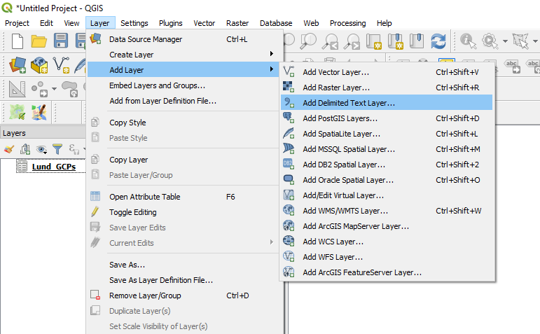
Setup the import correctly, check lat and long fields, Reachview survey coordinate EPSG 4326:
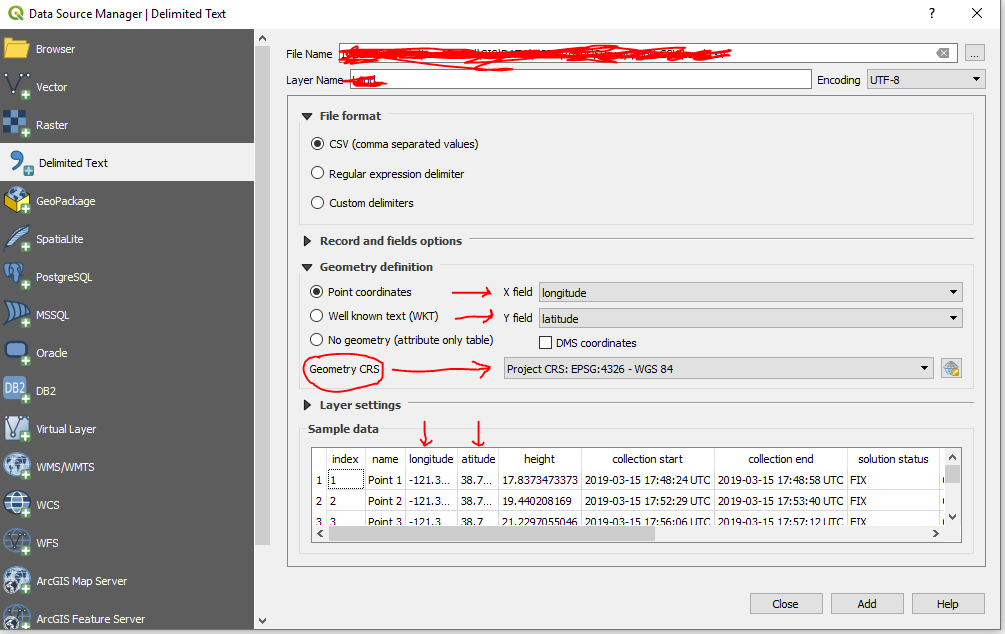
Once imported in QGIS right click the layer and export, save feature as:

Choose AutoCAD DXF and be sure to select an appropriate coordinate system for XYZ, try UTM:
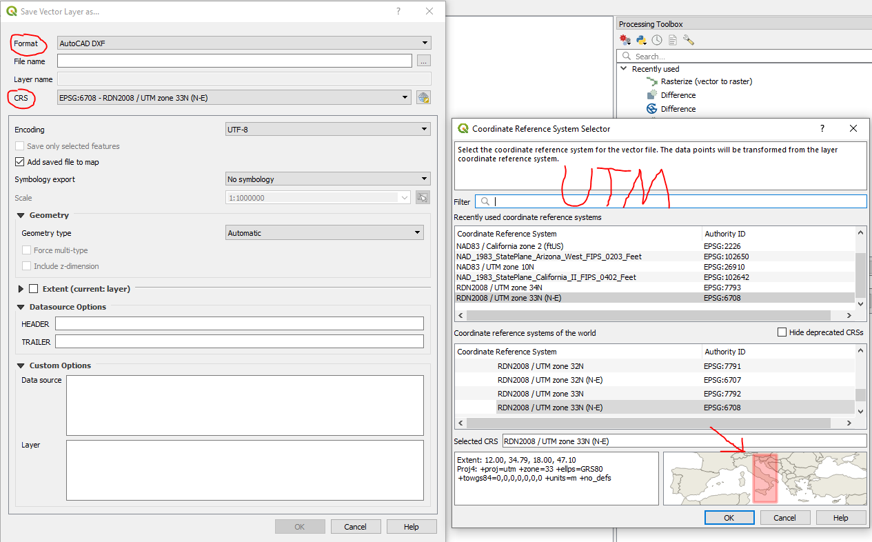
This gives Z as ellipsoid height. Follow the above to derive geoid and orthometric heights for each point.
5 Likes
This topic was automatically closed 100 days after the last reply. New replies are no longer allowed.