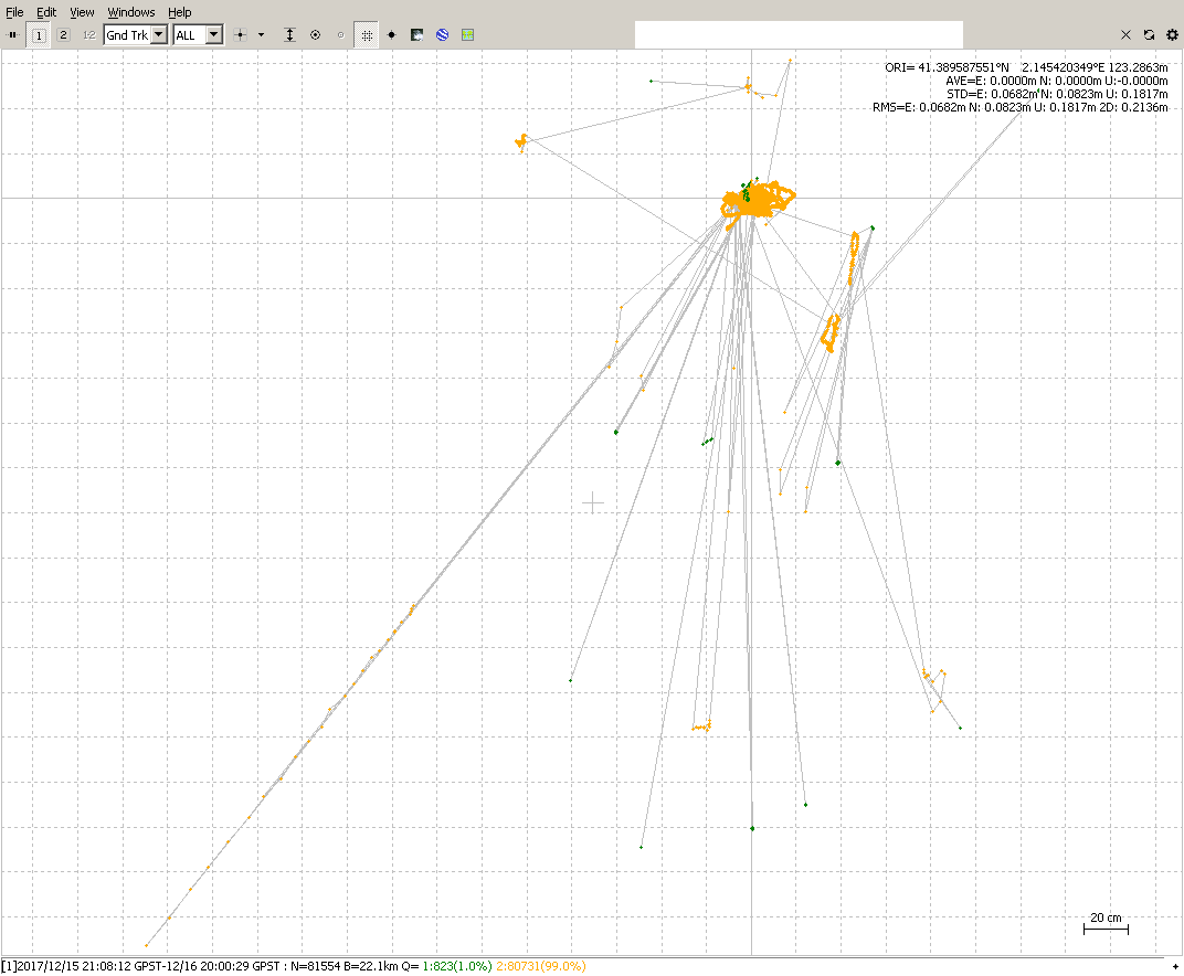
I couldn’t help but try another one with rnx2rtkp. This was using your supplied RINEX with no additional conversion. Settings were: GPS and GLO only; combined solution; elevation mask 25 degrees; base coordinate set to the average of the single solution.
I made this screenshot of the ground track because it is a much tighter grouping than the previous one: