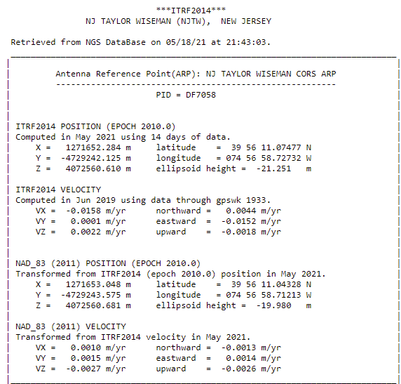
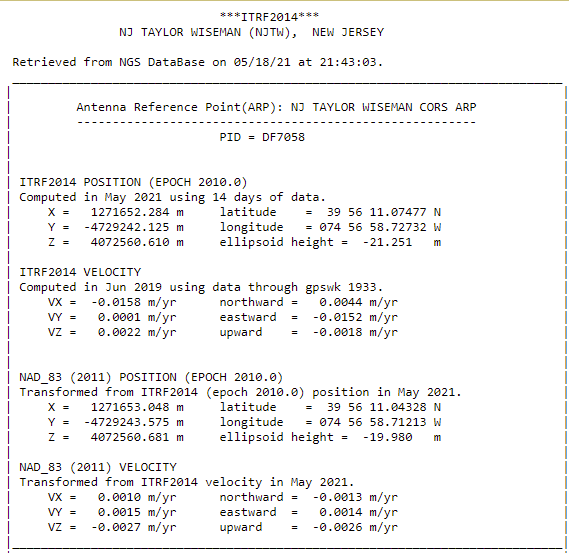
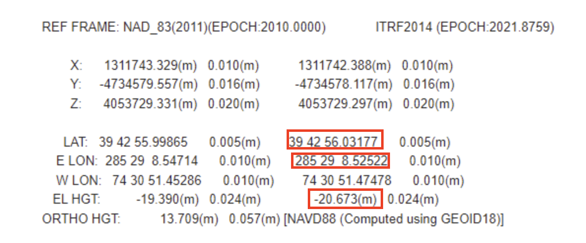
I am running into some problems when trying to transform coordinates between ITRF 2014 (2010) and NAD83(2010). I have been running some tests trying to find what software I like to do the transformations and was using either the Coordinate sheets from CORS station and also OPUS solutions to validate that the software and my workflow are working correctly.
The problem is that when I take the coordinates on the above sheets and enter them into various softwares, the results do not match up.
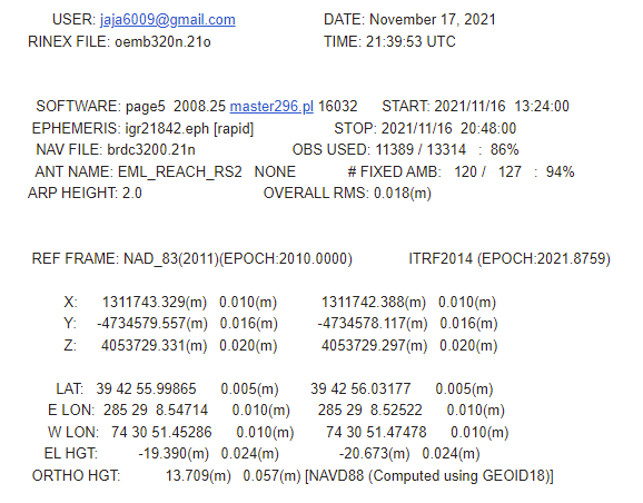
Example:
OPUS Solution Obtained from Emlid Reach RS2
When I entered Cartesian X,Y,Z from the Coordinate sheet it worked perfectly.
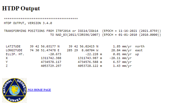
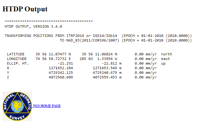
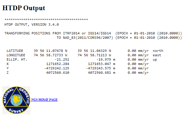
In the HTDP instructions it makes no mention of having to use Cartesian X,Y,Z.
I also tried the .exe version of this tool written in I think Fortran and it had the same results.
I am not sure why Cartesian X,Y,Z is needed and doing internet searches on the HTDP tool shows many just entering L,L,H and getting their transformations.
I suppose it should work fine. If there are difficulties, I’d suggest contacting NGS to check why it happens. Alternatively, you can try to transform the coordinates in a GIS app.
I emailed NGS and now feel stupid.
The application assumes that all longitudes are west, so if the -74 xx xx.xxxxx is entered without the negative sign it works fine.