Another update:
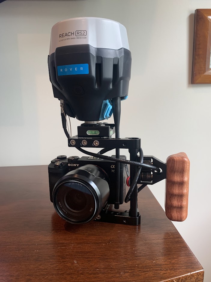
I’ve got a fairly straightforward PPK/RTK setup now. I assembled a small rig to hold a camera and RS2. It looks a little awkward but it’s not handles fine. A smaller rig could be assembled with an M2 and smaller antenna. Camera hotshoe is hooked up to RS2 with semi-custom cable. RS2 is centered above image sensor. Metashape takes care of antenna offset.
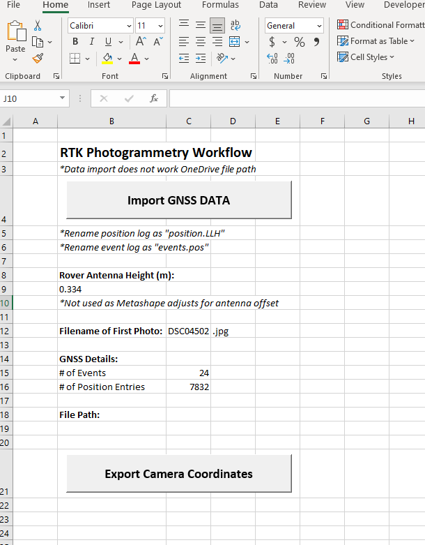
Workflow for RTK:
Raw and position logging on rover/camera RS2.
Emlid Studio to generate the events.pos file from the raw log.
Excel to generate the image geolocation from position.LLH and events.pos files.
Metashape for photogrammetry (import geolocation file generated by excel for photo reference)
Workflow for PPK:
This can be done within Emlid Studio.
There are a few commercially available handheld scanning options. This has a few benefits in that is not limited to NTRIP corrections and using the same receiver for photos as well as surveying GCPs.