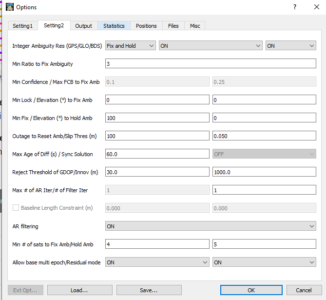
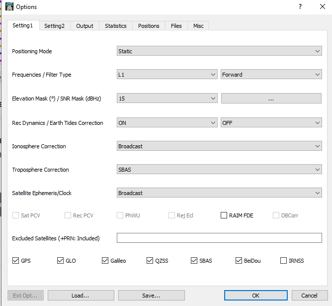
Hi guys,
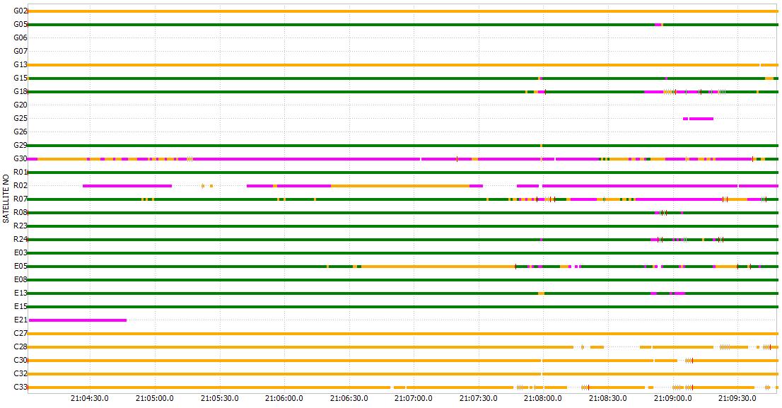
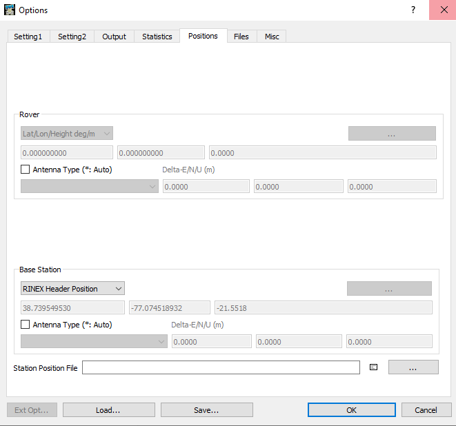
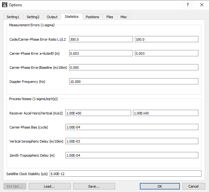
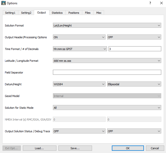
I recently acquired two RS2 units and been testing them out. For test, I set up a base station and rover nearby a NGS survey marker, and took 165 seconds reading on the rover set up on tripod. I went back to RTKlib for post processing. I used a nearby CORS unit ( 14km from my site) as my base station during PPK. The data I obtained from PPK, and the data on the NGS data sheet are 1.2 ft apart, and the difference in ellipsodial height is 2.58 m. Can someone please see what I am doing wrong. I used three different CORS station, but same result. I am worried that I may have gotten a defective unit. Here are the data and observation I used and got.
Using RTK (fix) W 77°18’20.60309", N 38° 50′ 27.74746" , 96.31393091(m)
After PPK - W 77°18’20.55367", N 38° 50′ 27.68867" , 101.3667(m)
Offical NGS data-W 77° 18’ 20".54110, N 38° 50′ 27.69358", 98.782(m)
Please see the google drive link for project files. Any help with this would be highly appreciated.
https://drive.google.com/drive/folders/1UE3PS1GMOSD-QkSB7KhRJuBxfGoLTFKx?usp=sharing
Simple system report
app version: 2.22.5-r0
'wifi_status, interface: wlan0':
- wifi_mode: infrastructure
- ip: 192.168.1.137
  is_added: true
  is_connected: true
  is_visible: false
  mac_address: C0:84:7D:39:C2:21
  security: wpa-psk
  ssid: GEWifi
  uuid: 9ef736d7-5c82-4c2e-bd49-b265d41425c2
base mode:
  base coordinates:
    accumulation: '2'
    antenna offset:
      east: '0'
      north: '0'
      up: '0'
    coordinates:
    - 0
    - 0
    - 0
    format: llh
    mode: single-and-hold
  output:
    enabled: false
    format: rtcm3
    path: tcpsvr://:9000#rtcm3
    type: tcpsvr
  rtcm3 messages:
    '1006':
      enabled: true
      frequency: '0.1'
    '1074':
      enabled: true
      frequency: '1'
    '1084':
      enabled: true
      frequency: '1'
    '1094':
      enabled: false
      frequency: '1'
    '1124':
      enabled: false
      frequency: '1'
bluetooth:
  discoverable: true
  enabled: true
  pin: '***'
constraints:
  lora:
    frequency:
    - - 902000
      - 928000
correction input:
  input2:
    enabled: true
    format: rtcm3
    path: lora
    send position to base: 'off'
    type: lora
  input3:
    enabled: false
    format: RTCM3
    io_type: tcpsvr
    path: :9028
device: null
logging:
  base:
    format: RINEX
    started: false
    version: '3.03'
  correction:
    format: RTCM3
    started: true
  debug: false
  interval: 24
  overwrite: true
  raw:
    format: RINEX
    started: false
    version: '3.03'
  solution:
    format: LLH
    started: false
lora:
  air rate: 18.23
  frequency: 915000
  mode: read
  output power: 20
position output:
  output1:
    enabled: false
    format: nmea
    path: bluetooth
    type: bluetooth
  output2:
    enabled: false
    format: llh
    path: :9001
    type: tcpsvr
rtk settings:
  elevation mask angle: 15
  glonass ar mode: 'off'
  gps ar mode: fix-and-hold
  max horizontal acceleration: 1
  max vertical acceleration: 1
  positioning mode: kinematic
  positioning systems:
    compass: true
    galileo: true
    glonass: true
    gps: true
    qzss: true
  snr mask: 35
  update rate: 1
sound: null