I am using RS2 to perform a static measurement on four points and planning to do a network adjustment by connecting the data with the CORS that I have. Initially I thought Trimble Business Center network adjustment will do fine but apparently the RS2 receiver is not listed in the Trimble Configuration Utility. I have tried to look a way around by editing the “Antenna.ini” files in the TBC config folder but I don’t see a hope in it.
So any have you able to perform adjustment with RS2 data set?
It’s highly appreciated if you could share your experience
I know several on here have done post processing of the data. I haven’t as I do not have a need for it in my application.
I chimed in regarding the Trimble Business Center. Most Trimble systems do not play well with others. Trimble’s Ag division had a product called WM-Survey which was based off TBC. They limited the antenna selection to only one Trimble GPS receiver. The receiver was an Ag version based off the SPS985, sorry I forget the model number now but, there was no work around for this.
EZSurv post-processing software can computes your RS2 static files. It can automatically add multiple CORS stations into your process. EZSurv post-processing software also includes least square adjustment with detailed report.
RS2 antenna model is available in EZSurv. Moreover, EZSurv can read ReachView CSV file with points details (start/end time, antenna height). That being said, you have very few manipulations to do, thus avoiding risk of errors.
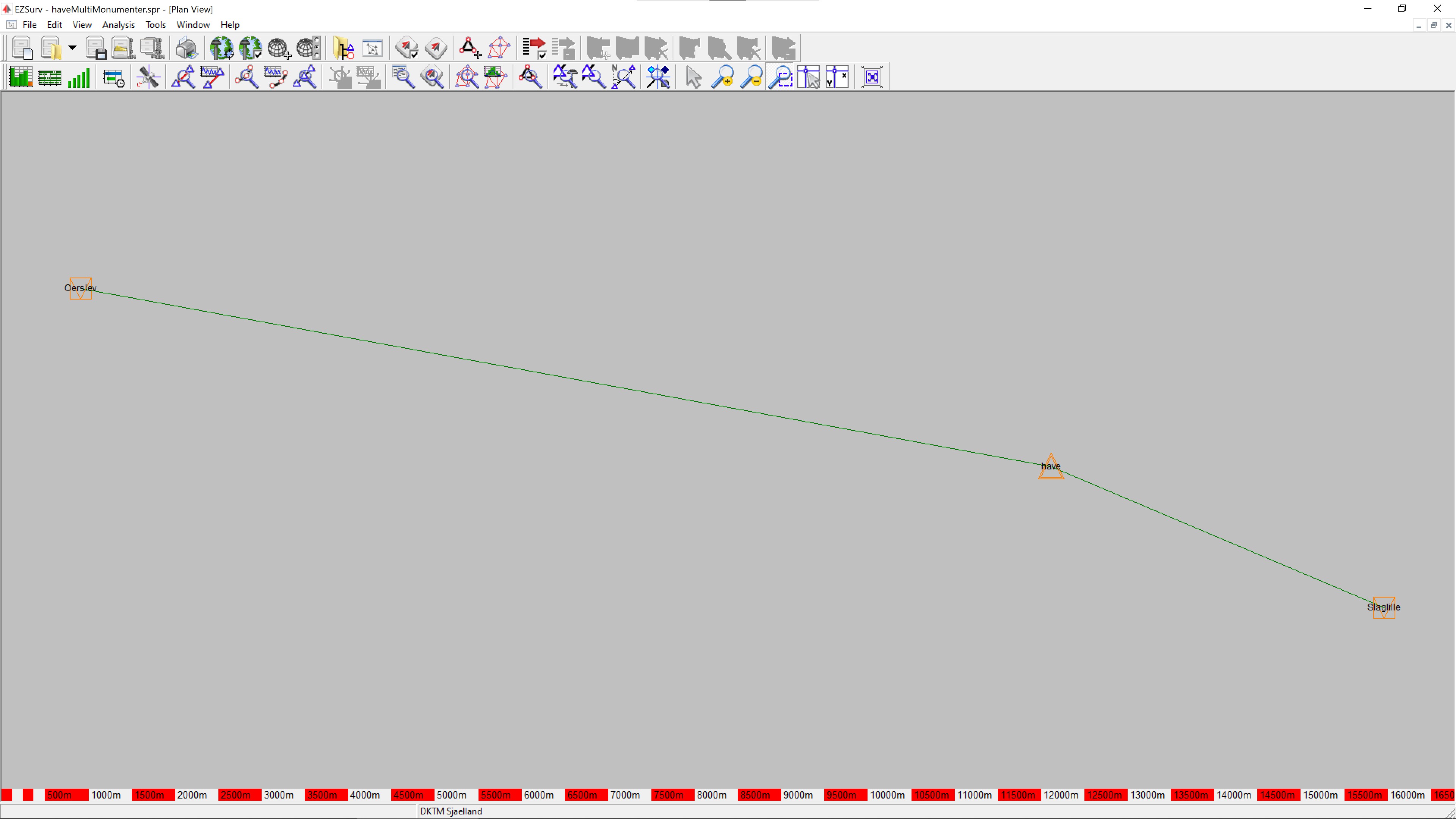
Here’s a screenshot of EzSurv doing similar to what you are talking about, using multiple stations (in this case a sequential RS2 on 2 official monuments) to create a solid known point.
I also found out painfully that TBC doesn’t list any EMLID Receiver or Antenna in the drop down list when importing static data, really hoped they’d implement the change when the RS2 was calibrated and the .atx file became available on the NGS website. There was even a software update for Configuration Utility shortly after the NGS addition of the RS2 .atx file but that didn’t help our cause, be on the look out for those, just maybe someday.
We haven’t had a chance to check if the Reach RS2 antenna is listed in different post-processing software. So, thanks for sharing your experience!
I can hardly comment on why it’s happening. Probably, the databases weren’t updated yet.
Regarding TBC, I can only suggest using the distance from antenna reference points (0.134 mm) instead of the antenna phase centers value. The antenna reference point of Reach RS2 is situated on the bottom of the receiver. As far as I know, TBC should support such an option.
I do not work with TBC but, if it is like anything on the Ag side of Trimble, they have updates every so often. Perhaps check the release notes to see if they add it to the system.