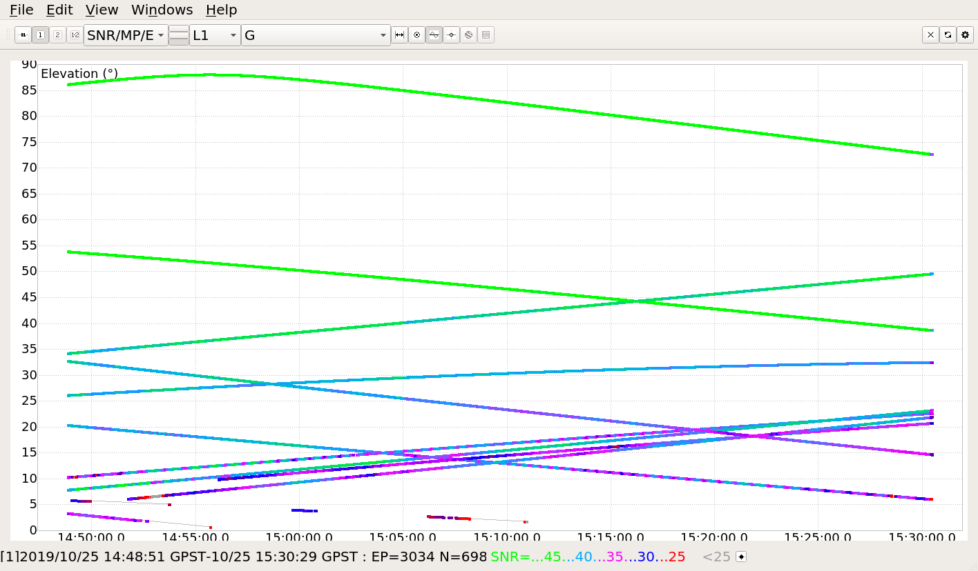
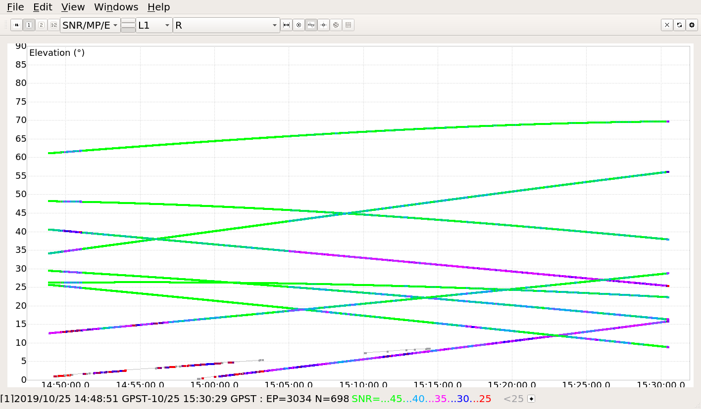
Either one of GPS or GLONASS can resolve the integer ambiguity and give the ‘fix’ status you are looking for. Both plots show 5+ satellites that are over 40 dBm, and the satellite geometry looks OK. So if you had been doing PPK or RTK at that time, and your base and rover had a similar sky view, then you could have expected to easily have ‘fix’ status on your rover position for the entirety of the time shown.
In setting up your base, there is no way for it to get ‘float’ or ‘fix’ unless you have a 3rd unit somewhere that is sending corrections to your base. There is more to say about how you can do that, but in your case, for the base coordinate averaging technique, you should pick ‘single’. AND you should record those coordinates if you ever plan to put your base back on that point. Each time you visit that spot you should enter in the same coordinates.
Correct. You should have the proper base coordinates set in your base first. Then you should start up the rover. Otherwise it is possible that is why you see something odd in the ‘baseline’ field on your rover.
Thank you for all the help. Your explanations make a lot of sense. I have known control points with coordinates available to me. I am going to be laid up for a while but will set up as soon as I am able and get to work.
It still seems odd that the baseline is over 7000 meters off but the points from the rover do fall in place. I think I was trying to make things too difficult.
thanks again