


As I understand it the accuracy wold be based on where the actual point is at in real life (the reach unit) vs. where the gps solution thinks it should be. I am by no mean a surveyor and do not by any means think of myself as a surveyor. I might also be totally off, hence seeking some clarification about why that assessment was taken out. I have read through this thread a few times, and again could be very very off on the way I think.
Do please share more, are you saying when you import GCP’s you simply set the accuracy to 2 or 3 cm, can you share any information about why that is not a good accuracy assessment in metashape? Do you set your marker accuracy within this screen 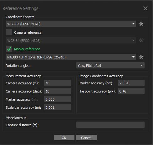 and just leave all accuracy on the gcp import page blank?