


I recently occupied/observed two local NYHARN control monuments nearby to test the Reach M2’s accuracy/precision under ideal conditions. I simply wanted to know what this device is capable of different time occupations post processed utilizing the NYCORS base stations and to share the results here. The two monuments chosen were each occupied for a slightly over 2 hour duration (I purposely went over two hours to evaluate OPUS static processing also). I chose a couple of NY CORS stations at different distances to evaluate the precision/accuracy of these time durations as distance to the rover increased. I then processed the data in RTKLIB at 2 hr, 1 hr, 45 min, 30 min, 15 min, 10 min, 5 min, 2 min durations by trimming the original rinex file from start of the occupation to the stated time duration. The results are shown below for the differences in easting, northing, and ellipsoidal heights calculated against the NGS published values. I have attached the NGS data sheets for both stations Ft Miller (PID AA7911) and Wright (PID NA2015). Both occupations were made with my antenna (Harxon GPS500 Mini-Survey Antenna with NGS antenna calibration) mounted on a 2 meter fixed height range pole. I cannot stress enough about the importance of using your antenna’s calibration AS WELL AS THE CORS BASE STATION CALIBRATION in your processing. I have attached the latest NGS antenna calibration file .atx that you can include in the Options/Files tab. This will provide a dropdown list for all antennas available with calibrations. To find out the antenna type of the base data downloaded from NGS it is located in the header information of that stations rinex file. Both .ubx files are attached so that those that wish can see if they can achieve better results by tweeking the setting in RTKLIB. Enjoy!
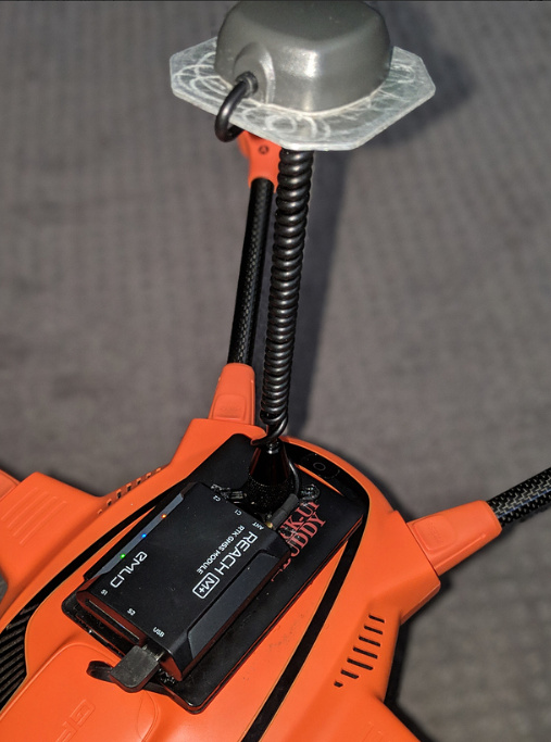
My Reach M2 setup consists of
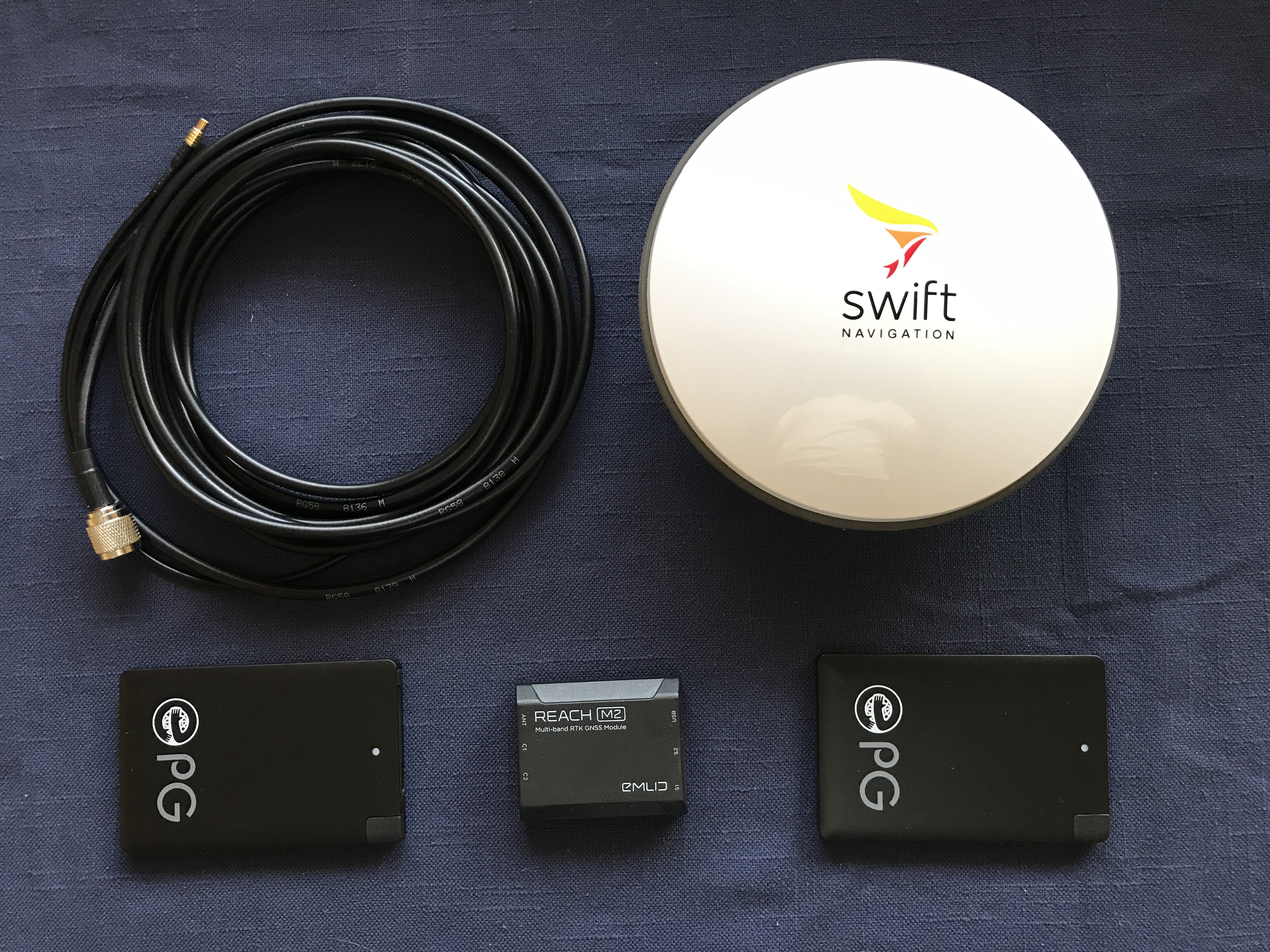
Reach M2 $468
Swift Navigation GPS500 Mini Survey Antenna $225
2 x 2400 mah rechargeable power banks $11.99 each
https://www.amazon.com/Ultra-Slim-Universal-Rechargeable-Credit-Card-Smartphones/dp/B076JB8P4Z/ref=sr_1_1?keywords=5v%2Bcredit%2Bcard%2Bbattery&qid=1574954964&sr=8-1
Raw Data Files
FtMi_202004021452_ubx.zip (6.0 MB)
Observation Photos:
Ft Miller
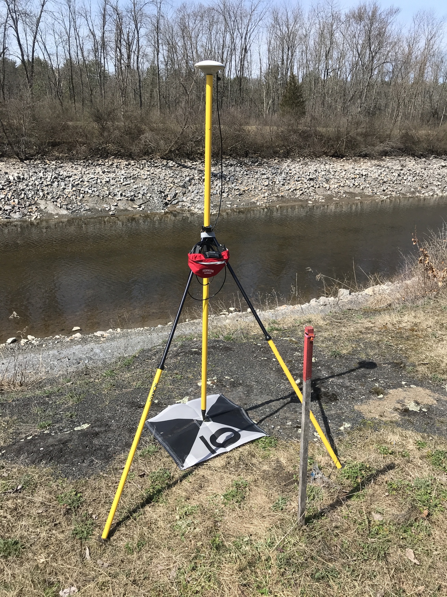
Wright

NGS Data Sheets and NGS Antenna Calibration file:
FtMi_Wrig_NGS_Antennas.zip (3.2 MB)
Results;
Rover Occupation Station Wright PID NA2015
26 Km Baseline CORS NYCS
Observation Time (Min) Delta Y (m) Delta X (m) Delta Z (m)
120 0.005 0.015 0.011
60 0.005 0.018 0.012
45 0.004 0.019 0.012
30 0.004 0.019 0.008
15 0.001 0.03 0
10 0.004 0.023 0.013
5 0.005 0.021 0.008
2 0.005 0.021 0.005
50 Km Baseline CORS NYST
Observation Time (Min) Delta Y (m) Delta X (m) Delta Z (m)
120 0.03 0.016 0.025
60 0.036 0.021 0.033
45 0.039 0.022 0.026
30 0.038 0.024 0.021
15 0.043 0.025 0.014
10 0.039 0.019 0.022
5 0.029 0.016 0.023
2 Float
86 Km Baseline CORS NYKT
Observation Time (Min) Delta Y (m) Delta X (m) Delta Z (m)
120 0.05 0.003 0.043
60 0.06 0.013 0.03
45 0.052 0.006 0.032
30 0.068 0.004 0.043
15 0.066 0.002 0.031
10 0.057 0.006 0.033
5 0.055 0.002 0.042
2 Float
Rover Occupation Station Ft Miller PID AA7911
22 Km Baseline CORS NYST
Observation Time (Min) Delta Y (m) Delta X (m) Delta Z (m)
120 0.004 0.011 0.03
60 0.002 0.009 0.029
45 0.003 0.009 0.032
30 0.001 0.009 0.031
15 0.003 0.008 0.03
10 0.002 0.007 0.031
5 0 0.006 0.029
2 0.003 0.003 0.031
44 Km Baseline CORS VTBE
Observation Time (Min) Delta Y (m) Delta X (m) Delta Z (m)
120 0.025 0.002 0.011
60 0.026 0.003 0.015
45 0.028 0.004 0.017
30 0.027 0.004 0.022
15 0.025 0.002 0.028
10 0.024 0.002 0.03
5 0.026 0.001 0.03
2 0.024 0.001 0.027
68 Km Baseline CORS NYFV
Observation Time (Min) Delta Y (m) Delta X (m) Delta Z (m)
120 0.001 0.02 0.046
60 0.001 0.019 0.05
45 0.003 0.017 0.053
30 0.006 0.02 0.053
15 0 0.015 0.046
10 0 0.013 0.042
5 0.008 0.01 0.042
2 Float
 Most of my GPS experience was with the Trimble 4000SSE’s then 4700’s utilizing first TrimVec Plus (DOS based software), then GPSurvey/Trimnet Plus Baseling Processing/Network Adjustment software, the Trimble Geomatics Office software suite. I was spoiled with the Trimble turn key product.
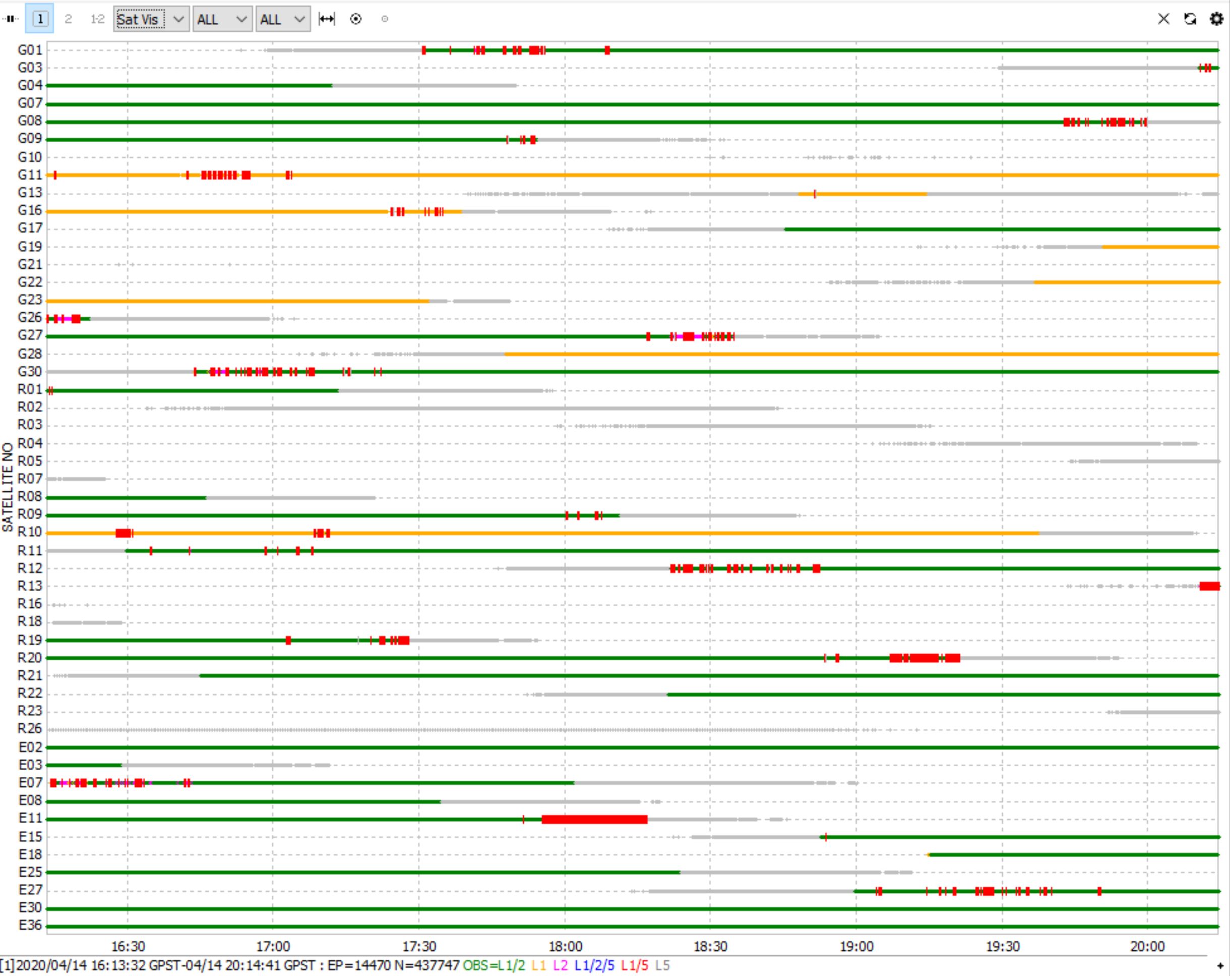
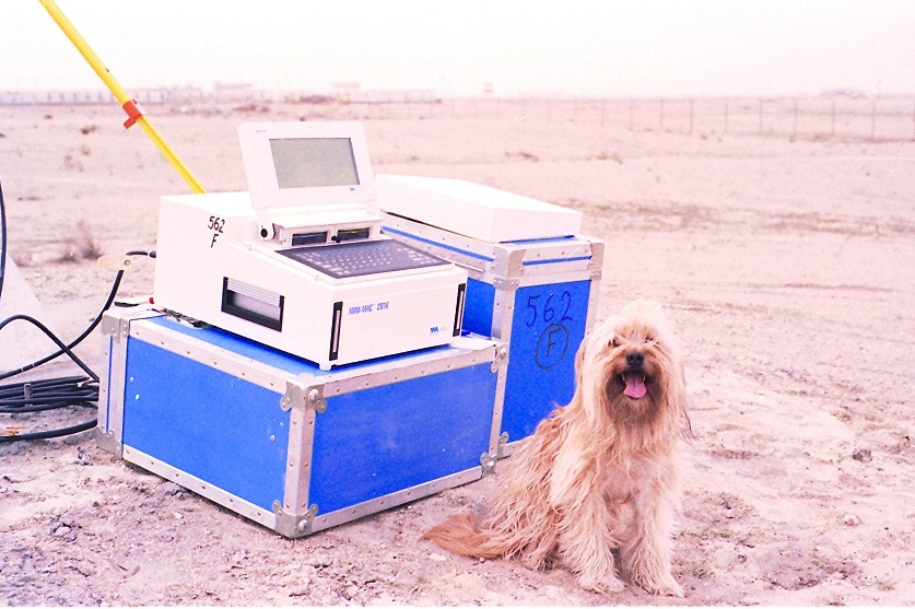
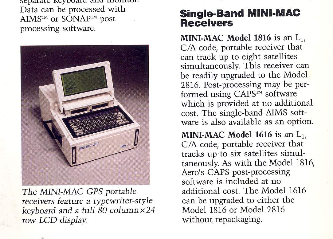

 receiver was 8-channel, single-frequency, weighed 20.2 kg without antenna and car battery 12V, produced by Western Atlas International with AIMS-10 (Automatic Interferometric MINI-MAC Software). There were only 6 GPS satellites in orbit.