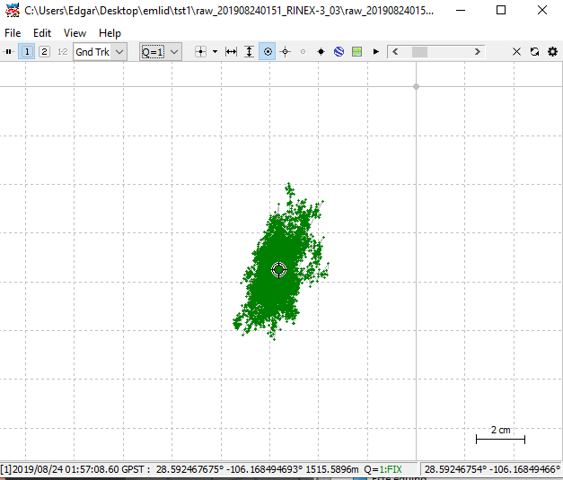
I am doing postprocessing in RTKLIB to obtain the coordinates of my base, what I am doing with the rinex files of the government network of my country and with that of my RS2.
The question is I already have in the rtkplot the Fixed points that I obtained, is there a way to RTKLIB average all the points to get only one with the best position?
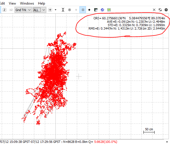
Not sure what you mean with best position.
But plot can show you statistics if you turn it on under settings.
Also use the proper coordinate origin. I use base, average or alt/long/hgt, depending on the situation.
RMS, AVG and STD is computed from the visible plot. Remember to sort out bad plot and keep the good FIXed points.
Are you setting up a base and then shooting is the “official” base point with your rover. You should be able to PPK those and get the point from RTKPOST?
You can also tell RTKLib to output a single position for static solutions. I prefer the above but some people expect to see just a single point rather than the “cluster”