


That works, but then requires a login. Don’t they have a description page, where they describe their systems ?
Ok, so that got us a little further. http://109.201.18.15/shamim/Files/guide/guide%20Septentrio%20Aps3G%20shamim.pdf
According to this, it should be send WGS84. Only thing we can do now is wait for the CORS data to be available, so we do some sort of 3rd party verification.
with mount point is best for emlid ?
FKP , VRS, IMAX, MAX, NEAREST
http://hitarget.ir/en/concept-and-comparison-of-vrs-max-imax-fkp-nearest-in-gps-networks/
Try it out ![]() short answer is “it depends” .
short answer is “it depends” .
So TEHN from day 113 is now available 
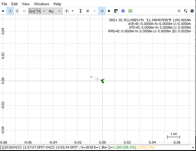
Baseline of 1.5 km, so pretty nice.
Here is the result of the base static processed with TEHN (using ECEF coordinates of the TEHN base from CDDIS):
And here is the resulting Rover processing, using the coordinates from the results above:
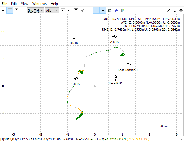
(Base Station 1 is the base used for the processing, BASE RTK is coordinate from your .csv)
1 Like
What is coordinates of processed base location ?
we must shift base and a,b,c and then process in ppk mode .
You can find the ECEF coordinates here: https://cddis.nasa.gov/Data_and_Derived_Products/SiteLogViewer/index.html
1 Like
This topic was automatically closed 100 days after the last reply. New replies are no longer allowed.