


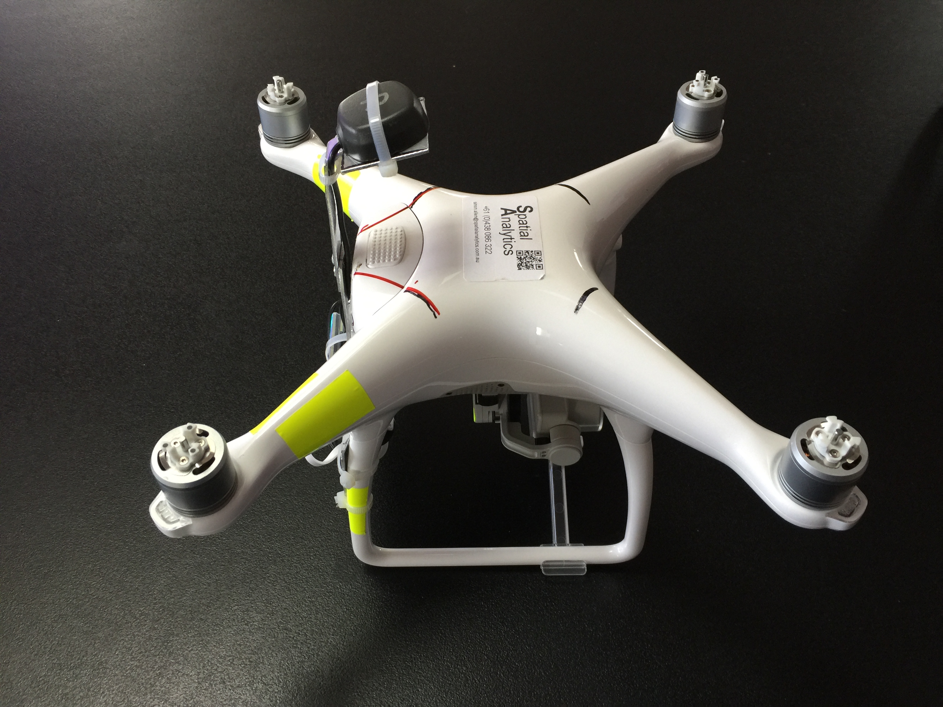
I have built a standalone module (140 grams) that fits under the battery, it is held in place by a tight fit and two tie wraps.
I collect reach data and post process for RTK with base data collected b a second reach (standard post process RTK)
I use the log file from map pilot to get the timing of the images taken (this is where I am currently looking for further improvement)
Biggest find to date is that the Phantom 4 altimeter warms up and the drone drops 3-4m over a 10 minute flight. the DJI altititude stays constant, but the RTK altitude decreases. This is verified on landing, when the drone lands the DJI altitude is 3m above the ground whereas the RTK altitude returns to ground level.
The level of integration and sheer capability of the P4 made me go down this route was mostly happy with the standard GNSS onboard, but PPK is a true differentiator on a very low cost drone ( I picked up a refurbished P4 for AU$1000).