


@TB_RTK In your skyplot picture above, you have 5 gps satellites which are more than 30 degrees above the horizon. You could raise your elevation mask to something between 22 and 30. Depending on the situation, that may eliminate some multipath signals and get you a fix.

in the picture above, the terrain rises from bottom to top. The terrain at the top is blocking and reflecting, and the patch of trees just below the road is doing the same thing. The blue dots are the default .pos file from Reach using RFD900 radios (multipath errors - mostly floats and a couple fixes), and the yellow dots are after playing with different settings (mostly elevation mask) in RTKPOST (all fixes). The difference is about 33 meters between the two lines. Usually it is not that much (a meter or 2, or tens of centimeters), but this is the most exaggerated example I could find.
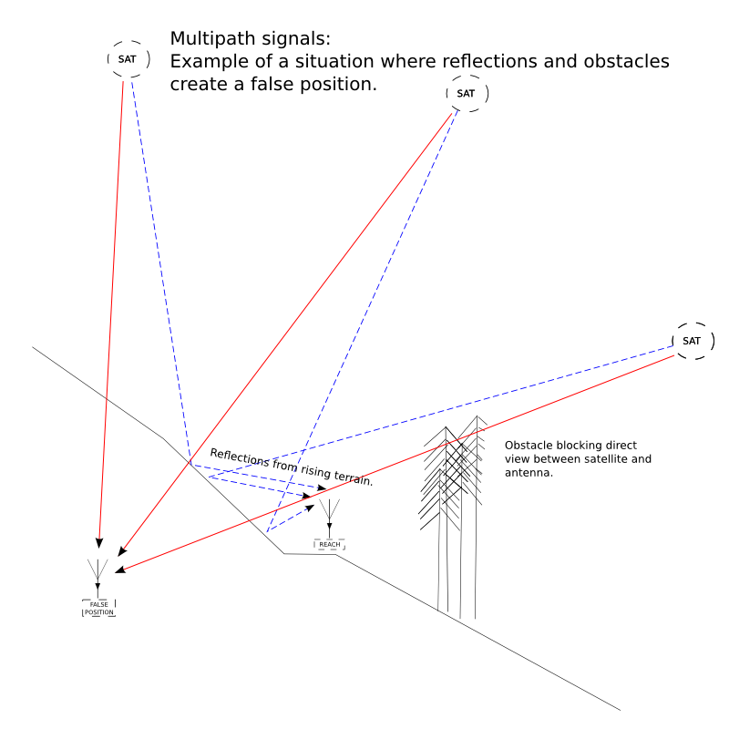
For example, this picture, or in the opposite case where a satellite that is below the terrain has a signal passing overhead and is reflecting off of something (trees/building) and then reaching the antenna and confusing your position.
Having a multi-frequency system, (L1/L2/L5, etc.) would help eliminate some of these problems, but they will also empty your wallet of many times more money than Reach does. Instead, it is better to spend time in getting experienced with RTKLIB and save money.