


Hello, We have been using these for about 4 years now but mostly RTK. In some cases, we do need to use base/rover. I just can’t seem to figure out how to manually enter my own coordinates for the base. What I want to do is if I have known pre-calc’d points in state plane coordinates, how do I enter one of the known coordinates for me to set my over and still be one state plan verse just pulling average coordinates??? Any help will greatly appreciated!
1 Like
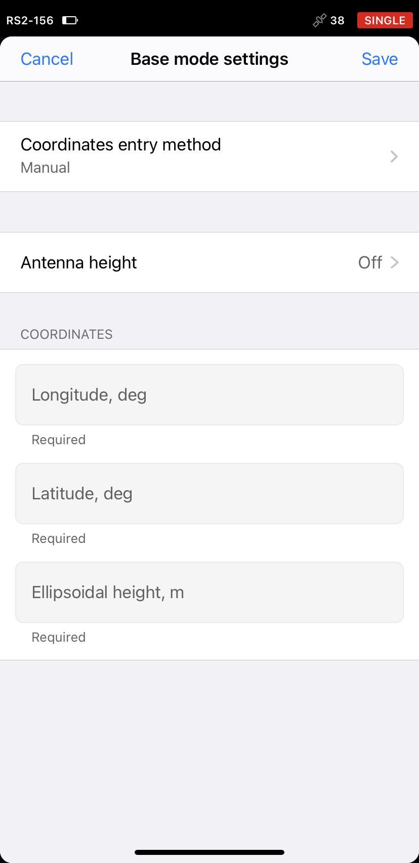
You have to use latitude Longitude and ellipsoidal height. So if you have state plane you will have to convert them
Ok, I don’t have a problem with converting to lat/long if that’s what needs to be done. We are using reachview3 as the controller. How do I enter them. That’s what I can’t figure out. I’m sure it’s supper easy to do and I’ve over complicated it but can’t figure it out.
1 Like
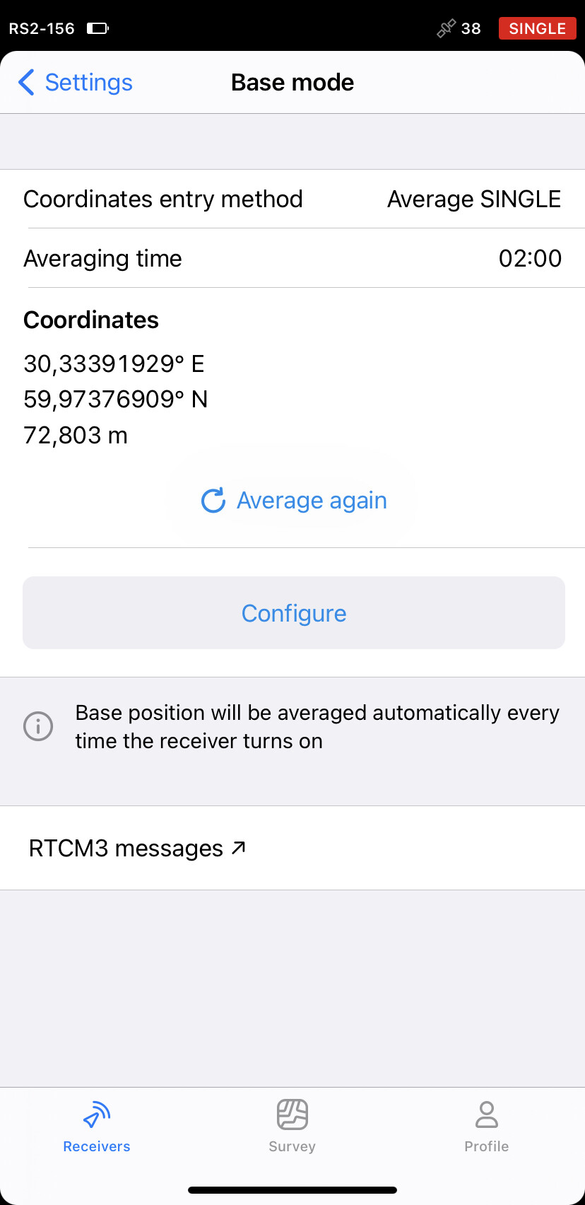
On the base tab, where the average in coordinates appear, there is a drop menu for fix type, pick manual, enter the coordinates then save them.
3 Likes
Hi Gregh,
I fully agree with Thomas and @PotatoFarmer. You need to convert state plane coordinates to latitude/longitude/ellipsoidal height. After that, enter them in a base mode tab as shown on the screenshots:
Also, you need to convert coordinates only to set up a base. On the rover you can use state plane coordinates.
4 Likes
Thank you everyone. Not sure how I new saw the manual entry spot. I’ll try this on my next base rover job
1 Like
Hi Greg, just a tip. You could also use the Base Shift feature for this, as the work-around does not need you to convert the coordinates into geographic ![]()
8 Likes
This topic was automatically closed 100 days after the last reply. New replies are no longer allowed.