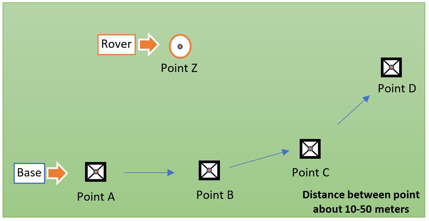
Hi, I have used Reach RS2 for 2 years in many projects, it’s god device. But I found elevation error every time move Base to new point. So, I doing some test like sketch below (In this test I using LoRa) :
Move Base to Point B (input base coordinate point B from step 2)
Takes coordinate Point C and Point Z
Move Base to Point C (input base coordinate point C from step 4)
Takes coordinate Point D and Point Z
Move Base to Point D (input base coordinate point D from step 6)
Takes coordinate Point Z
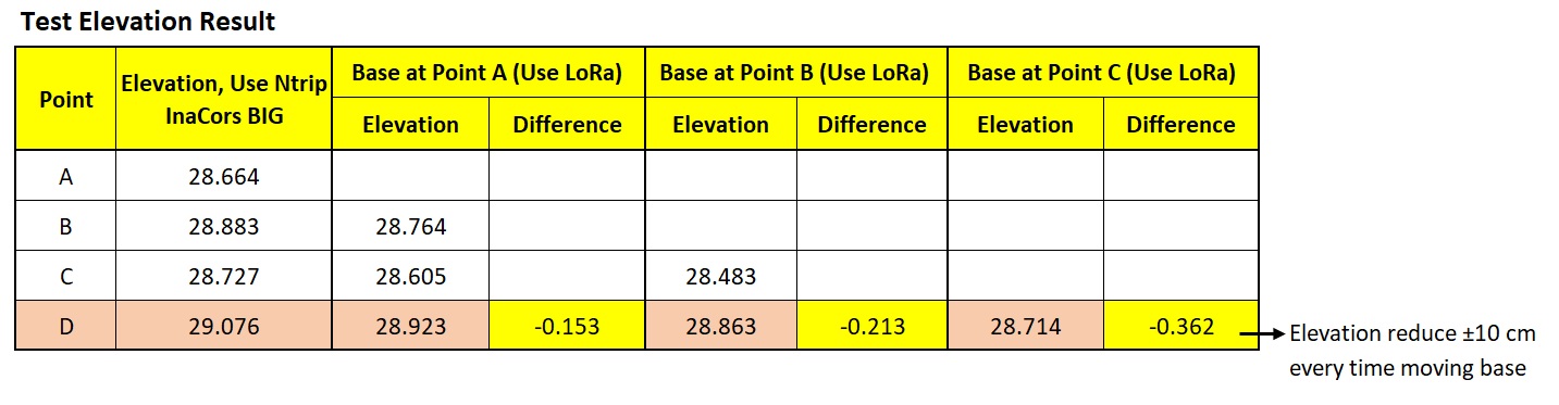
Result test is Every time I move Base to new point, elevation Point Z become decrease about 10 cm. At step 2 Point Z elevation is 120.752 m, at step 4 Point Z elevation is 120.652 m, at step 6 Point Z elevation is 120.552 m, at step 8 Point Z elevation is 120.452 m.
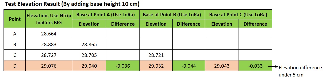
Now, to solve this error, I always add 10 cm when input Base Height to Emlid Flow from its real base height, if real base height is 1,25 meters then I input base height in Emlid Flow is 1,35 meters. Its can solve this error but I hope Emlid technical doing same test and repair this bug, because I things this is serious error.
When I use Emlid Flow and Nuwa from Tersus and connecting to same rover RS2, there are also show different elevation about 10 cm too.
I am not english speaking, may be my writing have some mistake, but I hope every one understand, thanks
That sounds really odd. I’d like to take a look at the data. Any chance you recorded raw data, base corrections, and position logs while doing such tests?
The CSV file with points would also be of help.
Of course, we can try to reproduce this. But I"m not sure we’ll be able to do this. Cause we’re testing the devices a lot, and haven’t ever noticed such an issue. So, there is a high chance it could be related to your device, and we need the data from it.
Also, am I right that you faced it on several survey sites?
Only on this one? Or every time you work with the devices?
The analysis is good, but I still need to take a look at the data. We actually work with the devices a lot and haven’t ever noticed something similar. And also didn’t receive similar reports from other users. So, checking CSV and logs is crucial. Can you send it to support@emlid.com?
Have you physically measured your rover pole? For example, if you enter 1.9m in Flow but in reality the pole measures 1.8m, wouldn’t this throw the Z point off by 10cm each time the base is moved to a measured point and set to a coordinate that is also off by 10cm?
I’m not saying that it’s user error necessarily, but not all measuring implements are created equal. I’ve seen measuring tapes that were off significantly. If it’s an adjustable pole from a questionable source, maybe the markings are off by 10cm?
I drew a quick sketch with true elevations at 0m for everything and what should be the measured value, if a mismatched pole height is entered, in red.
If the entered pole height value matches reality, then this is not the explanation, but it’s easy to check.
@Romi which version of Reach Firmware do you have? We used to have this inconsistency where you had to enter the phase center height in the base station setup menu. In newer versions this is much more clear and less prone to error.
I’ve never trusted the markings on a rover pole, there’s apparently some weird method to interpret the readings on the rod.
I always check my rod height with a measuring tape before measuring any points, I’ve either got it set at lowest point or full 2 meter extension. This keeps things simple, weird rod heights are trouble unless you’re careful. Make sure you change back to the standard heights for the next shot… not that I don’t use weird rod heights when necessary, but I keep them to a minimum. I always remember to check my rod heights if using weird heights and changing back to the regular heights for the next shot.
Stay focused on what you are doing for every shot !