


Hello,
we used a RS2 to log raw data for the trajectory correction of a LiDAR scanning mission. The RS2 was installed on a surveying point of which we didn’t have the coordinates in the field - we received it only some days later from the authorities in UTM.
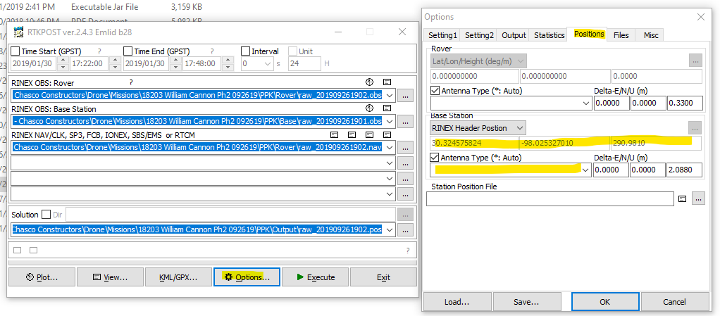
How can I put those coordinates into the *.obs file that we need for the correction? Is it enough to put them in the header or can I put them into RTKLIB?
Thank you very much!
This topic was automatically closed 100 days after the last reply. New replies are no longer allowed.