


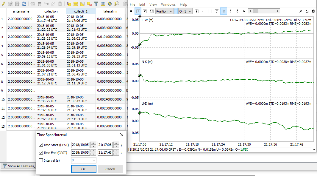
In the image below we can better see what wizprod is referring to. Screen to the left is the attribute table for the survey project shapefile right out of the Reachview App in QGIS. Notice the two collection columns denoting start and end time. Below the attributes is the dialogue box in RTKPlot to select by Time Span/Interval. In this case I used my first point and populated the dialogue box accordingly. To the right is the position plot in RTKPlot after selecting my time span/interval of interest. See statistics in upper right and particularly the ORI. We now have a coordinate for my first GCP.
This wasn’t too bad but sometimes I’m lazy and don’t want to manually type out coordinates. I haven’t found a good way to plot the ORI as waypoint in RTKPlot either. Not terrible for a few points but if you have a large number you may not like this method, not to mention the introduction of human error with a mistype. Me thinks a good method is buried in GIS somewhere just waiting for me.