


Revisiting ground control points after 2 weeks
This is a short report about the results of a revist of some ground control points (gcps) I placed 2 weeks earlier.The distance to my base (a Reach module) was between 200 and 400 m. The observation period during the first survey was 40 s which was to short and resulted in a fix for only 19 of the 24 points.
I calculated the position of the gcps with the help of a python script (fig. 1) which reads the observation period of each point from the survey csv file (exported from Reach). The script then calls rnx2rtkp.exe (the command line version of RTKpost) to calculate a static solution for each point. From the resulting solutions it averages the ones with the best ar ratio to get the final position.
During the revisit I was walking to the gcps with the help of the stake out feature. The corrections where transfered via a wifi network and a repeater in the field which made it possible to get the corrections from the base station without problems (I guess it works for more than 600 m in an open field). I prefere a wifi network now because than I do not have to switch settings when using the base station for my drone and we can work with two rovers at the same time.
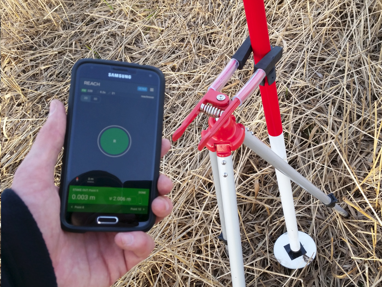
Some of the gcps survived the crossing of a mowing machine and when placing the rover on top of those gcps and controlling the position with the stake out feature the result was very accurate (fig. 2, z deviation 5 mm). I will add the results of the postprocessing later on.
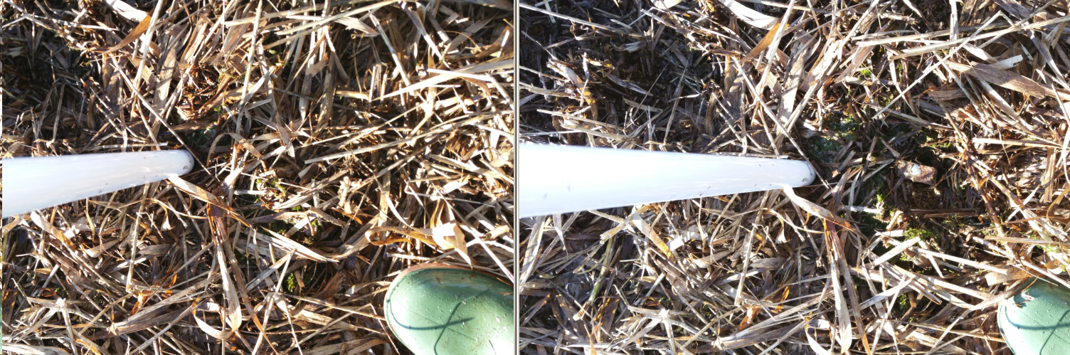
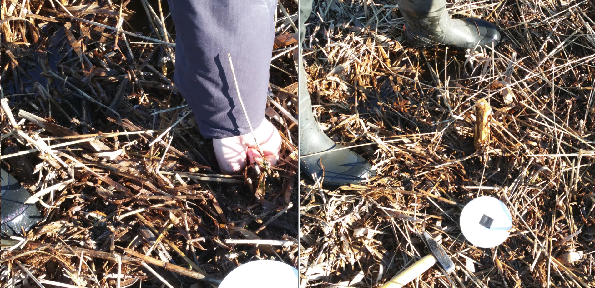
For those points which where pushed into the ground by the mowing machin the stake out feature helped to recover all points where a fix could be calculated. It was not possible to find those points without the help of Reach (example fig. 3 & 4). E.g. we searched for the base point marker for more than 30 min. and didn’t find it. After setting up the base on our backup base point marker I did find the original base point marker immediately. We could only find one of five points where no fix could be calculated. This point had more than 1 m offset.
I guess Reach can easily replace our Makers & Schonstedt Magnetic Locator which we normally use (with an additional GPS) to find our permant observation plots.