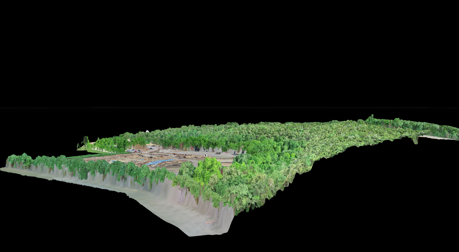
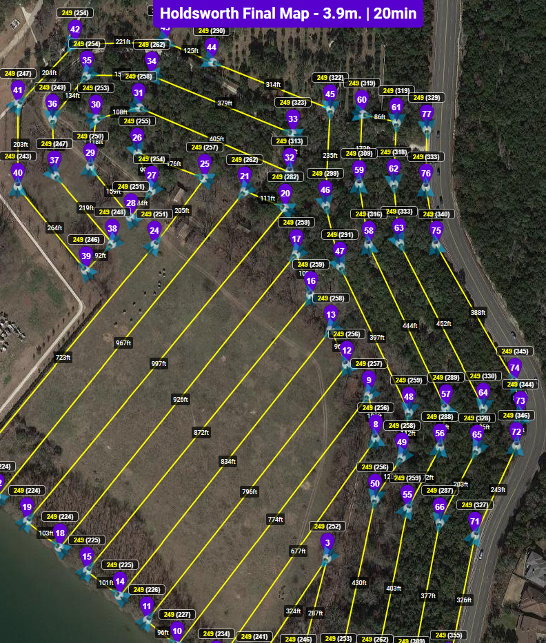
Here’s one of the crazier maps that I have done in Litchi. Solely for the fact of terrain following. Other programs will not do this with a change in direction like I have. The purposes was to run parallel with the major slope so that the drone would maintain a better constant altitude. Running into the slope can literally be bad, but I have also noticed that it does not follow the terrain as smoothly. Litchi does max out at 99 waypoints…
Consistent detail across the entire 160ft elevation change.
Profile