The epoch is the time you took the position of the base coordinates.
WGS84 has its xyz reference fixed like a geostationary satellite looking back at earth, so the coordinates drift with the plate movement. You have to reference what time the measurements were taken to find the exact same spot on the plate.
But it makes it really easy to measure how far a tectonic plate has drifted.
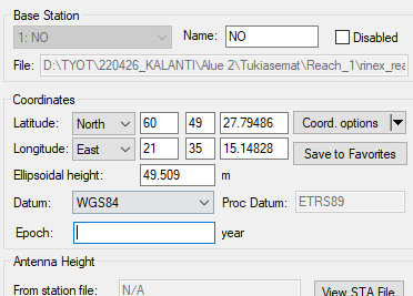
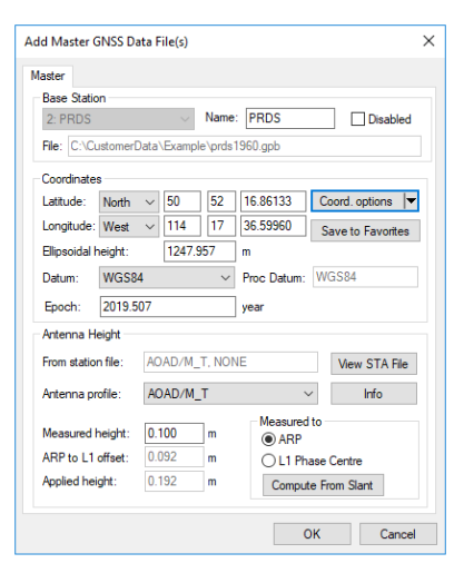
What reference system is your reference position in? If WGS84 then there is an associated epoch. You enter that epoch.
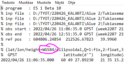
Now just because the circled part in your image says WGS84 doesn’t mean the output coordinates are WGS84. For differential processing they are essentially in the reference system of the base. The WGS84 just means the WGS84 ellipsoid was used to project those coordinates. If the base coordinates are actually, say, ETRF89, then the processing results are essentially ETRF89.
The bottom line is the datum and epoch of your output is the datum and epoch of your base reference system.
Thanks, I know the basics of datums and epochs, but this was exactly the info I was looking for!
I’m from Finland, so I download NLS (National Land Survey of Finland) or sometimes Finnish LeiCa Smartnet reference station data to calculate RS2 position. NLS and LeiCa Smartnet reference stations are in EUREF-FIN, which is the national realisation of ETRS89 (fixed to the stable part of the Eurasian Plate at epoch 1989.0)
So after using Finnish NLS (or LeiCa Smartnet) reference stations to calculate my RS2 location, also the results are in ETRS89.
Now when thinking this again, it makes total sense.
Was just confused by the Emlid Studio result files WGS84 line
Thank you all for help!