@igor.vereninov Do you have a ball-park release date for the Point Collection update?
I know we are all excited to try it out!!
Best,
Steve
@igor.vereninov Do you have a ball-park release date for the Point Collection update?
I know we are all excited to try it out!!
Best,
Steve
I know that this will be a very joyous day! There will be celebrations all over the world when this is released.
Unless you are a salesperson for Trimble, Topcon, etc. 
We are aiming at the end of the month.
Excellent! Just in time for the surveying season in the upper Midwest of the U.S. 
with the point collection update, would it be better if it was a software , rather than html web page based?
Will the new update give the ability to enter two points and connect them using a straight line? Just as important would be to zoom to cm or mm level anywhere along the line and see your current position relative to where the line is.
This to me would the #1 want in the beta before anything else. It would be great for marking two corners in ReachView and then being able to walk along a land boundary to find a tree opening using a straight line between the two points. This would save the trouble of having to place several markers along the boundary (between A and B) to try and locate one of those points which might happen to be under some brush or trees.
I think you are talking about a native app. That is where we want to get eventually, but that will be A LOT of work. The way we do the app currently helps us roll out new features quickly and have compatibility with all platforms.
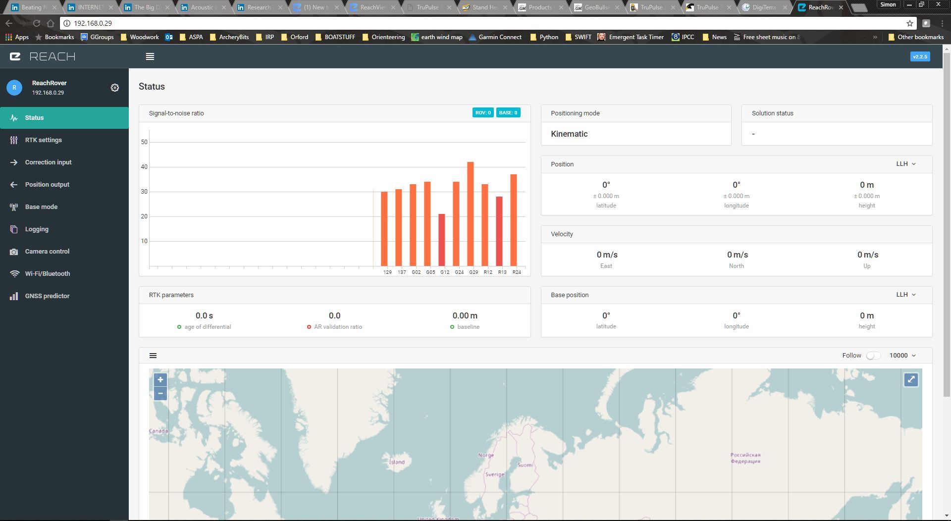
Thanks for the report, we will check why the graph is misbehaving.
This definitely makes sense. We will consider this during development.
Two requests:
Allow parts of ReachView to be locked.
With the arrival of the ReachRS it is obvious that the system is no longer aimed at hobbyists and enthusiasts; people who build and use their own system. It is now also for ‘users’ - people who just use a system set up by someone else. But there are a lot of settings in ReachView that I really would not want a casual user to have access to, the Base Mode and Correction Input pages being an obvious example. Once I know the connection is working it should not be open to tampering by a nosy user!
ReachView should at least allow an admin level user to disable or lock out whole pages, or even better lock out certain sections of any page.
Allow some kind of command line access to Reach / ReachRS without having to go through ReachView.
This should allow setting of things like the Manual Base Position, reading of various statuses, etc, perhaps via an API or pseudo NMEA sentences. This facility would allow 3rd party apps to be created that used the Reach / ReachRS as an everyday tool without having to understand the complexities of ReachView.
I see a lot of requests for really cool and complex features to be added to ReachView. I have some experience of developing apps that suffer from ‘feature creep’. In my experience you are far better of making a solid, stable, and basic app with one purpose - in this case controlling the Reach, and then having the facility to create additional, specialized apps for people who need to do surveying, farming, vehicle tracking, navigation, etc. Trying to do all those things in one app will just make it not really suitable for anyone.
David.
@dwilbourn These are good points and they align with what we see for the future of ReachView. Thank you for your suggestions!
Please add an option to save the Time-Tag file on the logging screen. I would like to do this when recording the raw rover and base streams to file. These files can be replayed in RTKNAVI for troubleshooting purposes, but needs the time-tag file in order to sync the data accurately.
ERB binary protocol is sending TOW in seconds to Ardupilot instead of the expected milliseconds (as described in the erb.pdf)
Please fix it otherwise pixhawk integration, will have vey flse timestamps and bending of multiplr GPSs will give strange results
Guys, for the point collection (Survey menu) is it possible to please include the reference base as a point in the final export? This would help a lot instead of having to go back after to check what your base coordinate was.
Just in case you guys missed it: Add some fields that would be of great value for ArduPilot applications: by amilcarlucas · Pull Request #21 · emlid/RTKLIB · GitHub
Emlid people, is it possible to please split up the fields of the exported Shapefile for the final coordinates? I see that the LAT / LONG / Height are combined into a field called “projected”. This would help enormously.
@Luke_Wijnberg Yes, there’ll be reworked table structure for all formats in the near future.
I do not have Reach yet but I’m considering it for my project. I have couple of questions/suggestions. First is it possible to install GPSD on Reach ?
Second, Do you have a plan to make a Dual frequency RTK GPS.
Is it possible to hookup a USB modem like Versizon or AT&T USB modem to receive correction from public CORS
Many Thanks
I can answer everything but the L2 question.
Reach is based on the Intel Edison which is a Linux computer. So yes, you can install GPSD.
Yes, Reach has support for some USB modems: